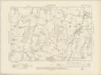
Maps of Ash-cum-Ridley
Kent XVIII.SW - OS Six-Inch Map
1 : 10560 Topographic maps Ordnance Survey Ordnance Survey
Kent XVIII.SW - OS Six-Inch Map
1 : 10560 Topographic maps Ordnance Survey Ordnance Survey
Kent XVIII.SW - OS Six-Inch Map
1 : 10560 Topographic maps Ordnance Survey Ordnance Survey
Kent XVIII.9 (includes: Ash; Hartley; Ridley) - 25 Inch Map
1 : 2500 Topographic maps Ordnance Survey Ordnance Survey
Kent XVIII.9 (includes: Ash; Hartley; Ridley) - 25 Inch Map
1 : 2500 Topographic maps Ordnance Survey Ordnance Survey
Kent XVIII.9 (includes: Ash; Hartley; Ridley) - 25 Inch Map
1 : 2500 Topographic maps Ordnance Survey Ordnance Survey
Kent XVIII.13 (includes: Ash; Ridley; Stansted) - 25 Inch Map
1 : 2500 Topographic maps Ordnance Survey Ordnance Survey
Kent XVIII.13 (includes: Ash; Ridley; Stansted) - 25 Inch Map
1 : 2500 Topographic maps Ordnance Survey Ordnance Survey
Kent XVIII.13 (includes: Ash; Ridley; Stansted) - 25 Inch Map
1 : 2500 Topographic maps Ordnance Survey Ordnance Survey
Kent XVIII.10 (includes: Meopham) - 25 Inch Map
1 : 2500 Topographic maps Ordnance Survey Ordnance Survey
Kent XVIII.10 (includes: Meopham) - 25 Inch Map
1 : 2500 Topographic maps Ordnance Survey Ordnance Survey
Kent XVIII.10 (includes: Meopham) - 25 Inch Map
1 : 2500 Topographic maps Ordnance Survey Ordnance Survey
Kent XVIII.14 (includes: Meopham; Ridley) - 25 Inch Map
1 : 2500 Topographic maps Ordnance Survey Ordnance Survey
Kent XVIII.14 (includes: Meopham; Ridley) - 25 Inch Map
1 : 2500 Topographic maps Ordnance Survey Ordnance Survey
Kent XVIII.14 (includes: Meopham; Ridley) - 25 Inch Map
1 : 2500 Topographic maps Ordnance Survey Ordnance Survey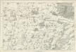
Kent XVIII - OS Six-Inch Map
1 : 10560 Topographic maps Ordnance Survey Ordnance Survey
TQ66 - OS 1:25,000 Provisional Series Map
1 : 25000 Topographic maps Ordnance Survey Ordnance Survey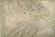
Cobham, Kent
1 : 10560 This map, showing the area around Cobham in Kent, is drawn on rectangular sheet lines, enclosed by a black border. Fields are coloured brown where cultivated, and green or blank if untilled. Stonework buildings and structures are drawn in red ink at major settlements. Pencil rays intersecting across the map, discernable beneath the inked detail, are evidence of angular measurements taken by the surveyor between fixed triangulation points. Altitudes on sites of eminence ('spot heights') have been measured and noted in red-ink figures.
A topographical-map, of the county of Kent, 7
1 Blatt : 54 x 71 cm A. Dury, W. Herbert
Dartford (Hills) - OS One-Inch Revised New Series
1 : 63360 Topographic maps Ordnance Survey Ordnance Survey
Dartford (Outline) - OS One-Inch Revised New Series
1 : 63360 Topographic maps Ordnance Survey Ordnance Survey
Die Environs von London
Londýn (Anglie) Kitchin, Thomas Bowles, Carington
London passenger transport map
Ordnance Survey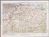
[Kaart], uit: S.E. London & Sevenoaks
1 : 64000 titelvariant: Ordnance Survey contoured road map of S.E. London and Sevenoaks; Annotatie: Omslagtitel: Ordnance Survey contoured road map of S.E. London and Sevenoaks Ordnance Survey Southampton : The Director General, at the Ordnance Survey Office
Delineatio ac finitima regio Magnae Brittaniae metropoleos Londini
Londýn (Anglie) Seutter, Matthäus a Matt. Seutter
London SE - OS One-Inch Map
1 : 63360 Topographic maps Ordnance Survey Ordnance Survey
London N.E. - OS One-Inch Map
1 : 63360 Topographic maps Ordnance Survey Ordnance Survey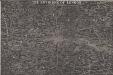
THE ENVIRONS OF LONDON
This map of London and part of the Home Counties was published in Pinnock's 'Guide to Knowledge'. Reduced from an original Ordnance Survey drawing, the map is printed in white on black, with the title in inset table at top centre. Though none of the sheets of the first edition of the Ordnance Survey covered London, part of the metropolitan area was contained in the maps of Middlesex, Essex, Surrey and Kent issued between 1805 and 1822. Archer, Joshua