Maps of Bromley
Kent XVI.SE - OS Six-Inch Map
1 : 10560 Topographic maps Ordnance Survey Ordnance Survey
Kent XVI.SE - OS Six-Inch Map
1 : 10560 Topographic maps Ordnance Survey Ordnance Survey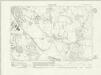
Kent XVI.SE - OS Six-Inch Map
1 : 10560 Topographic maps Ordnance Survey Ordnance Survey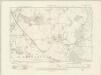
Kent XVI.SE - OS Six-Inch Map
1 : 10560 Topographic maps Ordnance Survey Ordnance Survey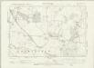
Kent XVI.SE - OS Six-Inch Map
1 : 10560 Topographic maps Ordnance Survey Ordnance Survey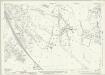
Kent XVI.11 (includes: Orpington) - 25 Inch Map
1 : 2500 Topographic maps Ordnance Survey Ordnance Survey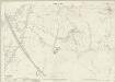
Kent XVI.11 (includes: Orpington) - 25 Inch Map
1 : 2500 Topographic maps Ordnance Survey Ordnance Survey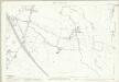
Kent XVI.11 (includes: Orpington) - 25 Inch Map
1 : 2500 Topographic maps Ordnance Survey Ordnance Survey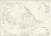
Kent XVI.15 (includes: Orpington) - 25 Inch Map
1 : 2500 Topographic maps Ordnance Survey Ordnance Survey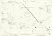
Kent XVI.15 (includes: Orpington) - 25 Inch Map
1 : 2500 Topographic maps Ordnance Survey Ordnance Survey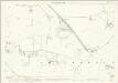
Kent XVI.15 (includes: Orpington) - 25 Inch Map
1 : 2500 Topographic maps Ordnance Survey Ordnance Survey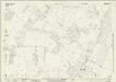
Kent XVI.12 (includes: Lullingstone; Orpington) - 25 Inch Map
1 : 2500 Topographic maps Ordnance Survey Ordnance Survey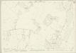
Kent XVI.12 (includes: Lullingstone; Orpington) - 25 Inch Map
1 : 2500 Topographic maps Ordnance Survey Ordnance Survey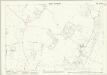
Kent XVI.12 (includes: Lullingstone; Orpington) - 25 Inch Map
1 : 2500 Topographic maps Ordnance Survey Ordnance Survey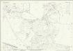
Kent XVI.16 (includes: Orpington; Shoreham) - 25 Inch Map
1 : 2500 Topographic maps Ordnance Survey Ordnance Survey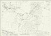
Kent XVI.16 (includes: Orpington; Shoreham) - 25 Inch Map
1 : 2500 Topographic maps Ordnance Survey Ordnance Survey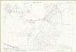
Kent XVI.16 (includes: Orpington; Shoreham) - 25 Inch Map
1 : 2500 Topographic maps Ordnance Survey Ordnance Survey
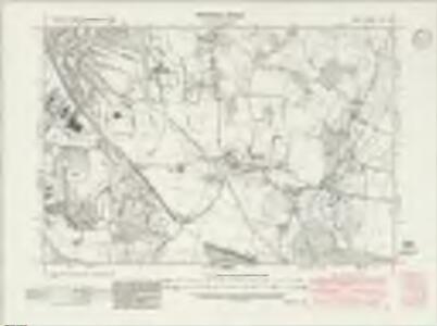
Kent XVI - OS Six-Inch Map
1 : 10560 Topographic maps Ordnance Survey Ordnance Survey
TQ46 - OS 1:25,000 Provisional Series Map
1 : 25000 Topographic maps Ordnance Survey Ordnance Survey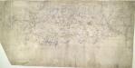
Eynsford (Kent)
This drawing, showing the area around Eynsford in Kent, is covered by a network of red rays, radiating from fixed points marking triangulation stations. These stations, usually sites of relative physical eminence, provided a framework within which to survey the topography of the land. On this plan, red lines radiate from the village church of Ash, marked by a red cross, and from an obelisk in Lullingstone Park. On the far left of the drawing, the word "flag" represents another triangulation point, from which the surveyor took angular measurements. Handwritten annotations at the bottom of the drawing refer to area measurements. There are some corrections in ink Pink, George
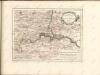
A topographical-map, of the county of Kent, 6
1 Blatt : 54 x 69 cm s.n.
Dartford (Hills) - OS One-Inch Revised New Series
1 : 63360 Topographic maps Ordnance Survey Ordnance Survey
Dartford (Outline) - OS One-Inch Revised New Series
1 : 63360 Topographic maps Ordnance Survey Ordnance Survey
London passenger transport map
Ordnance Survey
[Kaart], uit: S.E. London & Sevenoaks
1 : 64000 titelvariant: Ordnance Survey contoured road map of S.E. London and Sevenoaks; Annotatie: Omslagtitel: Ordnance Survey contoured road map of S.E. London and Sevenoaks Ordnance Survey Southampton : The Director General, at the Ordnance Survey Office
The Environs Of London.
1 : 95000 Colton, G.W.
London environs.
1 : 91500 Society for the Diffusion of Useful Knowledge (Great Britain)
Fairburn’s Map of the Country twelve miles round London. Second Edition
Fairburn, John London