Maps of Lewisham
London XVI.32 - OS London Town Plan
1 : 1056 Topographic maps Ordnance Survey Ordnance Survey
London (Edition of 1894-96) CXLVII (includes: Beckenham; Bromley; Lewisham) - 25 Inch Map
1 : 2500 Topographic maps Ordnance Survey Ordnance Survey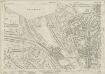
Kent VII.16 (includes: Beckenham; Bromley; Lewisham) - 25 Inch Map
1 : 2500 Topographic maps Ordnance Survey Ordnance Survey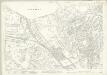
Kent VII.16 (includes: Beckenham; Bromley; Lewisham) - 25 Inch Map
1 : 2500 Topographic maps Ordnance Survey Ordnance Survey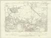
London XVI.NW - OS Six-Inch Map
1 : 10560 Topographic maps Ordnance Survey Ordnance Survey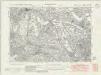
Kent VII.SE - OS Six-Inch Map
1 : 10560 Topographic maps Ordnance Survey Ordnance Survey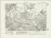
Kent VII.SE - OS Six-Inch Map
1 : 10560 Topographic maps Ordnance Survey Ordnance Survey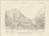
Kent VII.SE - OS Six-Inch Map
1 : 10560 Topographic maps Ordnance Survey Ordnance Survey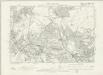
Kent VII.SE - OS Six-Inch Map
1 : 10560 Topographic maps Ordnance Survey Ordnance Survey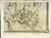
An exact survey of the city's of London Westminster , I
1 Blatt : 53 x 71 cm John Rocque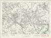
London Sheet T - OS Six-Inch Map
1 : 10560 Topographic maps Ordnance Survey Ordnance Survey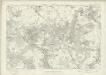
London Sheet T - OS Six-Inch Map
1 : 10560 Topographic maps Ordnance Survey Ordnance Survey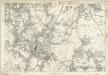
Kent VII - OS Six-Inch Map
1 : 10560 Topographic maps Ordnance Survey Ordnance Survey
TQ37 - OS 1:25,000 Provisional Series Map
1 : 25000 Topographic maps Ordnance Survey Ordnance Survey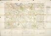
Militärgeographische Angaben über England.
Generalstab des Heeres, Abteilung für Kriegskarten u. Vermessungswesen IV. Mil.-Geo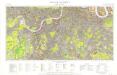
Great Britain [Second land utilisation survey] 1:25,000
Coleman, Alice Isle of Thanet Geographical Association
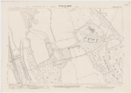
Bromley (Kent)
1 : 21120 Drawing showing the area around Bromley in Kent. Field boundaries enclosing cultivated land dominate this map of what is now south-east London. Such land is depicted by a striped pattern. Ruled dashed red lines also feature strongly. They radiate from trigonometrical stations used for measuring and plotting topographical features. The signalling telegraph station in Plow Garlic Hill at the top left of the plan marks the site of a trigonometrical station.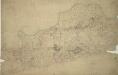
Woolwich
1 : 21120 This drawing covers the south bank of the River Thames from Deptford to Erith. Pencil and red ink rays extending from fixed points are clearly visible on the manuscript, and were used to plot the survey of the area. The numbers 1 to 7 in red ink across the map indicate the position from which field sketches were taken. Buildings are infilled and blocked in red at settlements like Woolwich and Greenwich. Clearly indicated is the Woolwich Warren, site of naval shipbuilding since the early-16th century. Before the Royal Arsenal was officially established there in 1805, the Warren had been home of military armsworks for more than a century.
A topographical-map, of the county of Kent, No. 1
1 Blatt : 54 x 69 cm A. Dury, W. Herbert
[Recto], uit: Map of general routes / Fred J.H. Elston
1 : 12500 Elston, Fred J. H. London : General Omnibus Co.
The Lancet Map of Medical London

Map of London [showing] work of the Metropolitan Public Gardens Association, November, 1882, to December, 1900. Scale of miles, 1 1/2[ = 2 1/4 inches]

A Map of London showing the proportion of the inhabitants of each registration sub-district in 1881, born in other parts of the United Kingdom
South London (Outline) - OS One-Inch Revised New Series
1 : 63360 Topographic maps Ordnance Survey Ordnance Survey
South London (Hills) - OS One-Inch Revised New Series
1 : 63360 Topographic maps Ordnance Survey Ordnance Survey
[Recto], uit: L.C.C. trams
1 : 50000 titelvariant: The tramways pocket map & timetable; Annotatie: Omslagtitel: The tramways pocket map & timetable London County Council [London : London County Council]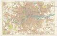
Stanford's new two inch map of London and its environs
1 : 31680 Londýn (Anglie) Edward Stanford
[Recto], uit: Route map and guide : [London]
1 : 50000 London : London General Omnibus Co.
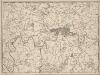
LONDON AND ITS ENVIRONS 241
This is a later edition of the map of London and the suburbs first issued by Davies in 1840. The map features title in top border, scale bar at bottom centre and key to symbols below the map. A note below the map states that the map contains "the boundaries of the Metropolitan Boroughs, the different railroads and stations, the new cemeteries and roads, docks, canals and all the modern improvements. The map is chiefly drawn from the Ordnance Survey, the railroads and the other improvements from the official copies and the Borough of Marylebone from the survey published by Mr Britton. The whole corrected from personal observations and measurements." Davies, Benjamin Rees