Maps of Croydon
London XV.85 - OS London Town Plan
1 : 1056 Topographic maps Ordnance Survey Ordnance Survey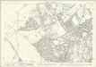
London (Edition of 1894-96) CLIV (includes: Croydon St John The Baptist) - 25 Inch Map
1 : 2500 Topographic maps Ordnance Survey Ordnance Survey
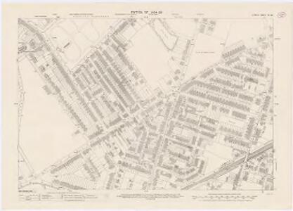
Surrey XIV.6 (includes: Croydon St John The Baptist) - 25 Inch Map
1 : 2500 Topographic maps Ordnance Survey Ordnance Survey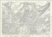
Surrey XIV.6 (includes: Croydon St John The Baptist) - 25 Inch Map
1 : 2500 Topographic maps Ordnance Survey Ordnance Survey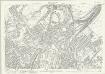
Surrey XIV.6 (includes: Croydon St John The Baptist) - 25 Inch Map
1 : 2500 Topographic maps Ordnance Survey Ordnance Survey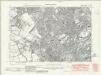
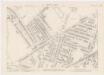
Surrey XIV.NW - OS Six-Inch Map
1 : 10560 Topographic maps Ordnance Survey Ordnance Survey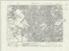
Surrey XIV.NW - OS Six-Inch Map
1 : 10560 Topographic maps Ordnance Survey Ordnance Survey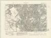
Surrey XIV.NW - OS Six-Inch Map
1 : 10560 Topographic maps Ordnance Survey Ordnance Survey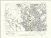
Surrey XIV.NW - OS Six-Inch Map
1 : 10560 Topographic maps Ordnance Survey Ordnance Survey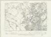
Surrey XIV.NW - OS Six-Inch Map
1 : 10560 Topographic maps Ordnance Survey Ordnance Survey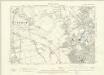
London XV.SW - OS Six-Inch Map
1 : 10560 Topographic maps Ordnance Survey Ordnance Survey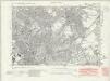
Kent XV.NW - OS Six-Inch Map
1 : 10560 Topographic maps Ordnance Survey Ordnance Survey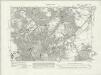
Kent XV.NW - OS Six-Inch Map
1 : 10560 Topographic maps Ordnance Survey Ordnance Survey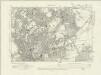
Kent XV.NW - OS Six-Inch Map
1 : 10560 Topographic maps Ordnance Survey Ordnance Survey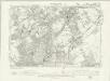
Kent XV.NW - OS Six-Inch Map
1 : 10560 Topographic maps Ordnance Survey Ordnance Survey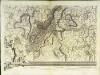
An exact survey of the city's of London Westminster , VIII
1 Blatt : 53 x 71 cm John Rocque
London Sheet S - OS Six-Inch Map
1 : 10560 Topographic maps Ordnance Survey Ordnance Survey
London Sheet S - OS Six-Inch Map
1 : 10560 Topographic maps Ordnance Survey Ordnance Survey
Surrey XIV - OS Six-Inch Map
1 : 10560 Topographic maps Ordnance Survey Ordnance Survey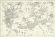
Kent XV - OS Six-Inch Map
1 : 10560 Topographic maps Ordnance Survey Ordnance Survey
TQ36 - OS 1:25,000 Provisional Series Map
1 : 25000 Topographic maps Ordnance Survey Ordnance Survey
Bromley (Kent)
1 : 21120 Drawing showing the area around Bromley in Kent. Field boundaries enclosing cultivated land dominate this map of what is now south-east London. Such land is depicted by a striped pattern. Ruled dashed red lines also feature strongly. They radiate from trigonometrical stations used for measuring and plotting topographical features. The signalling telegraph station in Plow Garlic Hill at the top left of the plan marks the site of a trigonometrical station.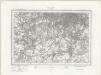
South London (Outline) - OS One-Inch Revised New Series
1 : 63360 Topographic maps Ordnance Survey Ordnance Survey
South London (Hills) - OS One-Inch Revised New Series
1 : 63360 Topographic maps Ordnance Survey Ordnance Survey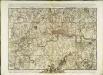
A plan of London
1 Karte : Kupferdruck ; 44 x 62 cm Rocque; Parr John Rocque
Croydon
1 : 31680 Woodland and agricultural land dominate this plan, which covers an area from Beckenham and Croydon at the top, to Felbridge, Hackenham and Gotwick at the bottom. Buildings are infilled and blocked together at Croydon, the largest settlement shown.
Die Environs von LONDON
Londýn (Anglie)
Die Environs von London
Londýn (Anglie) Landes Industrie Comptoirs
How to travel in and around London by railway
London : M. Vigers
Geological map London.
1 : 90000 Letts, Son & Co.