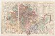
Maps of Croydon
London XV.64 - OS London Town Plan
1 : 1056 Topographic maps Ordnance Survey Ordnance Survey
London (Edition of 1894-96) CXLIX (includes: Croydon St John The Baptist) - 25 Inch Map
1 : 2500 Topographic maps Ordnance Survey Ordnance Survey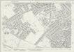
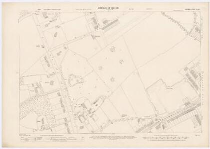
Surrey XIV.1 (includes: Croydon St John The Baptist; Mitcham) - 25 Inch Map
1 : 2500 Topographic maps Ordnance Survey Ordnance Survey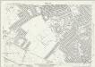
Surrey XIV.1 (includes: Croydon St John The Baptist; Mitcham) - 25 Inch Map
1 : 2500 Topographic maps Ordnance Survey Ordnance Survey
Surrey XIV.1 (includes: Croydon St John The Baptist; Mitcham) - 25 Inch Map
1 : 2500 Topographic maps Ordnance Survey Ordnance Survey
Surrey XIV.1 (includes: Croydon St John The Baptist; Mitcham) - 25 Inch Map
1 : 2500 Topographic maps Ordnance Survey Ordnance Survey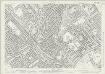
Surrey XIV.2 (includes: Croydon St John The Baptist) - 25 Inch Map
1 : 2500 Topographic maps Ordnance Survey Ordnance Survey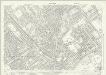
Surrey XIV.2 (includes: Croydon St John The Baptist) - 25 Inch Map
1 : 2500 Topographic maps Ordnance Survey Ordnance Survey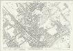
Surrey XIV.2 (includes: Croydon St John The Baptist) - 25 Inch Map
1 : 2500 Topographic maps Ordnance Survey Ordnance Survey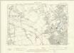
London XV.SW - OS Six-Inch Map
1 : 10560 Topographic maps Ordnance Survey Ordnance Survey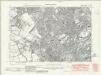
Surrey XIV.NW - OS Six-Inch Map
1 : 10560 Topographic maps Ordnance Survey Ordnance Survey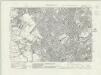
Surrey XIV.NW - OS Six-Inch Map
1 : 10560 Topographic maps Ordnance Survey Ordnance Survey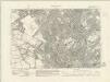
Surrey XIV.NW - OS Six-Inch Map
1 : 10560 Topographic maps Ordnance Survey Ordnance Survey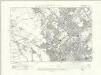
Surrey XIV.NW - OS Six-Inch Map
1 : 10560 Topographic maps Ordnance Survey Ordnance Survey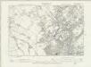
Surrey XIV.NW - OS Six-Inch Map
1 : 10560 Topographic maps Ordnance Survey Ordnance Survey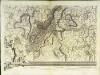
An exact survey of the city's of London Westminster , VIII
1 Blatt : 53 x 71 cm John Rocque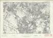
London Sheet S - OS Six-Inch Map
1 : 10560 Topographic maps Ordnance Survey Ordnance Survey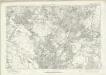
London Sheet S - OS Six-Inch Map
1 : 10560 Topographic maps Ordnance Survey Ordnance Survey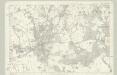
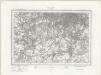
Surrey XIV - OS Six-Inch Map
1 : 10560 Topographic maps Ordnance Survey Ordnance Survey
TQ36 - OS 1:25,000 Provisional Series Map
1 : 25000 Topographic maps Ordnance Survey Ordnance Survey
MILNE'S PLAN of the CITIES of LONDON and WESTMINSTER, circumjacent TOWNS and PARISHES &c. laid down from a TRIGONOMETRICAL SURVEY taken in the YEARS 1795-1799
This is one of six sheets forming Milne's map of the area twenty miles around London. It was the first to make use of the 'Trygonometrical Survey' founded in 1791. This sheet covers the area to the west and south-west of the capital. It shows all the field boundaries and indicates land use with a complex system of letters and colours. The key is featured on the top corners. The borders of the map are divided in minutes and seconds, giving scale, angles of observations and magnetic variations. Thomas Milne trained as an estate surveyor and worked on the first Ordnance Survey map of Kent. Milne, Thomas
A Map of London showing the proportion of the inhabitants of each registration sub-district in 1881, born in other parts of the United Kingdom
South London (Outline) - OS One-Inch Revised New Series
1 : 63360 Topographic maps Ordnance Survey Ordnance Survey
South London (Hills) - OS One-Inch Revised New Series
1 : 63360 Topographic maps Ordnance Survey Ordnance Survey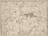
A New and Accurate Survey of the Country about the Cities of LONDON, and WESTMINSTER and the Borough of Southwark for 15 miles in Length & 12 in Depth
In the second half of the18th century, the introduction of turnpike roads and the increased coach-traffic in and out of London contributed to the popularity of the maps of the countryside around the capital. The title of this plan appears in cartouche at bottom centre, with a scale bar near bottom left and its border divided in degrees of latitude and longitude. Bennost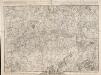
A PLAN of LONDON on the Same Scale as that of PARIS: In Order to ascertain the Difference of the extent of these two Rivals
The title of this plan appears in English and French along the top of the plate, along with the scale bars. The publisher’s imprint and dedication to John, Duke of Montague, feature below the plan. Allegorical figures are depicted at bottom centre holding the Duke's coat of arms. The border of the map is divided in degrees of longitude from the old meridian at St Paul's. Rocque, John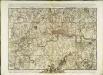
A plan of London
1 Karte : Kupferdruck ; 44 x 62 cm Rocque; Parr John Rocque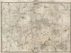
An Exact Survey of the Citys of London, Westminster, ye Borough of Southwark, and the Country near Ten Miles round
This map was first published by Rocque in 1746, and several editions appeared before his death in 1762. His widow Mary Ann carried on the business for a few years, until, in the late 1760s, she transferred the plates of the map to the publishers Carrington Bowles and Robert Sayer, under whose imprints this edition appeared in 1769. Printed in 16 sheets, the map is set within a decorative border. Its title features in English, Latin and French along the top, with emblematic figures below the City arms at top centre, and the compass star at top left. The map is dedicated to Lord Burlington at bottom centre. Scales are given at the foot of the map in versts, leagues, toises, yards and miles. A key to symbols distinguishing orchards, arable land, formal parkland and gardens, pasture, and woodland is included at bottom right. The "New Road" (Marylebone Road), Blackfriars Bridge and the roads across St George's Fields are also shown. Rocque, John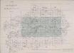
INDEX TO THE PLAN OF LONDON MADE FOR The Metropolitan Commissioners of Sewers
This map's title and imprint feature at top left, with an explanatory note at bottom right and scale bar at bottom centre. The map is divided into rectangles, forming the index to two "London and its Environs" Ordnance Survey maps. The cholera outbreaks of the 1830s and 40s forced the government to improve London drainage and sewage disposal. The Commission of Sewers was established to combine seven of the eight existing sewage companies into one, unifying their drainage systems. Metropolitan Commission of Sewers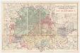
Map of London and its environs : shewing the boundary of the jurisdiction of the metropolitan board of work, also the boundaries of the city of London : Gas companies’ districts
1 : 31680 Standford, Edward, 1827-1904 Edward Standford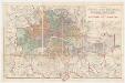
Map of London and its environs : shewing the boundary of the jurisdiction of the metropolitan board of work, also the boundaries of the city of London : Parliamentary boroughs
1 : 31680 Standford, Edward, 1827-1904 Edward Standford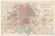
Map of London and its environs : shewing the boundary of the jurisdiction of the metropolitan board of work, also the boundaries of the city of London : Water companies’ district
1 : 31680 Standford, Edward, 1827-1904 Edward Standford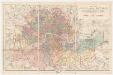
Map of London and its environs : shewing the boundary of the jurisdiction of the metropolitan board of work, also the boundaries of the city of London : Poor law unions
1 : 31680 Standford, Edward, 1827-1904 Edward Standford