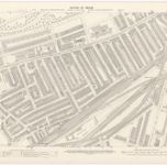
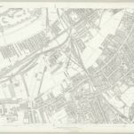
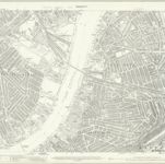
Mappa catalogata
London XI.21 - OS London Town Plan

Titolo completo:London XI.21 - OS London Town Plan
Anno di illustrazione:1893
Data di pubblicazione:1895
Editore:Ordnance Survey
Dimensione fisica:20 x 30 cm
Scala della mappa:1:1 056
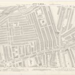
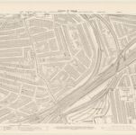
London XI.31 - OS London Town Plan
1893
Ordnance Survey
1:1k
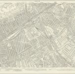
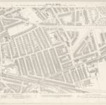
London XI.41 - OS London Town Plan
1893
Ordnance Survey
1:1k
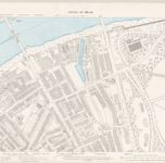
London (1915- Numbered sheets) IX.5 (includes: Battersea; Lambeth St Mary; Wandsworth Borough) - 25 Inch Map
1913
Ordnance Survey
1:3k
London (Edition of 1894-96) CI (includes: Battersea; Lambeth St Mary; Wandsworth Borough) - 25 Inch Map
1894
Ordnance Survey
1:3k
London (First Editions c1850s) LXV (includes: Battersea; Lambeth St Mary; Wandsworth Borough) - 25 Inch Map
1870
Ordnance Survey
1:3k
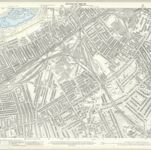
London X.50 - OS London Town Plan
1893
Ordnance Survey
1:1k
London X.40 - OS London Town Plan
1893
Ordnance Survey
1:1k

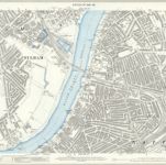
London XI.21 - OS London Town Plan
1893
Ordnance Survey
1:1k
London X.30 - OS London Town Plan
1893
Ordnance Survey
1:1k
London (1915- Numbered sheets) VIII.8 (includes: Battersea; Chelsea; Fulham) - 25 Inch Map
1913
Ordnance Survey
1:3k
London (Edition of 1894-96) C (includes: Battersea; Chelsea; Fulham) - 25 Inch Map
1894
Ordnance Survey
1:3k
London (First Editions c1850s) LXIV (includes: Battersea; Chelsea; Fulham) - 25 Inch Map
1866
Ordnance Survey
1:3k