Maps of Wandsworth
London X.66 - OS London Town Plan
1 : 1056 Topographic maps Ordnance Survey Ordnance Survey
Surrey VII.2 & 6 (includes: Wandsworth Borough; Wimbledon St Mary) - 25 Inch Map
1 : 2500 Topographic maps Ordnance Survey Ordnance Survey
Surrey VII.2 (includes: Wandsworth Borough) - 25 Inch Map
1 : 2500 Topographic maps Ordnance Survey Ordnance Survey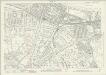
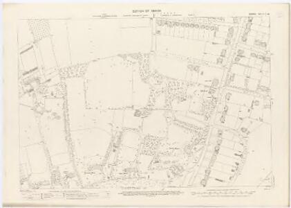
London (1915- Numbered sheets) VIII.11 (includes: Wandsworth Borough) - 25 Inch Map
1 : 2500 Topographic maps Ordnance Survey Ordnance Survey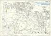
London (Edition of 1894-96) CXIII (includes: Wandsworth Borough) - 25 Inch Map
1 : 2500 Topographic maps Ordnance Survey Ordnance Survey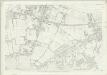
London (First Editions c1850s) LXXIII (includes: Wandsworth Borough) - 25 Inch Map
1 : 2500 Topographic maps Ordnance Survey Ordnance Survey
An Exact Survey of the Citys of London, Westminster and Borough of Southwark with the Country near 10 miles round
J.Rocque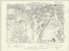
London X.SE - OS Six-Inch Map
1 : 10560 Topographic maps Ordnance Survey Ordnance Survey
Surrey VII.NW - OS Six-Inch Map
1 : 10560 Topographic maps Ordnance Survey Ordnance Survey
Surrey VII.NW - OS Six-Inch Map
1 : 10560 Topographic maps Ordnance Survey Ordnance Survey
Surrey VII.NW - OS Six-Inch Map
1 : 10560 Topographic maps Ordnance Survey Ordnance Survey
Surrey VII.NW - OS Six-Inch Map
1 : 10560 Topographic maps Ordnance Survey Ordnance Survey
Surrey VII.NW - OS Six-Inch Map
1 : 10560 Topographic maps Ordnance Survey Ordnance Survey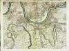
An exact survey of the city's of London Westminster , X
1 Blatt : 53 x 71 cm John Rocque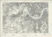
London Sheet N - OS Six-Inch Map
1 : 10560 Topographic maps Ordnance Survey Ordnance Survey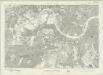
London Sheet N - OS Six-Inch Map
1 : 10560 Topographic maps Ordnance Survey Ordnance Survey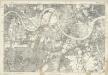
Middlesex XXI - OS Six-Inch Map
1 : 10560 Topographic maps Ordnance Survey Ordnance Survey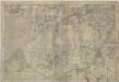
Surrey VII - OS Six-Inch Map
1 : 10560 Topographic maps Ordnance Survey Ordnance Survey
TQ27 - OS 1:25,000 Provisional Series Map
1 : 25000 Topographic maps Ordnance Survey Ordnance Survey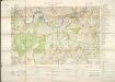
Militärgeographische Angaben über England.
Generalstab des Heeres, Abteilung für Kriegskarten u. Vermessungswesen IV. Mil.-Geo
MILNE'S PLAN of the CITIES of LONDON and WESTMINSTER, circumjacent TOWNS and PARISHES &c. laid down from a TRIGONOMETRICAL SURVEY taken in the YEARS 1795-1799
This is one of six sheets forming Milne's map of the area twenty miles around London. It was the first to make use of the 'Trygonometrical Survey' founded in 1791. This sheet covers the area to the west and south-west of the capital. It shows all the field boundaries and indicates land use with a complex system of letters and colours. The key is featured on the top corners. The borders of the map are divided in minutes and seconds, giving scale, angles of observations and magnetic variations. Thomas Milne trained as an estate surveyor and worked on the first Ordnance Survey map of Kent. Milne, Thomas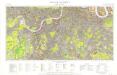
Great Britain [Second land utilisation survey] 1:25,000
Coleman, Alice Isle of Thanet Geographical Association
CRUCHLEY'S New Plan of LONDON and its ENVIRONS
This map is the 11th edition of Cruchley's 'New Plan'. It was altered on each publication, recording the many developments than spanned this period, particularly railway expansion. In this edition the Waterloo and Bricklayers Arms stations are shown, as are Battersea and Victoria Parks. Prior to the establishment of his own business, Cruchley worked for the Arrowsmiths map-publishing firm. Consequently the words “from Arrowsmiths" appear in his imprint on many of his early maps. George Frederick Cruchley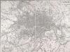
LONDON Drawn and engraved expressly for the POST OFFICE DIRECTORY
Map of London published by Benjamin Rees Davies for the Post Office Directory with title and scale bar in table at top right. The London post codes W, N, N.E., E, S.E., S and S.W. are indicated. Davies, Benjamin Rees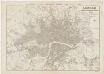
London : guide to the International Exhibition, 1862
1 : 15840 Dower, John, fl. 1838-1846? Illustrated London News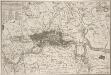
KAART van LONDEN enz en van het NABY GELEGEN LAND ruim een Uur gaans. rondsom dezelve Stad; getrokken uit de groote gemeeten Kaart van de Hr. JOHN ROCQUE, Te AMSTERDAM by ISAAK TIRION 1754
In the second half of the18th century, the introduction of turnpike roads and the increased coach-traffic in and out of London contributed to the popularity of the maps of the countryside around the capital. This map of the area ten miles round the City of London was published in Amsterdam by Isaak Tirion. Based on John Rocque's survey of 1744, the map’s title, imprint and key appears in a table at top left. The scale bars are in a panel below the plan. Built-up areas are stippled in the City and hatched elsewhere. Tirion, Isaak
LONDON AND ITS ENVIRONS LEVELS TAKEN BY ORDER OF THE COMMISSIONERS OF SEWERS
The cholera outbreaks of the 1830s and 1840s forced the government to make drastic improvements to the methods of drainage and sewage disposal in London. A Metropolitan Commission of Sewers was charged with the central task of unifying the existing piecemeal drainage system and forming a plan for a completely new one. A new map showing the levels of the land to be drained was needed for this. In March 1848, officers of the Royal Engineers began to prepare stations for triangulation. Observation posts were set up on one of the towers of Westminster Abbey and over the cross of St Paul's. This map is the result of the survey, showing the relative altitude of the land, a necessary preamble to planning drainage systems, as sewage can only be washed away downhill. Wyld, James
Kaart van Londen enz. en van het naby gelegen land ruim een uur gaans rondom dezelve stad : getrokken uit de groote gemeeten kaart van de Hr. John Rocque
1 : 63500 Amstersdam : Isaak Tirion
The fourth sheet of an actual survey of the county of Middlesex in which the parishes within the bills of mortality are bounded with red to be distinguished from the others
1 Blatt : 53 x 70 cm John Rocque