Maps of Hounslow
London X.1 - OS London Town Plan
1 : 1056 Topographic maps Ordnance Survey Ordnance Survey
Surrey I.12 (includes: Ealing St Mary; Heston and Isleworth; Kew; New Brentford; Old Brentford) - 25 Inch Map
1 : 2500 Topographic maps Ordnance Survey Ordnance Survey
Surrey I.12 (includes: Ealing St Mary; Heston and Isleworth; Kew; New Brentford; Old Brentford) - 25 Inch Map
1 : 2500 Topographic maps Ordnance Survey Ordnance Survey
Surrey I.12 (includes: Ealing St Mary; Heston and Isleworth; Kew; New Brentford; Old Brentford) - 25 Inch Map
1 : 2500 Topographic maps Ordnance Survey Ordnance Survey
Middlesex XXI.1 (includes: Chiswick St Nicholas; Kew; Mortlake; North Sheen; Old Brentford) - 25 Inch Map
1 : 2500 Topographic maps Ordnance Survey Ordnance Survey
Middlesex XXI.1 (includes: Chiswick St Nicholas; Kew; Mortlake; North Sheen; Old Brentford) - 25 Inch Map
1 : 2500 Topographic maps Ordnance Survey Ordnance Survey
London (Edition of 1894-96) LXXXIV (includes: Chiswick St Nicholas; Kew; Mortlake; North Sheen; Old Brentford) - 25 Inch Map
1 : 2500 Topographic maps Ordnance Survey Ordnance Survey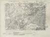
Surrey I.SE - OS Six-Inch Map
1 : 10560 Topographic maps Ordnance Survey Ordnance Survey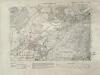
Surrey I.SE - OS Six-Inch Map
1 : 10560 Topographic maps Ordnance Survey Ordnance Survey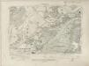
Surrey I.SE - OS Six-Inch Map
1 : 10560 Topographic maps Ordnance Survey Ordnance Survey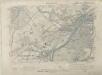
Surrey I.SE - OS Six-Inch Map
1 : 10560 Topographic maps Ordnance Survey Ordnance Survey
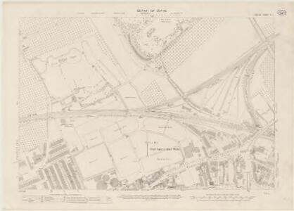
London X.NW - OS Six-Inch Map
1 : 10560 Topographic maps Ordnance Survey Ordnance Survey
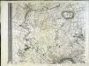
An actual survey and plan of the Processional Boundaries of the Parish of Ealing. ... Survey'd and drawn by A. Bassett.
An exact survey of the city's of London Westminster , XIV
1 Blatt : 53 x 71 cm John Rocque
Surrey I - OS Six-Inch Map
1 : 10560 Topographic maps Ordnance Survey Ordnance Survey
London Sheet N - OS Six-Inch Map
1 : 10560 Topographic maps Ordnance Survey Ordnance Survey
London Sheet N - OS Six-Inch Map
1 : 10560 Topographic maps Ordnance Survey Ordnance Survey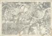
Middlesex XXI - OS Six-Inch Map
1 : 10560 Topographic maps Ordnance Survey Ordnance Survey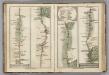
Brentford to Bagshot, Virginia Water to Oakingham.
1 : 63360 Cary, John
TQ17 - OS 1:25,000 Provisional Series Map
1 : 25000 Topographic maps Ordnance Survey Ordnance Survey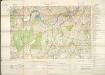
Militärgeographische Angaben über England.
Generalstab des Heeres, Abteilung für Kriegskarten u. Vermessungswesen IV. Mil.-Geo
Carte topographique de le comté de Middlesex, 3
1 Blatt : 53 x 70 cm John Rocque
Carte topographique de le comté de Middlesex, 1
1 Blatt : 53 x 69 cm John Rocque
[Recto], uit: Map of general routes / Fred J.H. Elston
1 : 12500 Elston, Fred J. H. London : General Omnibus Co.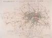
JURISDICTION OF THE METROPOLITAN POLICE
This map illustrates plans for the reform of the jurisdiction of Metropolitan Police. Based on Dawson's map of 1832, the map’s title appear along the top, with compass star at top right, explanatory note at bottom left, and a scale bar at bottom right. District boundaries are highlighted in colour, with the old limits of London, Westminster and Southwark shaded. Formed in 1829, the Metropolitan Police had its jurisdiction extended in 1839to Greater London - an area taken to mean all parishes partly within twelve miles of Charing Cross or wholly within fifteen miles of Charing Cross. In the same year, the City of London formed its own police force. Dawson, Lieut. Robert K.
Plan of a Proposed TURNPIKE ROAD From St. JOHN'S CHAPEL, ST. MARYLEBONE into the Great North Road Near the 8 Mile Stone at Finchley
1 : 31680 Plan of the proposed turnpike road from Regent's Park to Finchley, today's Finchley Road. The plan features title at top right, scale bars at lower right and sections of the road in elevation at the foot of the plate, with the new road represented by a double dotted line coloured red. Down the left of the plate a table gives distances between stations along the road and shows the savings in milage generated by the new road. Phillips, Henry
Map of London [showing] work of the Metropolitan Public Gardens Association, November, 1882, to December, 1900. Scale of miles, 1 1/2[ = 2 1/4 inches]
South London (Outline) - OS One-Inch Revised New Series
1 : 63360 Topographic maps Ordnance Survey Ordnance Survey
South London (Hills) - OS One-Inch Revised New Series
1 : 63360 Topographic maps Ordnance Survey Ordnance Survey