Maps of Newham
London VIII.3 - OS London Town Plan
1 : 1056 Topographic maps Ordnance Survey Ordnance Survey
Essex (New Series 1913-) n LXXXVI.1 (includes: Cann Hall; West Ham) - 25 Inch Map
1 : 2500 Topographic maps Ordnance Survey Ordnance Survey
London (Edition of 1894-96) XLII (includes: Cann Hall; West Ham) - 25 Inch Map
1 : 2500 Topographic maps Ordnance Survey Ordnance Survey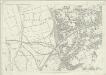
London (First Editions c1850s) XX (includes: Cann Hall; West Ham) - 25 Inch Map
1 : 2500 Topographic maps Ordnance Survey Ordnance Survey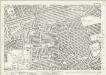
Essex (New Series 1913-) n LXXXVI.2 (includes: East Ham; West Ham) - 25 Inch Map
1 : 2500 Topographic maps Ordnance Survey Ordnance Survey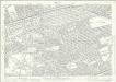
Essex (New Series 1913-) n LXXXVI.2 (includes: East Ham; West Ham) - 25 Inch Map
1 : 2500 Topographic maps Ordnance Survey Ordnance Survey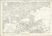
London (Edition of 1894-96) XLIII (includes: East Ham; West Ham) - 25 Inch Map
1 : 2500 Topographic maps Ordnance Survey Ordnance Survey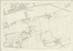
London (First Editions c1850s) XXI (includes: East Ham; West Ham) - 25 Inch Map
1 : 2500 Topographic maps Ordnance Survey Ordnance Survey
Insurance Plan of London North East District Vol. F: sheet 8-1
1 : 480 This detailed 1893 plan of London is one of a series of nineteen sheets in an atlas originally produced to aid insurance companies in assessing fire risks. The building footprints, their use (commercial, residential, educational, etc.), the number of floors and the height of the building, as well as construction materials (and thus risk of burning) and special fire hazards (chemicals, kilns, ovens) were documented in order to estimate premiums. Names of individual businesses, property lines, and addresses were also often recorded. Together these maps provide a rich historical shapshot of the commercial activity and urban landscape of towns and cities at the time. The British Library holds a comprehensive collection of fire insurance plans produced by the London-based firm Charles E. Goad Ltd. dating back to 1885. These plans were made for most important towns and cities of the British Isles at the scales of 1:480 (1 inch to 40 feet), as well as many foreign towns at 1:600 (1 inch to 50 feet). Chas E Goad Limited Chas E Goad Limited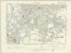
London VIII.NW - OS Six-Inch Map
1 : 10560 Topographic maps Ordnance Survey Ordnance Survey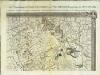
An exact survey of the city's of London Westminster , IV
1 Blatt : 53 x 71 cm John Rocque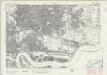
London Sheet L - OS Six-Inch Map
1 : 10560 Topographic maps Ordnance Survey Ordnance Survey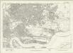
London Sheet L - OS Six-Inch Map
1 : 10560 Topographic maps Ordnance Survey Ordnance Survey
Essex LXXIII - OS Six-Inch Map
1 : 10560 Topographic maps Ordnance Survey Ordnance Survey
Stratford - Le - Bow
1 : 21120 This plan of north east London extends from the Isle of Dogs and Wapping at the bottom, to 'Layton Stone' and Epping Forest at the top. Field boundaries infilled with stripes depict tilled land. Major settlements are drawn in red ink. North of Stoke Newington, to the top left, a road is plotted as a series of fixed points pricked off with dividers and joined by ruled pencil lines. These protractions were made directly from the Ordnance Survey field books. Pencil rays intersect across the map, evidence of measurements taken by the surveyor between fixed triangulation points. Poplar Gut is outlined in red at the Isle of Dogs, the beginnings of the development of the West India Docks.
London in miniature : with the surrounding villages, an entire new plan in which the improvements both present and intended are actually reduced (by permission) from the surveys of the several proprietors : the whole laide down from the best authorities
1 : 16000 Mogg, Edward Edward Mogg
Map of London : made from an actual survey in the years 1824, 1825, & 1826
1 : 63360 C. & J. Greenwood C. & J. Greenwood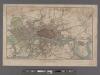
London
From Great Britain
A new map of London and its environs : from an original survey extending 8 miles east and west, 6 1/4 miles north & south, in which all new and intended buildings, improvements, &c. are carefully inserted
1 : 17150 Thompson, Mr Reeves & Hoare
Plan of the roads and main objects on the eastern part of London : as connected with the tunnel excavating under the Thames from Rotherhithe to Wapping
1 : 48000 Brunel, Marc Isambard, Sir, 1769-1849 H. Teape & Son
London : drawn and engraved expressly for the post office directory
1 : 253440 Kelly's Directories Ltd Kelly & Co. Ltd., Post Office Directory Office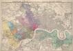
Stanford’s Map of London, shewing the Areas granted to the Electric Light Supply Companies
Edward STANFORD
LONDON Drawn and engraved expressly for the POST OFFICE DIRECTORY
Map of London published by Benjamin Rees Davies for the Post Office Directory with title and scale bar in table at top right. The London post codes W, N, N.E., E, S.E., S and S.W. are indicated. Davies, Benjamin Rees
London : guide to the International Exhibition, 1862
1 : 15840 Dower, John, fl. 1838-1846? Illustrated London News
KAART van LONDEN enz en van het NABY GELEGEN LAND ruim een Uur gaans. rondsom dezelve Stad; getrokken uit de groote gemeeten Kaart van de Hr. JOHN ROCQUE, Te AMSTERDAM by ISAAK TIRION 1754
In the second half of the18th century, the introduction of turnpike roads and the increased coach-traffic in and out of London contributed to the popularity of the maps of the countryside around the capital. This map of the area ten miles round the City of London was published in Amsterdam by Isaak Tirion. Based on John Rocque's survey of 1744, the map’s title, imprint and key appears in a table at top left. The scale bars are in a panel below the plan. Built-up areas are stippled in the City and hatched elsewhere. Tirion, Isaak
METROPOLITAN BOROUGHS
This map of London was produced for the 1832 Reform Bill that established the metropolitan boroughs. The map's title features along the top; with a compass star at top right, an explanatory note at bottom right. At bottom left is a list of the 'liberties' of the city - the name given to areas exempt from the jurisdiction of the country sheriff, being subject to a separate commission of the peace (in this case royal and governmental authorities). The new boroughs are highlighted in colour, with the shaded area representing the old boundaries of London, Westminster and Southwark. Dawson, Lieut. Robert K.
Kaart van Londen enz. en van het naby gelegen land ruim een uur gaans rondom dezelve stad : getrokken uit de groote gemeeten kaart van de Hr. John Rocque
1 : 63500 Amstersdam : Isaak Tirion
The fourth sheet of an actual survey of the county of Middlesex in which the parishes within the bills of mortality are bounded with red to be distinguished from the others
1 Blatt : 53 x 70 cm John Rocque
[Recto], uit: Map of general routes / Fred J.H. Elston
1 : 12500 Elston, Fred J. H. London : General Omnibus Co.