Maps of Camden

London VII.31 - OS London Town Plan
1 : 1056 Topographic maps Ordnance Survey Ordnance Survey
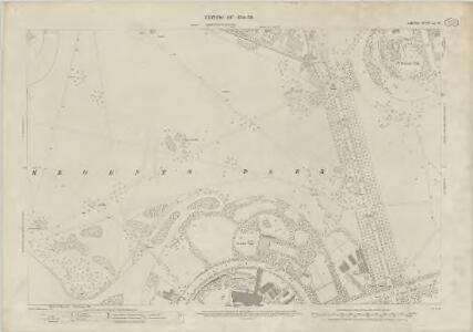
London (1915- Numbered sheets) V.5 (includes: St Marylebone; St Pancras) - 25 Inch Map
1 : 2500 Topographic maps Ordnance Survey Ordnance Survey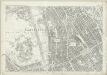
London (First Editions c1850s) XXV (includes: St Marylebone; St Pancras) - 25 Inch Map
1 : 2500 Topographic maps Ordnance Survey Ordnance Survey
Some account of the proposed improvements of the Western part of London, by the formation of the Regent's Park, the new street, the new sewer. ... Illustrated by plans and accompanied by critical observations.

THE REGENT'S PARK
1 : 4800 This plan was commissioned by the House of Commons and issued as a supplement to the Wood, Forests and Land Revenues report. The plan's title and imprint are at top right, with a scale bar and key at bottom right. The part of the park to be opened to the public is shown in pale yellow. The grounds of the Zoological Society and the Royal Botanic Society are shown in pink. The areas to be fenced off to protect the privacy of the local residents are shown in dark green. The land to the north of the park recently acquired by Eton College is shown in pale green, and that acquired by Lord Southampton, in pink. Basire, James
Insurance Plan of London North West District Vol. C: Index Key Plan A
1 : 480 This "key plan" indicates coverage of the Goad 1900 series of fire insurance maps of London that were originally produced to aid insurance companies in assessing fire risks. The building footprints, their use (commercial, residential, educational, etc.), the number of floors and the height of the building, as well as construction materials (and thus risk of burning) and special fire hazards (chemicals, kilns, ovens) were documented in order to estimate premiums. Names of individual businesses, property lines, and addresses were also often recorded. Together these maps provide a rich historical shapshot of the commercial activity and urban landscape of towns and cities at the time. The British Library holds a comprehensive collection of fire insurance plans produced by the London-based firm Charles E. Goad Ltd. dating back to 1885. These plans were made for most important towns and cities of the British Isles at the scales of 1:480 (1 inch to 40 feet), as well as many foreign towns at 1:600 (1 inch to 50 feet). Chas E Goad Limited Chas E Goad Limited
PLAN OF THE GARDEN of the ZOOLOGICAL SOCIETY within the Area of the REGENT'S PARK
1 : 1500 The title of this plan appears at lower left, along with scale bar and compass rose.The plan shows the animals' pens and enclosures numbered for reference. Opened to the public in 1828, in an area of Regent's Park laid out by Decimus Burton, London Zoo attracted 30.000 visitors in the first seven months. The collection of animals was expanded in 1830 by the arrival of the Royal M nagerie from Windsor and again in 1835 when animals from the Tower of London were transferred to the zoo, including an Indian elephant, an alligator and over a hundred rattlesnakes.
London VII.NW - OS Six-Inch Map
1 : 10560 Topographic maps Ordnance Survey Ordnance Survey
PLAN of the several Freehold Estates situated on the North side of the New Road within the Parish of St. Mary-le-bone and Parts of Hampstead and St. Pancras in the County of Middlesex
1 : 1584 This is Crace's own copy of an 18th-Century plan of the estates north of the New Road at Marylebone. The title and scale bar feature at bottom left, with compass at top centre, and descriptive notes at top left and down the right margin of the sheet. Outline colour marks the boundaries of estates and a single black line those of fields within the estate. The plan also reports the names of landlords and tenant occupiers, with key to the dimensions of each field and estate in a table above the plan. Jones, John
A Plan of the New Intended Road from Paddington to Islington.

Charles Booth's descriptive map of London poverty 1889
Charles Booth
PLAN OF THE PARISH OF ST. MARYLEBONE with the Improvements proposed ON THE MARYLEBONE PARK ESTATE WITH THE CONTIGUOUS PARTS of the Parish of St. Pancras
1 : 5333 Plan of the Parish of St. Marylebone with title at bottom left and explanatory note at bottom right describing proposals for building houses and gardens on land belonging to the Crown along the New Road. White, John
London NW.
1 : 15840 Stanford, Edward
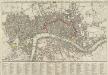
The LONDON DIRECTORY, or a New & Improved PLAN of LONDON, WESTMINSTER, & SOUTHWARK;
This is a reissue of a map first published in 1771 by John Bowles. Bowles' name has been removed, with the imprint of there issuer, Robert Wilkinson, appearing instead. This map highlights the London Wall in red, showing with arrows the direction of water-flow in the Thames. Bowles, John
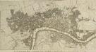
The LONDON DIRECTORY, or a New & Improved PLAN of LONDON, WESTMINSTER, & SOUTHWARK; 182
This map is a reissue of a map published in 1771 by John Bowles. Bowles's name has been replaced by that of Robert Wilkinson, the reissuer. A table of references to churches and public buildings appears below the map. The built-up area of the city is stippled, with other built-up areas done in crosshatching. Coloured lines delineate individual city wards. Bowles, John
The LONDON DIRECTORY, or a New & Improved PLAN of LONDON, WESTMINSTER, & SOUTHWARK; 152
Robert Laurie was a fine mezzotint engraver and regular exhibitor at the Society of Artists in the 1770s. He acquired the stock of surveyor John Sayer’s in 1794 and, in partnership with James Whittle, founded the map publishing firm Laurie & Whittle. This map is very similar to the 1765 map by Robert Sayer and is probably from the same plate. Blackfriars Bridge is shown along with its proposed approaches. Laurie, Robert, and Whittle, James.
The LONDON DIRECTORY, or a New & Improved PLAN of LONDON, WESTMINSTER & SOUTHWARK;
The title of this map appears along the top, with a key in panel below the plan and letters along the borders for reference. Sayer's maps of London, largely derivative, were issued with few alterations throughout the middle years of the 18th Century. This is a later edition of a map he first published in 1765, updated to include the approaches to Blackfriars Bridge, which did not feature in the first edition. Sayer, Robert
The LONDON DIRECTORY, or a New & Improved PLAN of LONDON,
Robert Sayer, the surveyor, traded as a map publisher and print seller in Fleet Street in the latter half of the 18th Century. Between 1751 and 1770and againfrom1784to 1794, he published maps under his own name or under the imprint of Sayer and Bennett. This is the 11th edition of a map published 14 times over a period of 27 years. During this time Robert Sayer became joined in partnership with John Bennett, with their joint imprint appearing on the third to eighth editions. The area of the city is highlighted in pink. A table of references for churches and public buildings appears below the map. In 1794 Sayers stock was acquired by Robert Laurie who founded the map publishing firm of Laurie & Whittle, with his friend James Whittle. Sayer, Robert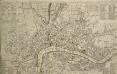
A NEW and CORRECT PLAN of the CITIES of LONDON, WESTMINSTER, and BOROUGH of SOUTHWARK wherein all the Streets, Roads, Churches, Public Buildings &c. to the Present Year 1775 are exactly Delineated
The title of this map runs along the top of the plan. The city boundaries are outlined in yellow, with a key to public buildings in London and Westminster in a table at top left. A list of parishes in Middlesex and Surrey features at top right, alongside a list of city wards and prominent London buildings. An inventory of churches in the City of London appears at bottom left and bottom right. The map shows the proposed new bridge and approaches at Blackfriars and all the proposed roads across St. George's Fields in Southwark, though not as finally laid out. Kitchin, Thomas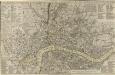
A NEW and CORRECT PLAN of the CITIES of LONDON, WESTMINSTER, and BOROUGH of SOUTHWARK wherein all the Streets, Roads, Churches, Public Buildings &c. To the Present Year 1785 are exactly delineated
Map publisher and print seller Robert Sayer traded from Fleet Street in the latter half of the 18th Century, first under his own name, and then under the joint imprint of Sayer& Bennett. This is a later edition of Sayer& Bennett's 1781 map of London. Coloured outlines appear along the boundaries of the London Wall, Westminster and Southwark. References tables appear in all four corners, listing public buildings, churches and the parishes within the Bills of Mortality (those parishes who reported deaths to the central London government). Open land, such as parks and gardens, is highlighted in green. R. Sayer & J. Bennett
The LONDON DIRECTORY, or a New & Improved PLAN of LONDON, WESTMINSTER, & SOUTHWARK; 157
This is the eighth edition of the an original 1765Sayer map. Bennett’s name was added to the imprint of the third edition of the map, published in 1776. The two men were in partnership between 1770 and 1787.Their business was taken over by Laurie and Whittle in 1792. R. Sayer & J. Bennett
BOWLES'S Reduced NEW POCKET PLAN of the CITIES of LONDON and WESTMINSTER, with the BOROUGH of SOUTHWARK, exhibiting the NEW BUILDINGS to the YEAR 1783.
Carrington Bowles (1724-93) came from a family of publishers and map sellers who published a considerable body of work during a century of trading. This is the fifth edition of an original 1777map. It includes a table of references to churches and principal buildings. The built-up areas of the City of London are stippled, with the city and county boundaries delineated by coloured lines. The scale is given in miles or furlongs in the bottom right-hand corner. Carrington Bowles
A NEW and CORRECT PLAN of the CITIES of LONDON, WESTMINSTER, and BOROUGH of SOUTHWARK wherein all the Streets, Roads, Churches, Public Buildings &c. To the Present Year 1781 are exactly delineated
A table of references in the top-left corner identifies the Great Offices of State and public buildings. Different colours denote the boundaries of Westminster, Southwark and the City. Sayer, Robert and Bennett, John
Plan of London, Westminster & Southwark
A NEW and Complete PLAN of LONDON WESTMINSTER and SOUTHWARK, with the Additional Buildings to the Year 1777.
The title of this small map of London appears in a panel below the plan. The built-up of the city is stippled while other built-up areas are hatched. This map was first issued as frontispiece to Book III of Walter Harrison's 'A New and Universal History, Description and Survey of the Cities of London and Westminster', 1776. Harrison, Walter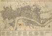
BOWLES'S Reduced NEW POCKET PLAN of the CITIES of LONDON & WESTMINSTER; WITH THE BOROUGH OF SOUTHWARK, exhibiting the New Buildings to the YEAR 1780
The Bowles family were successful map publishers and sellers whose considerable output spanned a century. This map is the second edition of an original 1777plan. It includes a table of references to churches and principal buildings. The built-up areas of the City of London are stippled. The scale is given in miles or furlongs. Bowles, Carington
BOWLES'S Reduced NEW POCKET PLAN of the CITIES of LONDON and WESTMINSTER, with the BOROUGH of SOUTHWARK, exhibiting the NEW BUILDINGS to the YEAR 1787.
This is the sixth edition of Bowles's Reduced New Pocket Plan. The map was reissued 11 times between1777 and 1799. It includes a table of references to churches and principal buildings. The built-up areas of the City of London are represented by stippling; with the city boundaries delineated it red. The scale is given in miles and furlongs. Bowles, Carington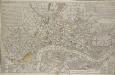
A NEW and CORRECT PLAN of the CITIES of LONDON, WESTMINSTER, and BOROUGH of SOUTHWARK wherein all the Streets, Roads, Churches, Public Buildings &c. to the Present Year 1791 are exactly delineated.
Map publisher and print seller Robert Sayer traded from Fleet Street in the latter half of the 18th century, first under his own name, and then under the joint imprint of Sayer& Bennett. This map has four-colour text panels in corners, including information relating to the recent Act for regulating Hackney Coaches. The development of turnpike roads in 1750 saw an increase of wheeled traffic, supplanting rivers as the main medium of transport. The map also features information about new rates for watermen introduced in 1785.The title of the plan states that it has been published as the "Act Directs”, a reference to the Copyright Act of 1734, used to curb the high incidence of uncredited copying among mapmakers. Sayer, Robert
NEW PLAN OF LONDON
This map was printed in black on white and appeared in the “Guide to Knowledge" anthology of 1839. The map's title, imprint and scale bar appear at bottom right. It shows the proposed Thames Tunnel, linking Wapping and Rotherhithe, as well as the Hungerford Bridge and the Greenwich and Birmingham railway lines. Archer, Joshua