Maps of Penzance

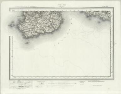
Land's End (Hills) - OS One-Inch Revised New Series
1 : 63360 Topographic maps Ordnance Survey Ordnance Survey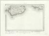
Land's End (Outline) - OS One-Inch Revised New Series
1 : 63360 Topographic maps Ordnance Survey Ordnance Survey
SW42 - OS 1:25,000 Provisional Series Map
1 : 25000 Topographic maps Ordnance Survey Ordnance Survey
SW52 - OS 1:25,000 Provisional Series Map
1 : 25000 Topographic maps Ordnance Survey Ordnance Survey
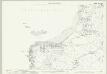
SW32 - OS 1:25,000 Provisional Series Map
1 : 25000 Topographic maps Ordnance Survey Ordnance Survey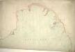
Lands End, Mount's Bay, Cornwall
This coastal survey shows the defence works of Mount's Bay, from Mousehole to Marazion. The area's status as a key defence point is shown by the large scale of the map: 6' to the mile. Positions and weights of cannons around the bay are noted, and the artillery on St Michael's Mount is described by a key. Small crosses mark the positions of rocks in the bay. The irregularly protruding surfaces of Augusta Rock and Long Rock are indicated by intersecting lines of varying lengths, differentiating these from the sand, which is symbolised by dots. The condition of this drawing is excellent. It is coloured with watercolour washes. Hewitt, John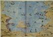
Mount's Bay, Cornwall
This plan shows Mount’s Bay in Cornwall in an invasion scenario and is thought to date from around 1540. It is orientated with south to the top, Penzance is lower right and St Michael’s Mount is in the centre. Lines extend between St Michael’s Mount and the mainland with distances expressed in words. Details of the landscape are shown pictorially, a feature typical of maps and plans of the Tudor period. Although the houses and churches of the area are depicted generically, the draughtsman has differentiated between those in good condition and those that have fallen into disrepair. Churches, with their towers and steeples, could be used as vantage points for surveillance, hence their prominent depiction here. The building shown here on St Michael’s Mount was home to a Benedictine monastery until the dissolution of the monasteries, after which it was fortified in order to take advantage of its excellent defensive location. The previous function of the building is clear from the crosses which decorate the apex of the gable ends of the central building. The existence of this drawing can be imputed to the threat of invasion which became probable in 1538 after a peace treaty was signed by Francis I of France and Charles V, Holy Roman Emperor and King of Spain. England and France were ancient enemies and the Catholic Charles V, nephew of Catherine of Aragon, was angered by Henry VIII’s decision to divorce her. Henry’s dissolution of the monasteries provided him with enormous wealth with which he was able to commission surveys of the vulnerable coastline and build defence fortifications. It is likely that this drawing was executed in order to illustrate defence strategies feared to be necessary in this climate of unease.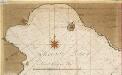
De rivier van Foweij en Mountsbaij int Canaal [Mountsbay]
England Gerard van Keulen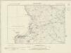
Cornwall LXXIII.SW - OS Six-Inch Map
1 : 10560 Topographic maps Ordnance Survey Ordnance Survey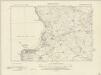
Cornwall LXXIII.SW - OS Six-Inch Map
1 : 10560 Topographic maps Ordnance Survey Ordnance Survey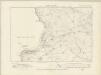
Cornwall LXXIII.SW - OS Six-Inch Map
1 : 10560 Topographic maps Ordnance Survey Ordnance Survey
Cornwall LXXIII.SW - OS Six-Inch Map
1 : 10560 Topographic maps Ordnance Survey Ordnance Survey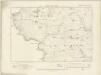
Cornwall LXXVIII.NW - OS Six-Inch Map
1 : 10560 Topographic maps Ordnance Survey Ordnance Survey
Cornwall LXXVIII.NW - OS Six-Inch Map
1 : 10560 Topographic maps Ordnance Survey Ordnance Survey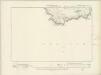
Cornwall LXXVIII.SW - OS Six-Inch Map
1 : 10560 Topographic maps Ordnance Survey Ordnance Survey
Cornwall LXXVIII.SW - OS Six-Inch Map
1 : 10560 Topographic maps Ordnance Survey Ordnance Survey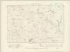
Cornwall LXXIII.SE - OS Six-Inch Map
1 : 10560 Topographic maps Ordnance Survey Ordnance Survey
Cornwall LXXIII.SE - OS Six-Inch Map
1 : 10560 Topographic maps Ordnance Survey Ordnance Survey
Cornwall LXXVIII.NE & SE - OS Six-Inch Map
1 : 10560 Topographic maps Ordnance Survey Ordnance Survey
Cornwall LXXVIII.NE & SE - OS Six-Inch Map
1 : 10560 Topographic maps Ordnance Survey Ordnance Survey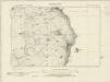
Cornwall LXXIV.SW - OS Six-Inch Map
1 : 10560 Topographic maps Ordnance Survey Ordnance Survey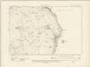
Cornwall LXXIV.SW - OS Six-Inch Map
1 : 10560 Topographic maps Ordnance Survey Ordnance Survey
Cornwall LXXIV.SW - OS Six-Inch Map
1 : 10560 Topographic maps Ordnance Survey Ordnance Survey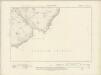
Cornwall LXXIX.NW - OS Six-Inch Map
1 : 10560 Topographic maps Ordnance Survey Ordnance Survey
Cornwall LXXIX.NW - OS Six-Inch Map
1 : 10560 Topographic maps Ordnance Survey Ordnance Survey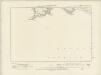
Cornwall LXXV.SW - OS Six-Inch Map
1 : 10560 Topographic maps Ordnance Survey Ordnance Survey
Cornwall LXXV.SW - OS Six-Inch Map
1 : 10560 Topographic maps Ordnance Survey Ordnance Survey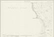
Cornwall LXXIII.9 (includes: Sennen; St Just in Penwith) - 25 Inch Map
1 : 2500 Topographic maps Ordnance Survey Ordnance Survey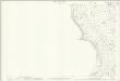
Cornwall LXXIII.9 (includes: Sennen; St Just in Penwith) - 25 Inch Map
1 : 2500 Topographic maps Ordnance Survey Ordnance Survey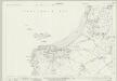
Cornwall LXXIII.13 (includes: Sennen; St Just in Penwith) - 25 Inch Map
1 : 2500 Topographic maps Ordnance Survey Ordnance Survey