Maps of South West England

Lundy Island (Outline) - OS One-Inch Revised New Series
1 : 63360 Topographic maps Ordnance Survey Ordnance Survey
Lundy Island (Outline) - OS One-Inch Revised New Series
1 : 63360 Topographic maps Ordnance Survey Ordnance Survey
Lundy Island (Hills) - OS One-Inch Revised New Series
1 : 63360 Topographic maps Ordnance Survey Ordnance Survey
SS14 - OS 1:25,000 Provisional Series Map
1 : 25000 Topographic maps Ordnance Survey Ordnance Survey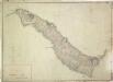
Lundy Island
1 : 10560 This plan of Lundy Island, produced by Royal Military Surveyor and Draughtsman Thomas Compton, was found to be incorrect by Major General William Mudge. A letter from Mudge to General Morse, dated 7th January 1804,,questions the praise of Compton's ability made by his teacher, Charles Budgen. The Ordnance Survey Letter Book records a letter dated 4th January 1821, from Budgen to Colby, refuting the suggestion that he had produced the "erroneous" plan. In 1820 Lundy was surveyed anew by Lieutenant Alexander W Robe. Compton, Thomas
Devonshire IVa.NW & SW - OS Six-Inch Map
1 : 10560 Topographic maps Ordnance Survey Ordnance Survey
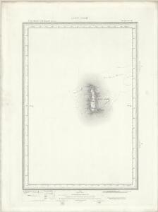
Plan Of Lundy Island
1 : 10560 A draughtsman's note in red ink, dated 28 April 1834, explains the corrections made to a small area of the west coast of the island, verifying the accuracy of the alterations made by Lieutenant Denham. Thomas Compton's original survey of the island made in 1804 was found to be incorrect, hence this revision. Robe, Alexander W
Devonshire IVa.NW - OS Six-Inch Map
1 : 10560 Topographic maps Ordnance Survey Ordnance Survey
Devonshire IVa.SW - OS Six-Inch Map
1 : 10560 Topographic maps Ordnance Survey Ordnance Survey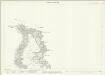
Devon IVA.2 (includes: Lundy Island) - 25 Inch Map
1 : 2500 Topographic maps Ordnance Survey Ordnance Survey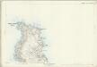
Devon IVA.2 (includes: Lundy Island) - 25 Inch Map
1 : 2500 Topographic maps Ordnance Survey Ordnance Survey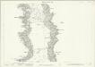
Devon IVA.6 (includes: Lundy Island) - 25 Inch Map
1 : 2500 Topographic maps Ordnance Survey Ordnance Survey
Devon IVA.6 (includes: Lundy Island) - 25 Inch Map
1 : 2500 Topographic maps Ordnance Survey Ordnance Survey
Devon IVA.6 (includes: Lundy Island) - 25 Inch Map
1 : 2500 Topographic maps Ordnance Survey Ordnance Survey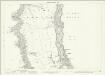
Devon IVA.10 (includes: Lundy Island) - 25 Inch Map
1 : 2500 Topographic maps Ordnance Survey Ordnance Survey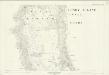
Devon IVA.10 (includes: Lundy Island) - 25 Inch Map
1 : 2500 Topographic maps Ordnance Survey Ordnance Survey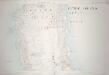
Devon IVA.10 (includes: Lundy Island) - 25 Inch Map
1 : 2500 Topographic maps Ordnance Survey Ordnance Survey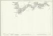
Devon IVA.14 (includes: Lundy Island) - 25 Inch Map
1 : 2500 Topographic maps Ordnance Survey Ordnance Survey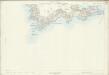
Devon IVA.14 (includes: Lundy Island) - 25 Inch Map
1 : 2500 Topographic maps Ordnance Survey Ordnance Survey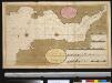
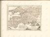
Het Canaal van Bristol of Severn of anders genaamt het Verkeerde Kanaal int grood
England Gerard van Keulen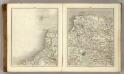
Sheets 11-12. (Cary's England, Wales, and Scotland).
1 : 360000 Cary, John, ca. 1754-1835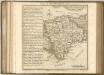

delineation of the strata of England and Wales, with part of Scotland
1 : 320000 Blatt 9 Smith, William Cary
England and Wales[OS civil air edition]
Ordnance Survey
England
1 : 778000 under the superintendence of the Society for the Diffusion of Useful Knowledge J. & C. Walker sculpt. London : Baldwin and Cradock
Ports & Harbours on the South East Coast of England.
Fullarton, A. & Co.
Watershed map England, Wales 5.
1 : 760320 Letts, Son & Co.
Provinces meridionales de l'Angleterre ou côtes septentrionales de la Manche, 1
1 Blatt : 53 x 68 cm Le Rouge