Mapa catalogado
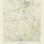
Chipping Norton (Outline) - OS One-Inch Revised New Series

Título completo:Chipping Norton (Outline) - OS One-Inch Revised New Series
Año de ilustración:1893
Tamaño físico:20 x 30 cm
Escala del mapa:1:63 360
A new improved map of Oxfordshire
1750
Kitchin; Hinton
n/a
1742
Oxonium comitatus vulgo Oxford Shire
1690
Valck; Schenk
Oxonivm comitatus, vulgo Oxford Shire
1646
Blaeu
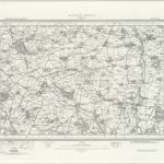
Banbury - OS One-Inch Map
1949
Ordnance Survey
1:63k
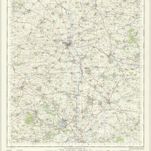
Oxford and Newbury - OS One-Inch Map
1956
Ordnance Survey
1:63k
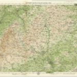
Oxford, Sheet 24 - Bartholomew's "Half Inch to the Mile Maps" of England & Wales
1903
Bartholomew, John George
1:127k
A map of the county of Berks
1762
Rocque; Rocque
An accurate map of Berkshire
1756
Bowen; Tinney; Bowles; Sayer; Bowles; Bowles
Bercheria vernacule Bark Shire
1646
Blaeu