Maps of Great Britain
Berwick upon Tweed (Outline) - OS One-Inch Revised New Series
1 : 63360 Topographic maps Ordnance Survey Ordnance Survey
Berwick upon Tweed (Hills) - OS One-Inch Revised New Series
1 : 63360 Topographic maps Ordnance Survey Ordnance Survey
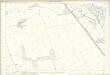
Northumberland IV - OS Six-Inch Map
1 : 10560 Topographic maps Ordnance Survey Ordnance Survey
Northumberland VIII - OS Six-Inch Map
1 : 10560 Topographic maps Ordnance Survey Ordnance Survey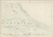
Northumberland VII - OS Six-Inch Map
1 : 10560 Topographic maps Ordnance Survey Ordnance Survey
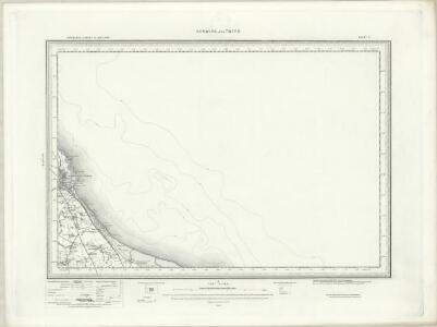
NU04 & Parts of NU14 - OS 1:25,000 Provisional Series Map
1 : 25000 Topographic maps Ordnance Survey Ordnance Survey
Northumberland nIV.NE - OS Six-Inch Map
1 : 10560 Topographic maps Ordnance Survey Ordnance Survey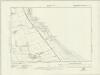
Northumberland nIV.SE - OS Six-Inch Map
1 : 10560 Topographic maps Ordnance Survey Ordnance Survey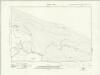
Northumberland nVIII.NW & nIVA.SW - OS Six-Inch Map
1 : 10560 Topographic maps Ordnance Survey Ordnance Survey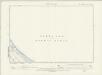
Northumberland VII.NE - OS Six-Inch Map
1 : 10560 Topographic maps Ordnance Survey Ordnance Survey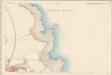
Berwick, Sheet XVIII.8 (Liberties of Berwick) - OS 6 Inch map
1 : 10560 Topographic maps Ordnance Survey Ordnance Survey
Berwick, Sheet XVIII.12 (Liberties Of Berwick) - OS 25 Inch map
1 : 2500 Topographic maps Ordnance Survey Ordnance Survey
Berwick, Sheet XVIII.4 (Liberties Of Berwick) - OS 25 Inch map
1 : 2500 Topographic maps Ordnance Survey Ordnance Survey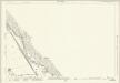
Northumberland (New Series) IV.7 (includes: Ancroft; Tweedmouth) - 25 Inch Map
1 : 2500 Topographic maps Ordnance Survey Ordnance Survey
Northumberland (New Series) IV.11 (inset IV.12) (includes: Ancroft) - 25 Inch Map
1 : 2500 Topographic maps Ordnance Survey Ordnance Survey
Northumberland (New Series) IV.15 (includes: Ancroft) - 25 Inch Map
1 : 2500 Topographic maps Ordnance Survey Ordnance Survey
Northumberland (New Series) VII.3 (includes: Ancroft) - 25 Inch Map
1 : 2500 Topographic maps Ordnance Survey Ordnance Survey
Northumberland (New Series) IV.11 (inset IV.12) - 25 Inch Map
1 : 2500 Topographic maps Ordnance Survey Ordnance Survey
Northumberland (New Series) IV.16 (includes: Ancroft) - 25 Inch Map
1 : 2500 Topographic maps Ordnance Survey Ordnance Survey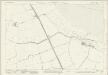
Northumberland (New Series) VII.4 (includes: Ancroft) - 25 Inch Map
1 : 2500 Topographic maps Ordnance Survey Ordnance Survey
Northumberland (New Series) VIII.1 (inset IVA.13) (includes: Ancroft) - 25 Inch Map
1 : 2500 Topographic maps Ordnance Survey Ordnance Survey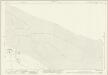
Northumberland (New Series) VIII.1 (inset IVA.13) (includes: Ancroft) - 25 Inch Map
1 : 2500 Topographic maps Ordnance Survey Ordnance Survey
Northumberland (New Series) VIII.2 (includes: Ancroft; Holy Island) - 25 Inch Map
1 : 2500 Topographic maps Ordnance Survey Ordnance Survey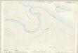
Northumberland (Old Series) VIII.9 & 13 (includes: Ancroft) - 25 Inch Map
1 : 2500 Topographic maps Ordnance Survey Ordnance Survey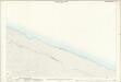
Northumberland (Old Series) VII.12 (includes: Ancroft) - 25 Inch Map
1 : 2500 Topographic maps Ordnance Survey Ordnance Survey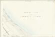
Northumberland (Old Series) VII.7 (includes: Ancroft) - 25 Inch Map
1 : 2500 Topographic maps Ordnance Survey Ordnance Survey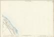
Northumberland (Old Series) IV.14 (includes: Ancroft; Tweedmouth) - 25 Inch Map
1 : 2500 Topographic maps Ordnance Survey Ordnance Survey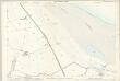
Northumberland (Old Series) VII.11 (includes: Ancroft) - 25 Inch Map
1 : 2500 Topographic maps Ordnance Survey Ordnance Survey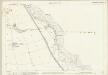
Northumberland (Old Series) VII.2 (includes: Ancroft) - 25 Inch Map
1 : 2500 Topographic maps Ordnance Survey Ordnance Survey