Maps of Lancashire
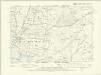
Lancashire XLVIII.SE - OS Six-Inch Map
1 : 10560 Topographic maps Ordnance Survey Ordnance Survey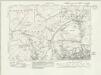
Lancashire XLVIII.SE - OS Six-Inch Map
1 : 10560 Topographic maps Ordnance Survey Ordnance Survey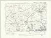
Lancashire XLVIII.SE - OS Six-Inch Map
1 : 10560 Topographic maps Ordnance Survey Ordnance Survey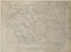
Lancashire XLVIII.SE - OS Six-Inch Map
1 : 10560 Topographic maps Ordnance Survey Ordnance Survey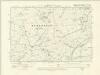
Yorkshire CLXXXIII.SE - OS Six-Inch Map
1 : 10560 Topographic maps Ordnance Survey Ordnance Survey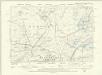
Yorkshire CLXXXIII.SE - OS Six-Inch Map
1 : 10560 Topographic maps Ordnance Survey Ordnance Survey
Yorkshire CLXXXIII.16 (includes: Blacko; Brogden; Colne; Foulridge) - 25 Inch Map
1 : 2500 Topographic maps Ordnance Survey Ordnance Survey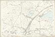
Yorkshire CLXXXIII.16 (includes: Blacko; Brogden; Colne; Foulridge) - 25 Inch Map
1 : 2500 Topographic maps Ordnance Survey Ordnance Survey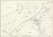
Lancashire XLVIII.12 (includes: Colne; Foulridge; Salterforth) - 25 Inch Map
1 : 2500 Topographic maps Ordnance Survey Ordnance Survey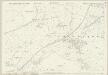
Lancashire XLVIII.12 (includes: Colne; Foulridge; Salterforth) - 25 Inch Map
1 : 2500 Topographic maps Ordnance Survey Ordnance Survey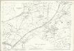
Lancashire XLVIII.12 (includes: Colne; Foulridge; Salterforth) - 25 Inch Map
1 : 2500 Topographic maps Ordnance Survey Ordnance Survey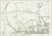
Lancashire XLVIII.16 (includes: Barrowford; Colne; Foulridge) - 25 Inch Map
1 : 2500 Topographic maps Ordnance Survey Ordnance Survey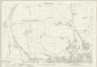
Lancashire XLVIII.16 (includes: Barrowford; Colne; Foulridge) - 25 Inch Map
1 : 2500 Topographic maps Ordnance Survey Ordnance Survey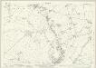
Lancashire XLVIII.15 (includes: Barrowford; Blacko; Colne; Roughlee Booth) - 25 Inch Map
1 : 2500 Topographic maps Ordnance Survey Ordnance Survey
Lancashire XLVIII.15 (includes: Barrowford; Blacko; Colne; Roughlee Booth) - 25 Inch Map
1 : 2500 Topographic maps Ordnance Survey Ordnance Survey
Lancashire XLVIII.15 (includes: Barrowford; Blacko; Colne; Roughlee Booth) - 25 Inch Map
1 : 2500 Topographic maps Ordnance Survey Ordnance Survey
Lancashire XLVIII.11 (includes: Barnoldswick; Blacko; Brogden; Colne; Foulridge; Salterforth) - 25 Inch Map
1 : 2500 Topographic maps Ordnance Survey Ordnance Survey
Lancashire XLVIII.11 (includes: Barnoldswick; Blacko; Brogden; Colne; Foulridge; Salterforth) - 25 Inch Map
1 : 2500 Topographic maps Ordnance Survey Ordnance Survey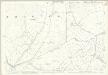
Lancashire XLVIII.11 (includes: Barnoldswick; Blacko; Brogden; Colne; Foulridge; Salterforth) - 25 Inch Map
1 : 2500 Topographic maps Ordnance Survey Ordnance Survey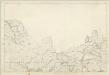
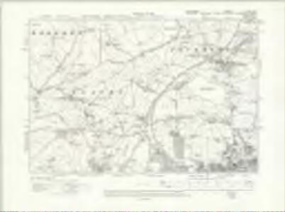
Lancashire XLVIII - OS Six-Inch Map
1 : 10560 Topographic maps Ordnance Survey Ordnance Survey
Yorkshire CLXXXIII.15 (includes: Barley With Wheatley Booth; Barrowford; Blacko; Brogden; Roughlee Booth) - 25 Inch Map
1 : 2500 Topographic maps Ordnance Survey Ordnance Survey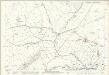
Yorkshire CLXXXIII.15 (includes: Barley With Wheatley Booth; Barrowford; Blacko; Brogden; Roughlee Booth) - 25 Inch Map
1 : 2500 Topographic maps Ordnance Survey Ordnance Survey
Yorkshire CLXXXIII.12 (includes: Barnoldswick; Blacko; Brogden; Foulridge; Salterforth) - 25 Inch Map
1 : 2500 Topographic maps Ordnance Survey Ordnance Survey
Yorkshire CLXXXIII.12 (includes: Barnoldswick; Blacko; Brogden; Foulridge; Salterforth) - 25 Inch Map
1 : 2500 Topographic maps Ordnance Survey Ordnance Survey
Yorkshire CLXXXIII.11 (includes: Barley With Wheatley Booth; Barnoldswick; Blacko; Brogden; Middop; Rimington) - 25 Inch Map
1 : 2500 Topographic maps Ordnance Survey Ordnance Survey
Yorkshire CLXXXIII.11 (includes: Barley With Wheatley Booth; Barnoldswick; Blacko; Brogden; Middop; Rimington) - 25 Inch Map
1 : 2500 Topographic maps Ordnance Survey Ordnance Survey
SD84 - OS 1:25,000 Provisional Series Map
1 : 25000 Topographic maps Ordnance Survey Ordnance Survey
Yorkshire 183 - OS Six-Inch Map
1 : 10560 Topographic maps Ordnance Survey Ordnance Survey
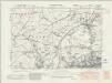
Yorkshire CLXXXIV.SW - OS Six-Inch Map
1 : 10560 Topographic maps Ordnance Survey Ordnance Survey