Maps of Northumberland
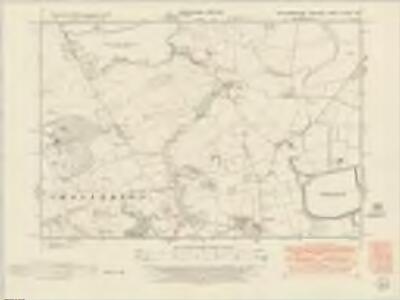
Northumberland nLXXIV.SE - OS Six-Inch Map
1 : 10560 Topographic maps Ordnance Survey Ordnance Survey
Northumberland nLXXIV.SE - OS Six-Inch Map
1 : 10560 Topographic maps Ordnance Survey Ordnance Survey
Northumberland (New Series) LXXIV.15 (includes: Chollerton) - 25 Inch Map
1 : 2500 Topographic maps Ordnance Survey Ordnance Survey
Northumberland (New Series) LXXIV.11 (includes: Chollerton; Thockrington) - 25 Inch Map
1 : 2500 Topographic maps Ordnance Survey Ordnance Survey
Northumberland (New Series) LXXIV.16 (includes: Chollerton) - 25 Inch Map
1 : 2500 Topographic maps Ordnance Survey Ordnance Survey
Northumberland (New Series) LXXIV.12 (includes: Chollerton; Little Bavington; Thockrington) - 25 Inch Map
1 : 2500 Topographic maps Ordnance Survey Ordnance Survey
Northumberland (Old Series) LXXVII.7 (includes: Chollerton; Thockrington) - 25 Inch Map
1 : 2500 Topographic maps Ordnance Survey Ordnance Survey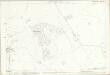
Northumberland (Old Series) LXXVII.6 (includes: Chollerton) - 25 Inch Map
1 : 2500 Topographic maps Ordnance Survey Ordnance Survey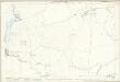
Northumberland (Old Series) LXXVII.3 (includes: Chollerton; Thockrington) - 25 Inch Map
1 : 2500 Topographic maps Ordnance Survey Ordnance Survey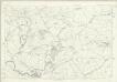
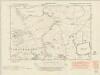
Northumberland LXXVII - OS Six-Inch Map
1 : 10560 Topographic maps Ordnance Survey Ordnance Survey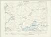
Northumberland LXXVII.NE - OS Six-Inch Map
1 : 10560 Topographic maps Ordnance Survey Ordnance Survey
Northumberland LXXVII.NW - OS Six-Inch Map
1 : 10560 Topographic maps Ordnance Survey Ordnance Survey
Northumberland (Old Series) LXXVII.2 (includes: Chollerton; Thockrington) - 25 Inch Map
1 : 2500 Topographic maps Ordnance Survey Ordnance Survey
Northumberland (Old Series) LXXVII.11 (includes: Chollerton) - 25 Inch Map
1 : 2500 Topographic maps Ordnance Survey Ordnance Survey
Northumberland (Old Series) LXXVII.10 (includes: Chollerton) - 25 Inch Map
1 : 2500 Topographic maps Ordnance Survey Ordnance Survey
NY97 - OS 1:25,000 Provisional Series Map
1 : 25000 Topographic maps Ordnance Survey Ordnance Survey
Northumberland LXXVII.SE - OS Six-Inch Map
1 : 10560 Topographic maps Ordnance Survey Ordnance Survey
Northumberland LXXVII.SW - OS Six-Inch Map
1 : 10560 Topographic maps Ordnance Survey Ordnance Survey
Northumberland (Old Series) LXXVII.8 (includes: Chollerton; Hallington; Little Bavington; Thockrington) - 25 Inch Map
1 : 2500 Topographic maps Ordnance Survey Ordnance Survey
Northumberland (Old Series) LXXVII.4 (includes: Chollerton; Great Bavington; Hallington; Little Bavington; Thockrington) - 25 Inch Map
1 : 2500 Topographic maps Ordnance Survey Ordnance Survey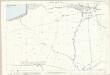
Northumberland (Old Series) LXXVII.12 (includes: Bingfield; Chollerton; Hallington) - 25 Inch Map
1 : 2500 Topographic maps Ordnance Survey Ordnance Survey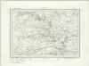
Bellingham (Outline) - OS One-Inch Revised New Series
1 : 63360 Topographic maps Ordnance Survey Ordnance Survey
Bellingham (Hills) - OS One-Inch Revised New Series
1 : 63360 Topographic maps Ordnance Survey Ordnance Survey
Hexham - OS One-Inch Map
1 : 63360 Topographic maps Ordnance Survey Ordnance Survey
Cheviots - Bartholomew's 'Survey Atlas of Scotland'
1 : 126720 Topographic maps John Bartholomew & Son, Ltd John Bartholomew & Son, Ltd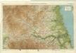
Northumberland, South, Sheet 2 - Bartholomew's "Half Inch to the Mile Maps" of England & Wales
1 : 126720 Topographic maps Bartholomew, John George John Bartholomew & Co
Episcopatus Dunelmensis, Vulgo The Bishoprike of Durham. [Karte], in: Theatrum orbis terrarum, sive, Atlas novus, Bd. 4, S. 469.
1 Karte aus Atlas Blaeu, Joan Blaeu, Willem Janszoon
Episcopatus Dunelmensis. Vulgo The Bishoprike of Durham. [Karte], in: Le théâtre du monde, ou, Nouvel atlas contenant les chartes et descriptions de tous les païs de la terre, Bd. 4, S. 403.
1 Karte aus Atlas Blaeu, Willem Janszoon und Blaeu, Joan Blaeu, Willem Janszoon
Episcopatus Dunelmensis, Vulgo The Bishoprike of Durham. [Karte], in: Theatrum orbis terrarum, sive, Atlas novus, Bd. 4, S. 469.
1 Karte aus Atlas Blaeu, Joan Blaeu, Willem Janszoon