Maps of Northumberland
Northumberland LXX.SE - OS Six-Inch Map
1 : 10560 Topographic maps Ordnance Survey Ordnance Survey
Northumberland (New Series) LXXV.4 (includes: Bradford; Capheaton; East Shaftoe; Harnham; West Shaftoe) - 25 Inch Map
1 : 2500 Topographic maps Ordnance Survey Ordnance Survey
Northumberland (Old Series) LXX.12 (includes: Bolam; Bradford; East Shaftoe; Harnham; Shortflatt) - 25 Inch Map
1 : 2500 Topographic maps Ordnance Survey Ordnance Survey
Northumberland (Old Series) LXX.16 (includes: Belsay; Bradford; Harnham; Shortflatt) - 25 Inch Map
1 : 2500 Topographic maps Ordnance Survey Ordnance Survey
Northumberland (Old Series) LXX.15 (includes: Bradford; Capheaton; West Shaftoe) - 25 Inch Map
1 : 2500 Topographic maps Ordnance Survey Ordnance Survey
Northumberland (Old Series) LXX.11 (includes: Bradford; Capheaton; East Shaftoe; West Shaftoe) - 25 Inch Map
1 : 2500 Topographic maps Ordnance Survey Ordnance Survey
Northumberland (New Series) LXXVI.1 (includes: Bolam; Bradford; Harnham; Shortflatt) - 25 Inch Map
1 : 2500 Topographic maps Ordnance Survey Ordnance Survey
Northumberland (New Series) LXXV.8 (includes: Belsay; Bradford; Capheaton; Kirkheaton) - 25 Inch Map
1 : 2500 Topographic maps Ordnance Survey Ordnance Survey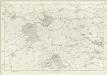
Northumberland LXX - OS Six-Inch Map
1 : 10560 Topographic maps Ordnance Survey Ordnance Survey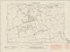
Northumberland nLXXV.NE - OS Six-Inch Map
1 : 10560 Topographic maps Ordnance Survey Ordnance Survey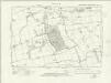
Northumberland nLXXV.NE - OS Six-Inch Map
1 : 10560 Topographic maps Ordnance Survey Ordnance Survey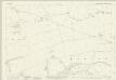
Northumberland (New Series) LXXVI.5 (includes: Belsay; Bradford; Harnham; Shortflatt) - 25 Inch Map
1 : 2500 Topographic maps Ordnance Survey Ordnance Survey
Northumberland (New Series) LXVII.16 (includes: Bolam; Corridge; Deanham; East Shaftoe; Harnham; South Middleton; West Shaftoe) - 25 Inch Map
1 : 2500 Topographic maps Ordnance Survey Ordnance Survey
Northumberland (New Series) LXVIII.13 (includes: Bolam; Corridge; Harnham; Highlaws; Low Angerton) - 25 Inch Map
1 : 2500 Topographic maps Ordnance Survey Ordnance Survey
NZ08 - OS 1:25,000 Provisional Series Map
1 : 25000 Topographic maps Ordnance Survey Ordnance Survey
Northumberland nLXXV - OS Six-Inch Map
1 : 10560 Topographic maps Ordnance Survey Ordnance Survey
Northumberland nLXXVI - OS Six-Inch Map
1 : 10560 Topographic maps Ordnance Survey Ordnance Survey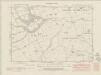
Northumberland nLXVII.SE - OS Six-Inch Map
1 : 10560 Topographic maps Ordnance Survey Ordnance Survey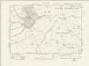
Northumberland nLXVII.SE - OS Six-Inch Map
1 : 10560 Topographic maps Ordnance Survey Ordnance Survey
Northumberland (New Series) LXXV.3 (includes: Capheaton; Deanham; Kirkharle; West Shaftoe) - 25 Inch Map
1 : 2500 Topographic maps Ordnance Survey Ordnance Survey
Northumberland (New Series) LXXV.7 (includes: Capheaton; Kirkharle; Kirkheaton) - 25 Inch Map
1 : 2500 Topographic maps Ordnance Survey Ordnance Survey
Northumberland (New Series) LXVII.15 (includes: Capheaton; Deanham; Kirkharle; Little Harle; West Shaftoe) - 25 Inch Map
1 : 2500 Topographic maps Ordnance Survey Ordnance Survey
Morpeth (Hills) - OS One-Inch Revised New Series
1 : 63360 Topographic maps Ordnance Survey Ordnance Survey
Morpeth (Outline) - OS One-Inch Revised New Series
1 : 63360 Topographic maps Ordnance Survey Ordnance Survey
Hexham - OS One-Inch Map
1 : 63360 Topographic maps Ordnance Survey Ordnance Survey
Newcastle Upon Tyne - OS One-Inch Map
1 : 63360 Topographic maps Ordnance Survey Ordnance Survey
Cheviots - Bartholomew's 'Survey Atlas of Scotland'
1 : 126720 Topographic maps John Bartholomew & Son, Ltd John Bartholomew & Son, Ltd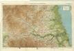
Northumberland, South, Sheet 2 - Bartholomew's "Half Inch to the Mile Maps" of England & Wales
1 : 126720 Topographic maps Bartholomew, John George John Bartholomew & Co
Sheets 68-69. (Cary's England, Wales, and Scotland).
1 : 360000 Cary, John, ca. 1754-1835