Maps of Northumberland
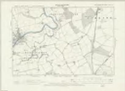
Northumberland XLVI.SW - OS Six-Inch Map
1 : 10560 Topographic maps Ordnance Survey Ordnance Survey
Northumberland (Old Series) XLVI.10 (includes: Acklington Park; Acklington; East Chevington; Thirston With Shothaugh) - 25 Inch Map
1 : 2500 Topographic maps Ordnance Survey Ordnance Survey
Northumberland (Old Series) XLVI.14 (includes: Acklington Park; Acklington; East Chevington; Eshott; Thirston With Shothaugh; West Chevington) - 25 Inch Map
1 : 2500 Topographic maps Ordnance Survey Ordnance Survey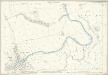
Northumberland (Old Series) XLVI.9 (includes: Acklington Park; Acton And Old Felton; Felton; Thirston With Shothaugh) - 25 Inch Map
1 : 2500 Topographic maps Ordnance Survey Ordnance Survey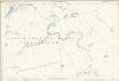
Northumberland (Old Series) XLVI.13 (includes: Bockenfield; Eshott; Felton; Thirston With Shothaugh) - 25 Inch Map
1 : 2500 Topographic maps Ordnance Survey Ordnance Survey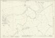
Northumberland (New Series) LI.2 (includes: Acklington Park; Acklington; Acton And Old Felton; Eshott; Felton; Thirston With Shothaugh) - 25 Inch Map
1 : 2500 Topographic maps Ordnance Survey Ordnance Survey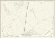
Northumberland (New Series) LI.3 (includes: Acklington Park; Acklington; East Chevington; Thirston With Shothaugh; West Chevington) - 25 Inch Map
1 : 2500 Topographic maps Ordnance Survey Ordnance Survey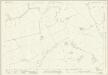
Northumberland (New Series) LI.6 (includes: Bockenfield; Eshott; Thirston With Shothaugh) - 25 Inch Map
1 : 2500 Topographic maps Ordnance Survey Ordnance Survey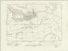
Northumberland nLI.NW - OS Six-Inch Map
1 : 10560 Topographic maps Ordnance Survey Ordnance Survey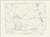
Northumberland nLI.NE - OS Six-Inch Map
1 : 10560 Topographic maps Ordnance Survey Ordnance Survey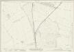
Northumberland (New Series) LI.7 (includes: Acklington; East Chevington; Eshott; Thirston With Shothaugh; West Chevington) - 25 Inch Map
1 : 2500 Topographic maps Ordnance Survey Ordnance Survey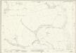
Northumberland (New Series) XLIII.14 (includes: Acklington Park; Acton And Old Felton; Felton; Guyzance) - 25 Inch Map
1 : 2500 Topographic maps Ordnance Survey Ordnance Survey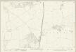
Northumberland (New Series) XLIII.15 (includes: Acklington Park; Acklington; Morwick) - 25 Inch Map
1 : 2500 Topographic maps Ordnance Survey Ordnance Survey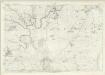
Northumberland XLVI - OS Six-Inch Map
1 : 10560 Topographic maps Ordnance Survey Ordnance Survey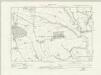
Northumberland nXLIII.SW - OS Six-Inch Map
1 : 10560 Topographic maps Ordnance Survey Ordnance Survey
Northumberland nXLIII.SE - OS Six-Inch Map
1 : 10560 Topographic maps Ordnance Survey Ordnance Survey
Northumberland (New Series) LI.1 (includes: Felton; Swarland; Thirston With Shothaugh) - 25 Inch Map
1 : 2500 Topographic maps Ordnance Survey Ordnance Survey
Northumberland (New Series) LI.5 (includes: Bockenfield; Thirston With Shothaugh) - 25 Inch Map
1 : 2500 Topographic maps Ordnance Survey Ordnance Survey
Rothbury (Hills) - OS One-Inch Revised New Series
1 : 63360 Topographic maps Ordnance Survey Ordnance Survey
Rothbury (Outline) - OS One-Inch Revised New Series
1 : 63360 Topographic maps Ordnance Survey Ordnance Survey
Alnwick - OS One-Inch Map
1 : 63360 Topographic maps Ordnance Survey Ordnance Survey
Northumberland, North, Sheet 1 - Bartholomew's "Half Inch to the Mile Maps" of England & Wales
1 : 126720 Topographic maps Bartholomew, John George John Bartholomew & Co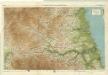
Northumberland, South, Sheet 2 - Bartholomew's "Half Inch to the Mile Maps" of England & Wales
1 : 126720 Topographic maps Bartholomew, John George John Bartholomew & Co
Sheets 68-69. (Cary's England, Wales, and Scotland).
1 : 360000 Cary, John, ca. 1754-1835
A new improved map of Northumberland
1 Karte : Kupferdruck ; 67 x 50 cm Kitchin; Hinton sold by J. Hinton at the Kings Arms in St. Pauls Church Yard
Comitatvs Northvmbria; vernacula Northvmberland
1 Karte : Kupferdruck ; 39 x 48 cm Blaeu Joan Blaeu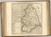

Holy-Island, Fairn Islands with the many Rocks and Hazards that lye Scatter'd in that Sea, and the Coast from Sunderland point in England to St Abbs-head in Scotland, survey'd and navigated by J[oh]n
Adair, John, ca. 1650-1722
COMITATVS | NORTHVMBRIA; | Vernacule | NORTHUMBERLAND.
Ioh. Blaeu Exc.