Maps of Northumberland
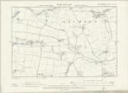
Northumberland VII.SW - OS Six-Inch Map
1 : 10560 Topographic maps Ordnance Survey Ordnance Survey
Northumberland (New Series) VII.2 (includes: Ancroft; Kyloe) - 25 Inch Map
1 : 2500 Topographic maps Ordnance Survey Ordnance Survey
Northumberland (Old Series) VII.9 (includes: Ancroft) - 25 Inch Map
1 : 2500 Topographic maps Ordnance Survey Ordnance Survey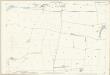
Northumberland (Old Series) VII.13 (includes: Ancroft; Kyloe) - 25 Inch Map
1 : 2500 Topographic maps Ordnance Survey Ordnance Survey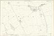
Northumberland (Old Series) VII.10 (includes: Ancroft) - 25 Inch Map
1 : 2500 Topographic maps Ordnance Survey Ordnance Survey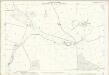
Northumberland (Old Series) VII.14 (includes: Ancroft; Kyloe) - 25 Inch Map
1 : 2500 Topographic maps Ordnance Survey Ordnance Survey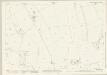
Northumberland (New Series) VII.3 (includes: Ancroft) - 25 Inch Map
1 : 2500 Topographic maps Ordnance Survey Ordnance Survey
Northumberland (New Series) VII.6 (includes: Ancroft; Kyloe; Lowick) - 25 Inch Map
1 : 2500 Topographic maps Ordnance Survey Ordnance Survey
Northumberland nVII.NW - OS Six-Inch Map
1 : 10560 Topographic maps Ordnance Survey Ordnance Survey
Northumberland nVII.NE - OS Six-Inch Map
1 : 10560 Topographic maps Ordnance Survey Ordnance Survey
Northumberland (New Series) VII.7 (includes: Ancroft; Kyloe) - 25 Inch Map
1 : 2500 Topographic maps Ordnance Survey Ordnance Survey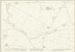
Northumberland (New Series) IV.14 (includes: Ancroft; Ord) - 25 Inch Map
1 : 2500 Topographic maps Ordnance Survey Ordnance Survey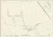
Northumberland (New Series) IV.15 (includes: Ancroft) - 25 Inch Map
1 : 2500 Topographic maps Ordnance Survey Ordnance Survey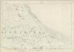
Northumberland VII - OS Six-Inch Map
1 : 10560 Topographic maps Ordnance Survey Ordnance Survey
NU04 & Parts of NU14 - OS 1:25,000 Provisional Series Map
1 : 25000 Topographic maps Ordnance Survey Ordnance Survey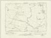
Northumberland nIV.SW - OS Six-Inch Map
1 : 10560 Topographic maps Ordnance Survey Ordnance Survey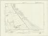
Northumberland nIV.SE - OS Six-Inch Map
1 : 10560 Topographic maps Ordnance Survey Ordnance Survey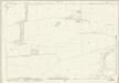
Northumberland (New Series) VII.1 (includes: Ancroft; Kyloe) - 25 Inch Map
1 : 2500 Topographic maps Ordnance Survey Ordnance Survey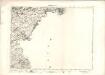
Berwick Upon Tweed - OS One-Inch map
1 : 63360 Topographic maps Ordnance Survey Ordnance Survey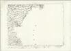
Berwick Upon Tweed - OS One-Inch map
1 : 63360 Topographic maps Ordnance Survey Ordnance Survey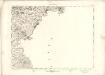
Berwick Upon Tweed - OS One-Inch map
1 : 63360 Topographic maps Ordnance Survey Ordnance Survey
Mercia vulgo vicecomitatvs Bervicensis
1 Karte : Kupferdruck ; 36 x 48 cm Pont; Blaeu Joan Blaeu
Berwick Upon Tweed - OS One-Inch Map
1 : 63360 Topographic maps Ordnance Survey Ordnance Survey
Berwick - Bartholomew's 'Survey Atlas of Scotland'
1 : 126720 Topographic maps John Bartholomew & Son, Ltd John Bartholomew & Son, Ltd
THE MERCE | or Shirrefdome of | BERWICK. [=] MERCIA | Vulgo | VICECOMITATVS BERVICENSIS
Auct Timothei Pont [Amsterdam : Joan Blaeu]
Northumberland, North, Sheet 1 - Bartholomew's "Half Inch to the Mile Maps" of England & Wales
1 : 126720 Topographic maps Bartholomew, John George John Bartholomew & Co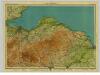
East Lothian, Sheet 9 - Bartholomew's "Half Inch to the Mile Maps" of Scotland
1 : 126720 Topographic maps John Bartholomew & Son, Ltd John Bartholomew & Son, Ltd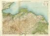
Berwick & Haddington, Sheet 9 - Bartholomew's "Half Inch to the Mile Maps" of Scotland
1 : 126720 Topographic maps Bartholomew, John George John Bartholomew & Co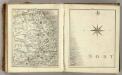
Sheets 68-69. (Cary's England, Wales, and Scotland).
1 : 360000 Cary, John, ca. 1754-1835