Maps of South Yorkshire
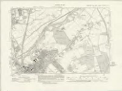
Yorkshire CCLXXVII.SW - OS Six-Inch Map
1 : 10560 Topographic maps Ordnance Survey Ordnance Survey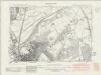
Yorkshire CCLXXVII.SW - OS Six-Inch Map
1 : 10560 Topographic maps Ordnance Survey Ordnance Survey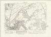
Yorkshire CCLXXVII.SW - OS Six-Inch Map
1 : 10560 Topographic maps Ordnance Survey Ordnance Survey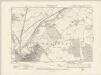
Yorkshire CCLXXVII.SW - OS Six-Inch Map
1 : 10560 Topographic maps Ordnance Survey Ordnance Survey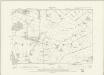
Yorkshire CCLXXVII.SW - OS Six-Inch Map
1 : 10560 Topographic maps Ordnance Survey Ordnance Survey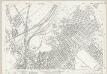
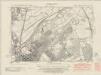
Yorkshire CCLXXVII.13 (includes: Bentley With Arksey; Doncaster; Spotbrough) - 25 Inch Map
1 : 2500 Topographic maps Ordnance Survey Ordnance Survey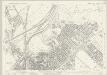
Yorkshire CCLXXVII.13 (includes: Bentley With Arksey; Doncaster; Spotbrough) - 25 Inch Map
1 : 2500 Topographic maps Ordnance Survey Ordnance Survey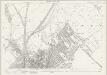
Yorkshire CCLXXVII.13 (includes: Bentley With Arksey; Doncaster; Spotbrough) - 25 Inch Map
1 : 2500 Topographic maps Ordnance Survey Ordnance Survey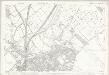
Yorkshire CCLXXVII.13 (includes: Bentley With Arksey; Doncaster; Spotbrough) - 25 Inch Map
1 : 2500 Topographic maps Ordnance Survey Ordnance Survey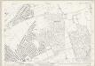
Yorkshire CCLXXVII.14 (includes: Armthorpe; Doncaster) - 25 Inch Map
1 : 2500 Topographic maps Ordnance Survey Ordnance Survey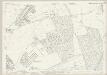
Yorkshire CCLXXVII.14 (includes: Armthorpe; Doncaster) - 25 Inch Map
1 : 2500 Topographic maps Ordnance Survey Ordnance Survey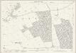
Yorkshire CCLXXVII.14 (includes: Armthorpe; Doncaster) - 25 Inch Map
1 : 2500 Topographic maps Ordnance Survey Ordnance Survey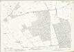
Yorkshire CCLXXVII.14 (includes: Armthorpe; Doncaster) - 25 Inch Map
1 : 2500 Topographic maps Ordnance Survey Ordnance Survey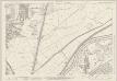
Yorkshire CCLXXVII.9 (includes: Bentley With Arksey; Doncaster) - 25 Inch Map
1 : 2500 Topographic maps Ordnance Survey Ordnance Survey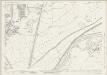
Yorkshire CCLXXVII.9 (includes: Bentley With Arksey; Doncaster) - 25 Inch Map
1 : 2500 Topographic maps Ordnance Survey Ordnance Survey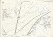
Yorkshire CCLXXVII.9 (includes: Bentley With Arksey; Doncaster) - 25 Inch Map
1 : 2500 Topographic maps Ordnance Survey Ordnance Survey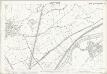
Yorkshire CCLXXVII.9 (includes: Bentley With Arksey; Doncaster) - 25 Inch Map
1 : 2500 Topographic maps Ordnance Survey Ordnance Survey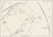
Yorkshire CCLXXVII.10 (includes: Armthorpe; Barnby Dun With Kirk Sandall; Bentley With Arksey; Doncaster) - 25 Inch Map
1 : 2500 Topographic maps Ordnance Survey Ordnance Survey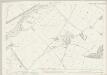
Yorkshire CCLXXVII.10 (includes: Armthorpe; Barnby Dun With Kirk Sandall; Bentley With Arksey; Doncaster) - 25 Inch Map
1 : 2500 Topographic maps Ordnance Survey Ordnance Survey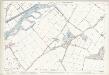
Yorkshire CCLXXVII.10 (includes: Armthorpe; Barnby Dun With Kirk Sandall; Bentley With Arksey; Doncaster) - 25 Inch Map
1 : 2500 Topographic maps Ordnance Survey Ordnance Survey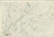
Yorkshire 277 - OS Six-Inch Map
1 : 10560 Topographic maps Ordnance Survey Ordnance Survey
SE50 - OS 1:25,000 Provisional Series Map
1 : 25000 Topographic maps Ordnance Survey Ordnance Survey
Doncaster (Hills) - OS One-Inch Revised New Series
1 : 63360 Topographic maps Ordnance Survey Ordnance Survey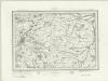
Doncaster (Outline) - OS One-Inch Revised New Series
1 : 63360 Topographic maps Ordnance Survey Ordnance Survey
Doncaster - OS One-Inch Map
1 : 63360 Topographic maps Ordnance Survey Ordnance Survey
Sheffield, Sheet 9 - Bartholomew's "Half Inch to the Mile Maps" of England & Wales
1 : 126720 Topographic maps Bartholomew, John George John Bartholomew & Co
Sheets 51-52. (Cary's England, Wales, and Scotland).
1 : 360000 Cary, John, ca. 1754-1835