Maps of Rennertshofen
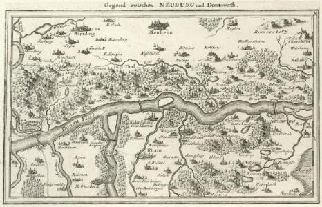
Gegend zwischen Neuburg und Donauwerth
Mollova mapová sbírka Bodenehr, Gabriel Bodenehr, Gabriel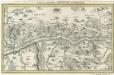
Gegend zwischen Neuburg und Donauwerth.
1 : 140000 Mollova mapová sbírka Bodenehr, Gabriel Bodenehr, Gabriel
Neuburg an der Donau mit der Gegend auf 2 Stund.
1 : 170000 Mollova mapová sbírka Bodenehr, Gabriel Bodenehr, Gabriel
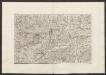
Bairische Landtafeln XXIIII. Darinnē das hochlöblich Furstenthumb Obern unnd Nidern Bayrn sambt der Obern Pflaz Erz unnd Stifft Salzburg Eichstet unnd andern mehrern anstossenden Herschafftē]
1 : 145000 Mollova mapová sbírka Apian, Philipp Amman, Jost Apian, Petrus
172. Nördlingen, uit: Topographische Uebersichtskarte des Deutschen Reiches / herausgegeben v. d. Kartogr. Abt. d. Königl. Preuß. Landesaufnahme
1 : 200000 titelvariant: Topogr. Übersichtskarte des Deutschen Reiches; Annotatie: Titel boven bladen ook: Topogr. Übersichtskarte des Deutschen Reiches; Annotatie geografische gegevens: Op elk blad twee maatstokken: 10 Kilometer = 5,5 cm; 1 geogr. Meile = 3,6 cm; Legenda onder op elk blad Königlich Preußische Landesaufnahme. Kartographische Abtheilung [S.l : Königlich Preußische Landesaufnahme, Kartographische Abtheilung]
Suevia Universa :
1 : 170000 Mollova mapová sbírka Michal, Jacques de Seutter, Matthäus Seutter, Matthäus
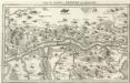
Monstrat mediam Partem Ducat: Bavariæ, Urbem Jmp: Augustam Vindelicorum, cum Parte Ducat Neoburg, et Episc. Frising
1 : 150000 Mollova mapová sbírka Buna, Wilhelm C. Broenner, Heinrich Ludwig
Weitere Fortsetzung des heurigen Kriegs Theatri
Mollova mapová sbírka Lidl, Johann Jakob Lidl, Johann Jacob
Pars IV. monstrat mediam partem ducat: Bavariæ, urbem jmp: Augustam Vindelicorum, cum parte ducat Neoburg, et episc. Frising
1 Karte : 54 x 52 cm Heinrich Ludwig Broenner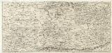
S. R. Imp. Circuli Franconici Geographica Delineatio Francken-Land mit Seinen Gräntzen
Mollova mapová sbírka Endter, Wolfgang Moritz Endter, Wolfgang Moritz
Theatrum des Krieges in der Marggrafschaft Burgau
Mollova mapová sbírka Stridbeck, Johann Stridbeck, Johann II
Ingolstad 129, uit: Special-Karte von Mittel-Europa / nach amtlichen Quellen bearbeitet von W. Liebenow
1 : 300000 titelvariant: W. Liebenow's Mittel-Europa; Annotatie: Titel boven de bladen: W. Liebenow's Mittel-Europa Johannes Wilhelm Liebenow 1822-1897 Frankfurt a. M. : Ludwig Ravenstein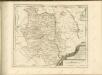

Mappa geographica comitatvs Oettingensis in circulo Sueviceo siti
1 : 100000 Švábsko (Německo) Cnopf, Matthäus Ferdinand edentibus Homanninanis Heredibus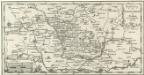
Vorstellung der Teuffels-Mauer in Nordgau und anliegenden Gegenden
1 : 340000 Mollova mapová sbírka
Mappa Geographica Comitatvs Oettingensis
1 : 100000 Mollova mapová sbírka Cnopf, Matthäus Ferdinand Homann, Johann Baptista - dědici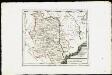
Die Grafschaft Oetingen mit den freyen Reichsstädten Nördlingen Bopfingen und Dünkelsbühl : Nro. 181
Reilly, Franz Johann Joseph von
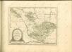
Geographica Provinciarum Sveviae Descriptio =
Mollova mapová sbírka Hurter, Johann Christoph Bodenehr, Johann Georg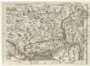
Geographica Provinciarum Sveviae Descriptio =
Mollova mapová sbírka Hurter, Johann Christoph Bodenehr, Gabriel
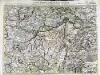
Nieuwe Kaart, van t'Land Donawert, en Hochstett &c.
1 : 200000 Mollova mapová sbírka Visscher, Nicolaes Jansz. Visscher, Nicolaus II.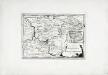
Die Grafschaft Pappenheim
1 Karte : Kupferdruck ; 19 x 27 cm Reilly F. J. J. von Reilly
Nova comitatus Pappenheimensis tabula, cum finitimis diversorum imperii statuum locis et tractibus, nec non dynastia Bellenberg in Suevia sita
1 : 90000 Švábsko (Německo) impensis Homannianorum Heredum
A plan of the famous victory at Bleinem obtained by His Grace the Duke of Malborough over the Elector of Bavaria and the Marechals Tallard and Marcin, the 13th August, 1704 S.N
1 : 20000 J. van Vianen fecit [Amsterdam] : Reynerus Leers excudit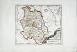
Die Grafschaft Oetingen
1 Karte : Kupferdruck ; 23 x 27 cm Reilly F. J. J. von Reilly
Suevia universa IX. tabulis delineata, 3
1 Blatt : s.n.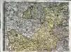
Sacri Romani imperii circuli et electoratus Bavariae tabula, 3
4 Blätter : s.n.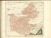
Carte topographique d'Allemagne contenant une partie de Baviere les principautés de Wurtemberg, d'Oettingen
1 Karte : Kupferdruck ; 45 x 63 cm Jaeger se vend chez l'auteur