Maps of Kirchberg i.Wald

Bairische Landtafeln XXIIII. Darinnē das hochlöblich Furstenthumb Obern unnd Nidern Bayrn sambt der Obern Pflaz Erz unnd Stifft Salzburg Eichstet unnd andern mehrern anstossenden Herschafftē]
1 : 145000 Mollova mapová sbírka Apian, Philipp Amman, Jost Apian, Petrus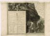
Müllerova mapa Čech
1 : 132000
174. Straubing, uit: Topographische Uebersichtskarte des Deutschen Reiches / herausgegeben v. d. Kartogr. Abt. d. Königl. Preuß. Landesaufnahme
1 : 200000 titelvariant: Topogr. Übersichtskarte des Deutschen Reiches; Annotatie: Titel boven bladen ook: Topogr. Übersichtskarte des Deutschen Reiches; Annotatie geografische gegevens: Op elk blad twee maatstokken: 10 Kilometer = 5,5 cm; 1 geogr. Meile = 3,6 cm; Legenda onder op elk blad Königlich Preußische Landesaufnahme. Kartographische Abtheilung [S.l : Königlich Preußische Landesaufnahme, Kartographische Abtheilung]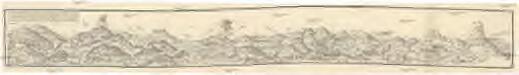
Eine Böhmenwald-Grenzkarte vom Jahre 1514
Šumava-oblast Schrötter, Georg Instituts für ostbairische Heimatforschung
Generální mapa Protektorátu Čechy a Morava

Regensburg 130, uit: Special-Karte von Mittel-Europa / nach amtlichen Quellen bearbeitet von W. Liebenow
1 : 300000 titelvariant: W. Liebenow's Mittel-Europa; Annotatie: Titel boven de bladen: W. Liebenow's Mittel-Europa Johannes Wilhelm Liebenow 1822-1897 Frankfurt a. M. : Ludwig Ravenstein
Sacri Romani imperii circuli et electoratus Bavariae tabula, 4
4 Blätter : s.n.
Pars VI designat partem orientem regiminis Landh: et Straub; infer partem ditionis Burchh; episc: Patav; com: Ortemb: et Neoburg; cum oris archid: Austriæ
1 Karte : 54 x 52 cm Heinrich Ludwig Broenner
designat partem orientem Regiminis Landh: et Straub; Infer Partem ditionis Burchh; Episc: Patav; Com: Ortemb: et Neoburg; cum oris Archid: Austriæ
1 : 150000 Mollova mapová sbírka Buna, Wilhelm C. Broenner, Heinrich Ludwig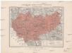
Generální mapa okresního hejtmanství Prachatického
1 : 220000 Prachatice-oblast (Česko) Wagner, Jan Eduard F. Kytka
Podrobná mapa Království českého
1 : 100000 Kvilda (Česko : oblast) Srp, Jan Jaroslav Bursík
Generální mapa okresních hejtmanství

Eisenstein und Viechtach.
from Spezialkarte der osterreichisch-ungarischen Monarchie.
Kuschwarda.
from Spezialkarte der osterreichisch-ungarischen Monarchie.
Nová Mapa království Českého
1 : 200000 Čechy jihozápadní (Česko) Kotyška, Václav Hanf, Norbert Bursík & Kohout
[Kartenblatt]
1 : 25000 Zwiesel (Německo) Reichsamt für Landesaufnahme
Meßtischblatt 282 : Zwiesel, 1930
1 : 250000 Zwiesel. - Aufn. 1926, 1927, Ausg. 1930. - 1:25000. - Topograph. Zweigstelle d. Bayer. Landesvermess, 1930. - 1 Kt.
Südwestliches Böhmen
1 : 220000 Jihočeský kraj (Česko) Wagner, Jan Eduard F. Kytka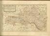
Šumava
1 : 200000 Šumava-oblast Pacovský, Jaroslav Klub českoslov. turistů
Šumava
1 : 200000 Šumava (pohoří : oblast) Klub českoslov. turistů
175. Passau, uit: Topographische Uebersichtskarte des Deutschen Reiches / herausgegeben v. d. Kartogr. Abt. d. Königl. Preuß. Landesaufnahme
1 : 200000 titelvariant: Topogr. Übersichtskarte des Deutschen Reiches; Annotatie: Titel boven bladen ook: Topogr. Übersichtskarte des Deutschen Reiches; Annotatie geografische gegevens: Op elk blad twee maatstokken: 10 Kilometer = 5,5 cm; 1 geogr. Meile = 3,6 cm; Legenda onder op elk blad Königlich Preußische Landesaufnahme. Kartographische Abtheilung [S.l : Königlich Preußische Landesaufnahme, Kartographische Abtheilung]
Jihozápadní Čechy

Jihozápadní Čechy
1 : 220000 Šumava-oblast Wagner, Jan Eduard F. Kytka
Jihozápadní Čechy
1 : 220000 Šumava-oblast Wagner, Jan Eduard F. Kytka
Šumava
1 : 288000 Šumava-oblast Kohut, Josef Líčka, Josef nákladem Františka Řivnáče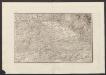
Militair Karte von Süd-Deutschland in 20 Sectionen
1 : 400000 11. Section Coulon, Alois von A. von Coulon
Fol. II
1 Karte : 43 x 55 cm Königliche Akademie der Wissenschaften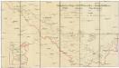
Schutzvereins-Ortsgruppen des Böhmerwaldes und Deutsch-Südböhmens
1 : 200000 Čechy jižní (Česko)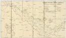
![Bairische Landtafeln XXIIII. Darinnē das hochlöblich Furstenthumb Obern unnd Nidern Bayrn sambt der Obern Pflaz Erz unnd Stifft Salzburg Eichstet unnd andern mehrern anstossenden Herschafftē]](https://images-2.georeferencer.com/images/iiif/841332370356/full/,300/0/native.jpg)

