Maps of Rheinland-Pfalz

Vollständige Carte des gantzen Rhein Stroms]
1 : 840000 Mollova mapová sbírka Riegel, Christoph Riegel, Christoph
Carte de France, 4
2 Blätter : Kupferdruck ; 54 x 45 cm Crepy
S.R.I. circulos Rhenanus inferior sive electorum Rheni
1 : 632000 Kolín nad Rýnem-oblast (Německo) Homann, Johann Baptist â Ioh. Baptista Homanno
S. R. I. circulus Rhenanus inferior sive electorum Rheni
1 : 624000 Kolín nad Rýnem (Německo) Homann, Johann Baptist I. B. Homann
Teatre de la Guerre sur le Rhin, Moessele, Mayn, le Necker, Meuse, Avec les Pais voisins
1 : 420000 Mollova mapová sbírka Sanson, Nicolas Huyberts, Cornelis Mortier, Pierre
Totius Rheni â fontibus usque ad Ostia Novissima Descriptio
1 : 550000 Mollova mapová sbírka Steudner, Johann P. Bodenehr, Johann Georg Steüdner, Johann Philipp
Der Nider Rheinische Crais samt Dessen angrenzenden Landern
1 : 560000 Mollova mapová sbírka
Generalis Lotharingiæ ducatus tabula
1 Karte auf 2 Blättern : Kupferdruck ; 61 x 55 cm Visscher N. Visscher
Synopsis Circuli Rhenani Inferioris, Sive Electorum Rheni
1 : 620000 Mollova mapová sbírka Seutter, Matthäus Seutter, Matthäus
Le Theatre De La Guerre En Allemagne :
Mollova mapová sbírka Fer, Nicolas de Danet, Guillaume
Das Kriegstheater an der Rhein & Mainlinie
1 : 990000 Porýní-Falc (Německo) Meyer, A. litogr. Maschinendruck von A. Meyer
Die Preussische Rhein-Provinz und das Herzogthum Nassau
Grosser Hand-Atlas über alle Theile der Erde in 170 Karten Meyer, J. Verlag des Bibliographischen Instituts
Generalis Lotharingiae ducatus tabula, qua accuratissimé ostenduntur ducatus Lotharingiae propriae et Barrensis, nec non Metensis, Tullensis, Verdunensis et alii tractus inserti et finitimi, et in quas minores ditiones subjacentes eorundem quisque divisus
1 : 500000 per Nicolaum Visscher Amst. Bat. Amst. Bat. : per Nicolaum Visscher

Synopsis Circuli Rhenani Inferioris sive Electorum Rheni, exhibens Archi Episcopatum Moguntinum, Coloniensem, Trevirensem et Palatinatum Rheni, Comitatus Beilstein, Newenaer, Isenburg Infer. et Reifferscheid
1 : 800000 ob oculos posita a Matth. Seutter Aug. Vind : Matth. Seutter
Kreise der Rheinprovinz 1864
Preußen, Rheinprovinz, Verwaltungsgliederung Kunz, Andreas ; Moeschl, Joachim Robert
Le Cercle Eslectoral du Rhein subdivisé et touts les Estats qui le composent
1 : 560000 Mollova mapová sbírka Sanson, Guillaume Jaillot, Alexis Hubert
S.R.I. circulus Rhenanus inferior sive electorum Rheni
1 : 640000 Dolní Porýní (Německo) Homann, Johann Baptist a Ioh. Baptista Homanno
S.R.I. circulus Rhenanus inferior sive electorum Rheni
1 : 640000 Dolní Porýní (Německo) Homann, Johann Baptist a Ioh. Baptista Homanno
S.R.I. circulus Rhenanus inferior sive electorum Rheni
1 : 640000 Dolní Porýní (Německo) Homann, Johann Baptist a Ioh. Baptista Homanno
S. R. I. circulus Rhenanus inferior sive electorum Rheni
1 : 660000 Kolín nad Rýnem (Německo) Homann, Johann Baptist J.B. Homann
S.R.I. circulus Rhenanus inferior sive electorum Rheni
1 : 640000 Dolní Porýní (Německo) Homann, Johann Baptist á Ioh. Baptista Homanno
Uterque Rheni Circulus, Superior, et Inferior Electoralis, cum Palatinatu :
1 : 620000 Mollova mapová sbírka Valk, Gerhard Valck, Gerard

Synopsis circuli Rhenani inferioris sive electorum Rheni
1 Karte : Kupferdruck ; 48 x 55 cm Lotter Tobias Konrad Lotter
Synopsis circuli Rhenani inferioris sive electorum Rheni
1 Karte : Kupferdruck ; 48 x 56 cm Seutter Matthäus Seutter
Tabula episcopatuum Leodiensis et Coloniensis Trevirensis ut et ducatuum Iuliacensis et Montensis novissima et accur[atis]sima
1 : 470000 1 Karte : Kupferdruck ; 49 x 56 cm Danckerts, Theodorus [Danckerts]
Circvlvs Rhenanvs Inferior s. potius Electoralis integer complectens simul Partem mediam Circvli Rhenani Svperioris
1 : 1800000 Mollova mapová sbírka Franz, Johann Michael Homann, Johann Baptista - dědici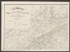
Lutzenburg Ducatus [Karte], in: Le théâtre du monde, ou, Nouvel atlas contenant les chartes et descriptions de tous les païs de la terre, Bd. 1, S. 366.
1 Karte aus Atlas Blaeu, Willem Janszoon und Blaeu, Joan Blaeu, Willem Janszoon
![Vollständige Carte des gantzen Rhein Stroms]](https://images-2.georeferencer.com/images/iiif/893208793914/full/,300/0/native.jpg)

