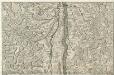
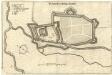
Maps of Dachstein
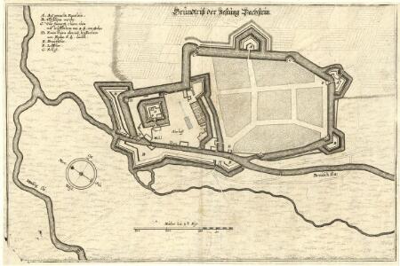
Grundtriß der Vestung Dachstein
Mollova mapová sbírka Merian, Matthaeus Merian, Matthäus
Meßtischblatt 3623 : Geispolsheim, 1913
1 : 250000 Geispolsheim. - Aufn. 1883. - 1:25000. - [Berlin]: Reichsamt für Landesaufnahme, 1913. - 1 Kt.
Meßtischblatt 3623 : Geispolsheim, 1884
1 : 250000 Geispolsheim. - Aufn. 1883. - 1:25000. - [Berlin]: Reichsamt für Landesaufnahme, 1884. - 1 Kt.
Blatt X: Molsheim, uit: Karte der Vogesen / herausgegeben vom Central-Ausschuss des Vogesen-Clubs ; bearbeitet im kartographischen Institut von Carl Flemming in Glogau
1 : 500000 Annotatie: Bladwijzer op omslag; Annotatie geografische gegevens: Legenda Vogesen-Club. Central-Ausschuss Strassburg : in Kommission bei J.H. Ed. Heitz (Heitz & Mündel)
Argentoratensis Agri Descriptio
1 : 770000 Mollova mapová sbírka Specklin, Daniel Plantin, Christoph
Strasburg
1 : 160000 Mollova mapová sbírka Person, Nikolaus Person, Nicolas
Carte Tres Particuliere Des Environs de la Ville de Strasbourg Avec toutes les subdivisions des Terres y comprises
1 : 130000 Mollova mapová sbírka Sengre, Henri Sengre, Henry
Accuratissima Territorij Argentoratensis et Annexorum Tabella In lucem edita
1 : 90000 Mollova mapová sbírka Person, Nikolaus Person, Nicolas
Territorium Argentoratense
1 : 625000 Štrasburk (Francie) Janssonius, Johannes Ioannes Iansonius
Territorium Argentoratense
1 : 600000 Štrasburk (Francie) Janssonius, Johannes Ioannes Iansonius
Chorographia Argentorati Alsatiae Metropolis
1 : 85000 Mollova mapová sbírka Seutter, Matthäus Seutter, Matthäus
Argentorati Territorium, vulgo Strasburger Gebiet Cum Maxima Episcopatus Cognominis, ac Occidentaliori Badensis Marchionatus Parte &c.
1 : 120000 Mollova mapová sbírka Allard, Carel Allard, Carel
Le cours du Rhin de Bâle à Hert près Philisbourg contenant l'Alsace et partie du Brisgau, 4
1 Blatt : 76 x 52 cm Le Rouge
Territorium Argentoratense
1 : 130000 Mollova mapová sbírka Valk, Gerhard Schenk, Pieter Schenk, Peter I
Territorium Argentoratense
1 : 130000 Mollova mapová sbírka Janssonius, Johannes Keere, Pieter van den Janssonius, Johannes I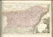
162 Strasbourg.
1 : 86400 Cassini family; Cassini, Cesar-Francois, 1714-1784
Chorographia Argentorati Alsatiæ metropolis
1 Karte : Kupferdruck ; 47 x 56 cm Seutter Matthäus Seutter
Argentorati territorium, vulgo Strasburger Gebiet
1 Karte : Kupferdruck ; 46 x 57 cm Allard by I. Cóvens et C. Mortier
169. Strassburg i. Elsass, uit: Topographische Uebersichtskarte des Deutschen Reiches / herausgegeben v. d. Kartogr. Abt. d. Königl. Preuß. Landesaufnahme
1 : 200000 titelvariant: Topogr. Übersichtskarte des Deutschen Reiches; Annotatie: Titel boven bladen ook: Topogr. Übersichtskarte des Deutschen Reiches; Annotatie geografische gegevens: Op elk blad twee maatstokken: 10 Kilometer = 5,5 cm; 1 geogr. Meile = 3,6 cm; Legenda onder op elk blad Königlich Preußische Landesaufnahme. Kartographische Abtheilung [S.l : Königlich Preußische Landesaufnahme, Kartographische Abtheilung]
[Strasbourg]
1 Blatt : 60 x 92 cm s.n.
Abcon Terfeitv[n]g der Bistv[m]bs Strassbvrg samt andern angrenzende landschaften
1 : 400000 Štrasburk (Francie)
Argentoratensis Agri Descriptio. [Karte], in: Theatrum orbis terrarum, S. 175.
1 Karte aus Atlas Ortelius, Abraham
Argentoratensis Agri Descriptio. [Karte], in: Theatrum orbis terrarum, S. 267.
1 Karte aus Atlas Ortelius, Abraham Vrients, Jan Baptista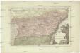
Der District Hagenau
1 : 182000 Haguenau (Francie)
Territorium Argentoratense
1 Karte : Kupferdruck ; 36 x 48 cm Janssonius van Waesbergen; Pitt; Swart apud Janssonio-Waesbergios Mosem Pitt et Stephanum Swart
Territorium Argentoratense
1 Karte : Kupferdruck ; 36 x 48 cm Janssonius; Keere Ioannes Ianssonius excudit
Le Theatre de la Guerre Sur le Haut Rhein
1 : 142000 Mollova mapová sbírka Sanson, Guillaume
Territorium Argentoriatense. [Karte], in: Novus atlas absolutissimus, Bd. 2, S. 208.
1 Karte aus Atlas Janssonius Offizin