Maps of Germany
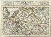
Das Heyl. Römische Reich Teutscher Nation
1 : 2100000 Mollova mapová sbírka Sanson, Guillaume Hipschmann, Sigmund Gabriel Hofmann, Johann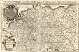
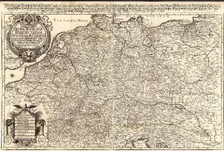
Das Teutsche Keiserthum samt allen darzu gehörigen Chur- und Fürstenthümen Ertz- und Bistumen, Grav- und Herrschaften, auch andern theils daran gräntzenden Ländern und Statten
1 : 2100000 Mollova mapová sbírka Hoffmann, Johannes Hoffmann, Johann
[Übersicht der Meteorologischen Stationen in Deutschland, der Schweiz, den Niederlanden]
Erster Band, enthaltend in vier Abtheilungen die Erscheinungen der anorganischen Natur: 1. Meteorologie und Klimatographie. 2. Hydrologie und Hydrographie. 3. Geologie. 4. Tellurischer Magnetismus Humboldt, Alexander von Verlag von Justus Perthes
[Botanische Karte von Deutschland; enthaltend die Statistik der vornehmsten Pflanzen-Familien so wie die Isotheren und Isochimenen]
Zweiter Band, enthaltend in vier Abtheilungen die Vertheilung der Organismen: 5. Pflanzen-Geographie, 6. Thier-Geographie, 7. Anthropographie, 8. Ethnographie Humboldt, Alexander von Verlag von Justus Perthes
Geschäfts- und Reise-Karte von Deutschland und den angrenzenden Ländern
Evropa střední Koenig, Theophil R. Drawert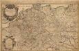
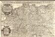
L'Empire d'Allemagne
1 : 2100000 Mollova mapová sbírka Sanson, Guillaume Jaillot, Alexis Hubert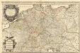
L'Empire d'Allemagne
1 : 2100000 Mollova mapová sbírka Sanson, Guillaume Jaillot, Alexis Hubert
Botanische Karte von Deutschland.
1 : 3700000 Berghaus, Heinrich
Mappa geographica exhibens postas omnes tam vehiculares quam veredarias totius Germaniae cum earum accurata distantia
1 : 2500000 diligentissime propriis sumptibus excudit Tobias Conrad Lotter Aug. Vindelicor : Tob. Conr. Lotter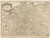
L'empire d'Allemagne
1 : 2600000 Evropa střední Sanson, Guillaume Cordier, Louis chez H. Iaillot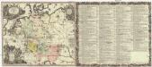
Historia Imperii Romano-Germanici, nec non finitimarum regionum
1 : 2700000 Evropa střední Seutter, Matthäus Matthaeo Seutter
Historia Imperii Romano-Germanici, nec non finitimarum regionum
1 : 2700000 Evropa střední Seutter, Matthäus Matthaeo Seutter
Neueste Post-Charte von Deutschland und den angränzenden Ländern : für Extraposten, Couriere, Diligencen u. Eilwagen / mit benützung der besten Materialien gezeichnet
1 : 1000000 Annotatie: Met afstandentabel Nürnberg : Bauer & Raspe
Peraccurata S. Romani Imperii Tabula, comprehendens Regiones vulgo sub Nomine Germaniae Nuncupantes
1 : 2100000 Mollova mapová sbírka Visscher, Nicolaes Jansz. Schenk, Peter II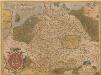
Germania. [Karte], in: Theatrum orbis terrarum, S. 40.
1 Karte aus Atlas Ortelius, Abraham
L'Empire d'Allemagne
Mollova mapová sbírka Fer, Nicolas de Danet, Guillaume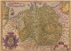
Germania. [Karte], in: Theatrum orbis terrarum, S. 102.
1 Karte aus Atlas Ortelius, Abraham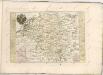

Imperium Romano-Germanicum
1 : 2600000 Mollova mapová sbírka Seutter, Matthäus Seutter, Matthäus
Deutschland, Königr. der Niederlande, Kgr. Belgien und die Schweiz, nebst Theilen der angränzenden Länder
1 : 1500000 Belgie Diez, F. M. Bär, Johann Christoph Justus Perthes
Deutschland, Königr. der Niederlande, Kgr. Belgien und die Schweiz, nebst Theilen der angränzenden Länder
1 : 1500000 Belgie Diez, F. M. Bär, Johann Christoph Justus Perthes
Deutschland, oder, Deutsche Bundesstaaten
1 : 185000 Německo Tranquillo Mollo
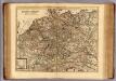
Nova totius Germaniae Descriptio Teütschland
1 : 4300000 Mollova mapová sbírka Merian, Matthaeus Merian, Matthäus
Allgemeine Postkarte von Deutschland zur Uebersicht
Německo Alberti, Ignaz im von Reillyschen Landkarten und Kunstwerke Verschleiss Komptoir
Mappa Geographica exhibens Postas
Carte exacte des postes et routes de l'Empire d'Allemagne divisee en ses cercles.
1 : 2500000 Covens et Mortier
Reisekarte von Deutschland und den angrenzenden Ländern
Evropa střední Mahlmann, H. Morin, F. H. F.H. Morin
Neueste Eisenbahn-Karte von Deutschland und den angrenzenden Ländern
Evropa střední Walseck, Georg Georg Walseck
Bez titulu: soubor map pag. 125