Maps of Southwest

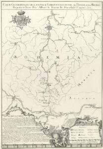
Carte Geographique de la nouvelle Communication entre le Danube &. la Moldau
Mollova mapová sbírka Sterndahl, Albert von Winkler, Johann Christoph
Carte geographique de la nouvelle communication entre le Danube & la Moldau
1 : 700000 Dunaj Sterndahl, Albert de Winkler, Johann Christoph
Mapa polesí Lomany
1 : 5000
Karte der Holzartenverbreitung in Protektorat Böhmen und Mähren
Svoboda, Pravdomil
Generální mapa Protektorátu Čechy a Morava

Südlicher Theil von Boehmen...

[Čechy]
Česko Wöber, Josef J. Kiss
Karte des Taborer und Budweiser Kreises im österreichischen Kronlande Böhmen
1 : 285000 Tábor-oblast (Česko) Obentraut, Maxmilian Friedrich Kretzschmar
[Südlichen Böhmen und nördlichen Österreich]
Rakousko severní Reisenauer
Jihočeský kraj

Jihočeský kraj

Südlicher Theil von Boehmen enthaltend den Klatttauer, Berauner, Taborer, Prachiner und Budweiser Kreis
Čechy jižní (Česko) Kindermann, Joseph Karl Kunst= und Industrie Comptoir
Südlicher Theil von Boehmen enthaltend den Klattauer, Berauner, Taborer, Prachiner und Budweiser Kreis
Čechy jižní (Česko) Kindermann, Joseph Karl im Verlage des Kunst- und Industrie Comptoirs
Regni Bohemiae Circuli Taborensis et Budweisensis...

Regni Bohemiae Circulus Bechinensis
1 : 264000 Bechyně-oblast (Česko) Müller, Johann Christoph ab Homannianis Heredibus
Regni Bohemiae Circulus Bechinensis
1 : 264000 Bechyně-oblast (Česko) Müller, Johann Christoph ab Homannianis Heredibus
Militair Karte von Süd-Deutschland in 20 Sectionen
1 : 400000 12. Section Coulon, Alois von A. von Coulon
Locus Conjuctionis Danubij cum Moldava
Mollova mapová sbírka Vogemont, Lothar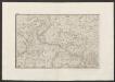
Militair Karte von Süd-Deutschland in 20 Sectionen
1 : 400000 8. Section Coulon, Alois von A. von Coulon
Provincia Bechinensis
Bechyně-oblast (Česko) Bernardi, Augustin Augustin Bernardi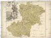
Provincia Bechinensis
Bechyně-oblast (Česko) Müller, Johann Christoph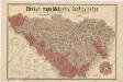
Církevní mapa biskupství Budějovického

Kraj Českobudějovický

Provincia Bechinensis
1 : 217000 Mollova mapová sbírka Erber, Bernardinus Winkler, Johann Christoph Kurzböck, Josef von
Bechiner Kreis
Bechyně-oblast (Česko) Berndt, Johann Christoph Anton Elsenwanger
Bechiner Kreis
Bechyně-oblast (Česko) Berndt, Johann Christoph Anton Elsenwanger
Vermehrte und Verbesserte Landkarten des Königreichs Ungarn :
1 : 500000 Mollova mapová sbírka Stier, Martin Böner, Johann-Alexander Endter, Martin
Jihovýchodní Čechy
1 : 220000 Jihočeský kraj (Česko) Wagner, Jan Eduard F. Kytka