Maps of Germany

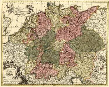
Peraccurata S. Romani Imperii Tabula, comprehendens Regiones vulgo sub Nomine Germaniae Nuncupantes
1 : 2100000 Mollova mapová sbírka Visscher, Nicolaes Jansz. Schenk, Peter II
Ubersicht der Meteorologischen Stationen in Deutschland.
1 : 3700000 Berghaus, Heinrich
Germany.
1 : 2920000 Carey, Mathew
Germany.
1 : 2950000 Carey, Mathew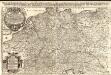
Das Heyl. Römische Reich Teutscher Nation
1 : 2100000 Mollova mapová sbírka Sanson, Guillaume Hipschmann, Sigmund Gabriel Hofmann, Johann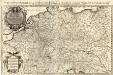
Das Teutsche Keiserthum samt allen darzu gehörigen Chur- und Fürstenthümen Ertz- und Bistumen, Grav- und Herrschaften, auch andern theils daran gräntzenden Ländern und Statten
1 : 2100000 Mollova mapová sbírka Hoffmann, Johannes Hoffmann, Johann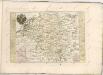

Germania Seraphico-Observans seu Provinciae Fratrum Minorum strictioris Observantiae, in Germania sitae
1 : 2700000 Mollova mapová sbírka Seutter, Matthäus Seutter, Albrecht Carl Seutter, Matthäus
Karte von Deutschland in XVI Blätt
1 : 1000000 nach des H.O.C. Büsching Erdbeschreibung u. den besten Hülfsmitteln entworffen und jetzt nach den neuesten Friedens-Schlüssen gänzlich umgeändert von D.F. Sotzmann J.W. Meil inv. ; C. Jäck sculp. Berlin : In Verlag der K. P. Ac. Kunst- und Buchhandlung von Simon Schropp & Co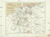
Deutschland zu Anfang des dreissigjährigen Krieges, 1618
Evropa střední Goedsche & Steinmetz
Deutschland unter den sächsischen und fränkischen Kaisern bis 1138
Evropa střední Goedsche & Steinmetz
Deutschland im Jahre 1792
Evropa střední Goedsche & Steinmetz
Deutschland unter den Hohenstaufen
1 : 6000000 Evropa střední Goedsche & Steinmetz
Deutschland zur Zeit der Reformation
1 : 6000000 Evropa střední Goedsche & Steinmetz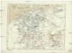
Deutschland im Jahre 1512
Evropa střední Goedsche & Steinmetz
Allgemeine Postkarte von Deutschland zur Uebersicht
Německo Alberti, Ignaz im von Reillyschen Landkarten und Kunstwerke Verschleiss Komptoir
Nova totius Germaniae Descriptio Teütschland
1 : 4300000 Mollova mapová sbírka Merian, Matthaeus Merian, Matthäus

[Botanische Karte von Deutschland; enthaltend die Statistik der vornehmsten Pflanzen-Familien so wie die Isotheren und Isochimenen]
Zweiter Band, enthaltend in vier Abtheilungen die Vertheilung der Organismen: 5. Pflanzen-Geographie, 6. Thier-Geographie, 7. Anthropographie, 8. Ethnographie Humboldt, Alexander von Verlag von Justus Perthes
Karte von Central-Europa bis Paris, Mailand, Triest, Pesth, Krakau, Köningsberg, Schleswig, zur Uebersicht der politischen Gestaltung im J. 1867, und der Eisenbahnen und andern Communicationen
1 : 1800000 Annotatie: Bijlage bij: Petermann's geographische Mittheilungen. Ergänzungsheft 19 Gotha : Justus Perthes
Teutschland die Niederlande und die Schweiz
1 : 2860000 Nizozemsko Streit, Friedrich Wilhelm Boreux, J. J. C. Hinrichssche Buchhandlung
Deutschland, Niederlande und Schweiz
Hand-Atlas über alle Theile der Erde nach dem neuesten Zustande und über das Weltgebäude Stieler, Adolf bei Justus Perthes
Botanische Karte von Deutschland.
1 : 3700000 Berghaus, Heinrich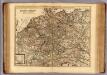
Carte exacte des postes et routes de l'Empire d'Allemagne divisee en ses cercles.
1 : 2500000 Covens et Mortier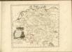

Besondere Post und Reise Carte der Wege Durch Teutschland
1 : 3600000 Mollova mapová sbírka
Tabula Geographica totius S[acri] Imperii Romani
1 : 1800000 Mollova mapová sbírka Müller, Johann Ulrich Bodenehr, Georg Conrad
Empire d'Allemagne, divisé en ses dix cercles, ces cercles en leurs principaux estats
1 : 2810000 Evropa střední Sanson, Nicolas Cordier, Louis Pierre Mariette
Karte von Deutschland
1 : 1880000 Evropa střední Reilly, Franz Johann Josef von Benedicti, Hieronymus Franz Joh. Jos. von Reilly
Karte von Deutschland
1 : 1880000 Evropa střední Reilly, Franz Johann Josef von Benedicti, Hieronymus Franz Joh. Jos. von Reilly