Maps of Northern Great Plain

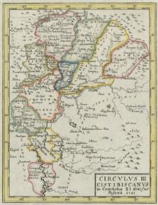
Circvlvs III Cistibiscanvs in Comitatus XI divisus
1 : 2100000 Mollova mapová sbírka Tomka Szászky, János
[Karte der Königreiche Ungarn, Croatien, Slavonien und den Militärgränzen]
1 : 850000 Chorvatsko Raffelsperger, Franz im Typographischen Landkarten-Verlage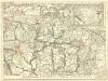
Partie du Royaume de Hongrie, vers le Septentrion, et l'Orient
1 : 680000 Mollova mapová sbírka Coronelli, Vincenzo Maria Nolin, Jean Baptiste
Partis. Hungariae Inter Tibiscum Et Nigrum Chrysum. Nova et Accurata Descriptio. [Karte], in: Novus atlas absolutissimus, Bd. 2, S. 288.
1 Karte aus Atlas Janssonius Offizin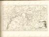

IX, uit: General-Karte des oesterreichischen Kaiserstaates mit einem grossen Theile der angrenzenden Länder / durch Josef Scheda ... bearb. und hrsg
1 : 576000 Annotatie geografische gegevens: Maatstokken: oesterreichische Meilen, geografische oder deutsche Meilen, preussische Meilen, türkische Berri, französische Lieues, russische Werste; Maatstok per blad: wiener Klafter, öster. Meilen; Blad XIX: statistische en taalkundige informatie; Blad XIX: legenda [Wien : K.K. Militärisch-Geografisches Institut]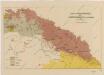
Sbírka map a diagramů použitých na mírových konferencích v Paříži v letech 1919 - 1920
Přehled prací regulačních a zahrazovacích provedených v roce 1929 a projektovaných na rok 1930
1 : 750000 Dunaj (řeka : povodí) Vojenský zeměpisný ústav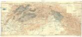
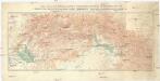
Přehledná hydrografická mapa povodí Dunaje a Visly na Slovensku a v Podkarpatské Rusi
1 : 750000 Dunaj (řeka : povodí) Vojenský zeměpisný ústav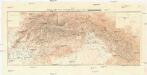
Přehledná hydrografická mapa povodí Dunaje a Visly na Slovensku
1 : 750000 Dunaj (řeka : povodí) Vojenský zeměpisný ústav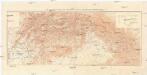
Přehledná hydrografická mapa povodí Dunaje a Visly na Slovensku a v Podkarpatské Rusi
1 : 750000 Dunaj (řeka : povodí) Vojenský zeměpisný ústav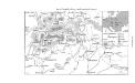
Neusohl im Zentrum des Ungarischen Erzgebirges
Banská Bystrica Bergbau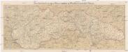
Podrobná mapa Slovenska a Podkarpatské Rusi
1 : 400000 Podkarpatská Rus (Ukrajina) Machát, František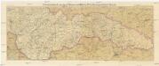
Podrobná mapa Slovenska a Podkarpatské Rusi
1 : 400000 Podkarpatská Rus (Ukrajina) Machát, František
Slovakia
1 : 750000 Podkarpatská Rus (Ukrajina)
Slovakia
1 : 750000 Podkarpatská Rus (Ukrajina)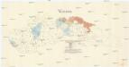
Slovakia
1 : 750000 Podkarpatská Rus (Ukrajina)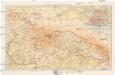
Slovensko a Porkarpatská Rus
1 : 250000 Podkarpatská Rus (Ukrajina) Machát, František V. Neubert a synové
A Tisavölgy vizszabályozasi átnézeti térképe

Sheet IX: Karte Des Oesterreichischen Kaiserstaates.
1 : 576000 Scheda, Josef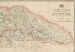
Podrobný přehled politického rozdělení Slovenska
Vojenský zeměpisný ústav
Ober Ungern
Maďarsko Ossenbrug, J. von im Verlage des Kunst und Industrie Comptoir's
Ober Ungern
Maďarsko Ossenbrug, J. von im Verlage des Kunst und Industrie Comptoir's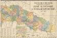
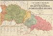
Podrobný přehled politického rozdělení země Slovenské a Podkarpatoruské
Vojenský zeměpisný ústav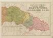
Podrobný přehled politického rozdělení Slovenska a Podkarpatské Rusi
Podrobný přehled politického rozdělení Slovenska a Podkarp. Rusi
Vojenský zeměpisný ústav
Vybudování železniční sítě na Slovensku a v Karpatské Rusi
1 : 900000 Podkarpatská Rus (Ukrajina) Koněrza, Josef Spolek československých inženýrů a architektů
Partis Hungariae Inter Tibiscum et Nigrum Chrysum Nova et Accurata Descriptio
1 : 530000 Mollova mapová sbírka Valk, Gerhard Schenk, Peter I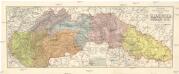
Podrobná místopisná a silniční mapa Slovenska a Podkarp. Rusi
1 : 500000 Podkarpatská Rus (Ukrajina) Divíšek, Otakar Jos. L. Švíkal