Maps of Emilia-Romagna

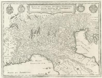
Nova et Accvrata Dvcatvs Venetiani, Mediolani, Genvae, Mantvaeque et Finitimorvm Principatvm delineatio
1 : 760000 Mollova mapová sbírka Merian, Matthaeus Merian, Caspar - dědici
Italien 1.
1 : 1800000 Flemming, Carl
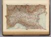
Italien. Nördliche Hälfte

Northern Italy.
1 : 1090000 Pinkerton, John, 1758-1826
N. Italy, Alps, Apennines.
1 : 1250000 Arrowsmith, John
Karte des Kriegschauplatzes in Italien
1 : 1800000 Itálie Dittmarsch, C. Trpog.-liter.-artist. Anstalt
Géographie. croquis n1, Italie continentale
1 : 1000000 Messain, Capitaine 18..-.... [Paris] : Service Géographique de l'Armée
76-77. Italy, North. The World Atlas.
1 : 1250000 USSR (Union of Soviet Socialist Republics).
Italie Septentrionale.
1 : 1500000 Clouet, J. B. L. (Jean-Baptiste Louis), b. 1730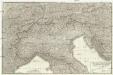
Carte dell'Italia superiore e di parte degli stati limitrofi
1 : 1000000 Itálie severní Bacler Dalbe, Louis Albert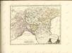
Italy North.
1 : 1500000 Andree, Richard; Times (London, England)
Delineatio Regni Italici seu potius reliquiarum Regni Longobardici, quae hodie Longobardia seu Italis Lombardia dicuntur, finibus Franciae, Helvetiae, Germaniae, Dom. Veneti et St. Ecclesiae accurate distinctis
1 : 4600000 Mollova mapová sbírka Franz, Johann Michael Homann, Johann Baptista - dědici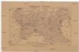
Severní Italie [sic]
Itálie severní Lotter, Tobias Conrad Wagner, Jan Eduard Jaroslav Pospíšil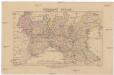
Severní Italie [sic]
Itálie severní Lotter, Tobias Conrad Wagner, Jan Eduard Jaroslav Pospíšil
[Kaart], uit: Italie (section Nord)
1 : 600000 Paris : Taride
Nördliches Jtalien
Stieler's Hand-Atlas Stieler, Adolf bei Justus Perthes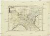
Postkarte von Ober Italien
Itálie severní Stenger, Johann im von Reillyschen Landkarten und Kunstwerke Verschleiss Komptoir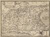
Italia Gallica, Sive Gallia Cisalpina. [Karte], in: Theatrum orbis terrarum, S. 490.
1 Karte aus Atlas Ortelius, Abraham Vrients, Jan Baptista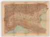
Norditalien. Sonderkarte 3
1 : 1000000 Geographische Anstalt von Velhagen & Klasing (Lipsko) Leipzig : Velhagen & Klasing
Ancient Italy I.
1 : 1770000 Society for the Diffusion of Useful Knowledge (Great Britain)
Italy I.
1 : 1770000 Society for the Diffusion of Useful Knowledge (Great Britain)
Florenz
1 : 1500000 Itálie severní K. u. k. Militärgeograph. Institute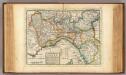
The upper part of Italy.
1 : 2700000 Moll, Herman, d. 1732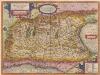
Italia Gallica, Sive Gallia Cisalpina. [Karte], in: Theatrum orbis terrarum, S. 389.
1 Karte aus Atlas Ortelius, Abraham
Composite XI, XII, XVI, XVII: Karte Des Oesterreichischen Kaiserstaates.
1 : 576000 Scheda, Josef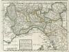
The Upper Part of Italy
1 : 2600000 Mollova mapová sbírka Moll, Herman Moll, Hermann
Carta d'Italia alla scala di 1 a 1 000 000
1 : 1000000 Nordwest-Blatt Istituto Geografico Militare (Firenze) Istituto Geografico Militare