Maps of Scandinavia

Theatrum Historicum :
1 : 8500000 Mollova mapová sbírka Delisle, Guillaume Desrosiers, F. L'Isle, Guillaume de
Machtverhältnisse der Europ. Staaten
1 : 14000000 Eisenbahnen Block, Maurice Justus Perthes
Machtverhältnisse der Europ. Staaten
1 : 14000000 Religionsbekenntnisse Block, Maurice Justus Perthes
Machtverhältnisse der Europ. Staaten
1 : 14000000 Zolltarife Block, Maurice Justus Perthes
Machtverhältnisse der Europ. Staaten
1 : 14000000 Relative Steuer Block, Maurice Justus Perthes
[Europa]
1 : 4000000 Evropa Art. Institut Orell Füssli
Machtverhältnisse der Europ. Staaten
1 : 14000000 Volkszunahme Block, Maurice Justus Perthes
Machtverhältnisse der Europ. Staaten
1 : 14000000 Seemacht Block, Maurice Justus Perthes
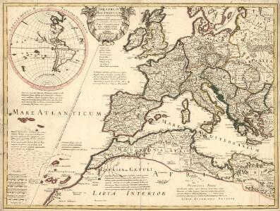
Patriarchatus Romanus
1 : 11100000 Mollova mapová sbírka Sanson, Nicolas Covens, Johannes I
Machtverhältnisse der Europ. Staaten
1 : 14000000 Volksdichtickeit Block, Maurice Justus Perthes
Machtverhältnisse der Europ. Staaten
1 : 14000000 Landmacht Block, Maurice Justus Perthes
Schema glavnějšich peredviženīj russkago flota v ėpochu Napoleonovskich Vojn s 1798, po 1814 gody
Europa Seeschlacht Napoleonische Kriege
Machtverhältnisse der Europ. Staaten
1 : 14000000 Credit Block, Maurice Justus Perthes
Machtverhältnisse der Europ. Staaten
1 : 14000000 Handel Block, Maurice Justus Perthes
Machtverhältnisse der Europ. Staaten
1 : 14000000 Absolute Finanzmacht Block, Maurice Justus Perthes
Karte IV: Panslawistische Karte von Europa
Europa Panslawismus Nach Komarov-Sarjanto
Esquisse orographique de l'Europe
1 : 6543100 par J.H. Bredsdorff & O.N. Olsen, en 1824 gravée par P.J. Seehusen. Copenhaque : C. A. Reitzel
Machtverhältnisse der Europ. Staaten
1 : 14000000 Schuldenlast Block, Maurice Justus Perthes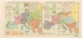
Rozsah panství Habsburků ... za Karla V. (1555) Říše Napoleonova (1810) a Evropa po kongresu Vídeňském (1815)

Europa 2007
Europa Kunz, Andreas ; Moeschl, Joachim Robert
Europa 1830
Europa Kunz, Andreas ; Röss, Wolf ; Moeschl, Joachim Robert
Europa 1913
Europa Kunz, Andreas ; Moeschl, Joachim Robert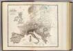
Mountains of Europe.
1 : 20000000 Johnston, Alexander Keith, 1804-1871