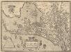
Maps of Zuid-Holland
Nizozemsko]
1 : 850000 Mollova mapová sbírka
Holland
1 : 440000 [François Halma] [Leeuwarden] : [Henrik Halma]
Holland
1 : 440000 [François Halma] [Leeuwarden] : [Henrik Halma]
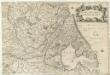
Hollandia
1 : 970000 [Pieter van den Keere engraver] [Arnhem etc.] : [Jan Jansz. etc.]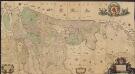
Comitatus Hollandiæ et Dominii Ultraiectini tabula
1 : 60000 [Jacob Aertsz. Colom] Amstelodami : ex officina I. Côvens et C. Mortier vulgo de Vygendam
Les provinces de Hollande et d'Utrecht
1 : 800000 [Georges-Louis Le Rouge] [Paris] : G. Le Rouge
Hollandia
1 : 950000 [Jodocus Hondius sr. engraver] [Amsterdam etc.] : [Jodocus Hondius sr. etc.]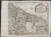
Les provinces de la Hollande et d'Utrecht
1 : 800000 [Anthoni de Winter] [Amsterdam] : [François Halma]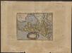
Hollandiæ comitatus Hollant grafschaftt
1 : 1000000 [Frans Hogenberg] [Keulen] : [s.n.]
Charte von Holland
1 Karte : Kupferdruck ; 55 x 43 cm Güssefeld by den Hom. Erben
Hollandiae antiquorum catthorum sedis nova descriptio, auctore Iacobo a Daventria
1 : 400000 [Abraham Ortelius] [engraver: Frans Hogenberg] [Antwerpen] : [Abraham Ortelius ; Gilles Coppens van Diest]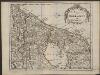
De provintien van Hollandt en Utrecht
1 : 800000 [Anthoni de Winter] [Amsterdam] : [François Halma]
Hollandiae antiquorum catthorum sedis nova descriptio, auctore Iacobo a Daventria
1 : 400000 [Abraham Ortelius] [engraver Frans Hogenberg] [Antwerpen] : [Abraham Ortelius ; Gilles Coppens van Diest]
Hollandiae antiquorum catthorum sedis nova descriptio, auctore Iacobo a Daventria
1 : 400000 [Abraham Ortelius] [Frans Hogenberg, engraver] [Antwerpen] : [Abraham Ortelius]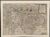
Hollãdiæ integra comita descript.
1 : 400000 [Gerard and Cornelis de Jode] [Antwerpen] : [Widow and heirs Gerard de Jode]
Hollandia
1 : 470000 Petrus Kerius. Amstelodami : Petrus Kerius excudebat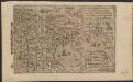
Hollandia
1 : 700000 Henricus Nagel fecit. [Keulen] : Joan Bussemchr [!] exc.
Hollandiae Antiqvorvm Catthorvm Sedis Nova Descriptio
1 : 370000 Mollova mapová sbírka Deventer, Jacob van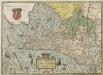
Hollandiae Antiqvorvm Catthorvm Sedis Nova Descriptio
1 : 370000 Mollova mapová sbírka Deventer, Jacob van
Hollandiae Antiquorum Catthorum Sedis Nova Descriptio [Karte], in: Theatrum orbis terrarum, S. 192.
1 Karte aus Atlas Ortelius, Abraham Vrients, Jan Baptista
Comitatus Hollandiæ nova descriptio, ex optimis & novißimis delineationibus designata
1 : 350000 Geeraerd Coeck sculpsit. [Amsterdam] : [apud Gerardum Valk, et Petrum Schenk]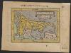
Hollandia
1 : 1800000 [Ambrosius and Ferdinand Arsenius engravers] [Antwerpen : [Johannes Keerbergen]
Hollandiae Comitatus in ejusdem subjacentes ditiones; una cum toto Ultrajectino Dominio, nec non maximis partibus Geldriæ Ducatus, Frisiæ Comitatus, aliarumq[ue] vicinarum provinciarum foederatarum; exactissimè delineatus = Landkaart vertonende het Graafschap Holland, seer dienstig om te reysen na, en van syne naburige provincien, als mede de hoven van Soestdyk, ’t Loo en Cleef
1 : 300000 per Nicolaum Visscher ... G. Gouwen schulp. t' Amsteldam : nunc apud Petrum Schenk Junior
Caerte vanden lande ende graefschappe van Hollandt, midtsgaders het landt van Utrecht, de deelen ende houcken van andere landê annex Holl[an]t gelegê, ende tselve landt naest beleyt hebben, perfect gemaect nade jegenwoirdige situatie eñ gelegentheyt
1 : 480000 [Jan Pietersz. Saenredam engraver] [Amsterdam] : [Cornelis Claesz.]
Hollandia
1 : 1800000 [Filips Galle engraver] [Antwerpen] : [Filips Galle]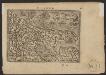
Hollandt
1 : 1800000 [Filips Galle, designer and engraver] [Abraham Ortelius] [Antwerpen] : [Philips Galle]
Hollandiae cattorum regionis typus
1 : 550000 [Lodovico Guicciardini] [Antwerpen] : [Christoffel Plantijn]
Hollandiae Batavor[um] veteris insulae et locorum adjacentium exacta descriptio
1 : 400000 [Jacob van Deventer] Jac. Bossius Baelga, in ae incidebat. Amsterdam : Frederik Muller & Co.
![Nizozemsko]](https://images-2.georeferencer.com/images/iiif/655062720984/full/,300/0/native.jpg)

