Maps of Regierungsbezirk Freiburg
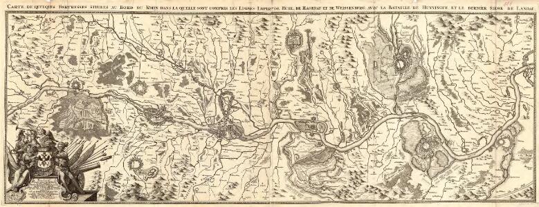
Carte de Quelques Fortresses situees au Bord du Rhin dans la quelle sont compris les Lignes Imperes de Buhl, de Hagenau et de Weissenburg, avec la Bataille de Hunningue, et le dernièr Siège de Landau
1 : 180000 Mollova mapová sbírka Fuchs, Johann Konrad Wolff, Jeremias
Neu Accurate Geographische Mappa Des Ober und Unter Rhein Stroms
Mollova mapová sbírka
Karten Einiger an dem User deß Rheins sigender Festungen
1 : 180000 Mollova mapová sbírka Fuchs, Johann Konrad Wolff, Jeremias
Carte des Rein Stroms
Basilej (Švýcarsko)
General Idèe Du Terrain qu'ont occupé nos Troupes tant dans la foret noire que le Long de L'inondation et du Rhin. La Campagne. 1735
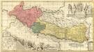
Vera totius Marchionatus Badensis
1 : 230000 Mollova mapová sbírka Valk, Gerhard Schenk, Peter I
Theatrum belli ad Rhenum superior
1 : 400000 Alsasko (Francie) Homanninanis Heredes
Theatrum belli ad Rhenum superior
1 : 400000 Alsasko (Francie) Homanninanis Heredes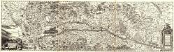
Accurata Et Novissima Landgraviatus Alsatiae Chorographia
Mollova mapová sbírka Person, Nikolaus Person, Nicolas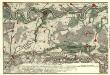
Die Gegenden des Rheins von Speyer biss Mayntz :
Mollova mapová sbírka Homann, Johann Baptist Homann, Johann Baptista - dědici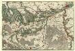
Die Gegenden des Rheins von Speyer biss Mayntz :
Mollova mapová sbírka Homann, Johann Baptist Homann, Johann Baptista - dědici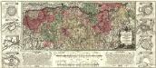
Charte Geographique De la Campagne Du Haut Rhin Pour L'anne MDCCXXXIV
1 : 500000 Mollova mapová sbírka Oettinger, Johann Friedrich Seutter, Matthäus
Utriusque Alsatiæ, landgraviatus ducatus Dupontii, et Spirensis episcopatus, nova tabula
1 Karte : Kupferdruck ; 47 x 55 cm Wit ex officina I. Cóvens et C. Mortier
Utriusque Alsatiæ, landgraviatus ducatus Dupontii, et Spirensis episcopatus, nova tabula
1 Karte : Kupferdruck ; 47 x 55 cm Wit F. de Wit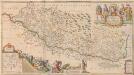
Vera totius Marchionatus Badensis, et Hochbergensis, ceterorumque Ducatuum Landgravionatuum et Comitatuum [...] [Karte], in: Novus atlas absolutissimus, Bd. 2, S. 203.
1 Karte aus Atlas Janssonius Offizin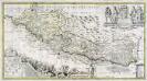
Vera totius marchionatus Badensis, et Hochbergensis
1 Karte auf 2 Blatt : Kupferdruck ; 43 x 80 cm Valck; Schenk; Morell; Beuch apud Gerardum Valk et Petrum Schenk
Le Theatre de la Guerre Sur le Haut Rhein
1 : 380000 Mollova mapová sbírka Nolin, Jean-Baptiste Rousseau, I. B. T. Leonard, Jean
Mappa geographica ad Historiam Nigræ Silvæ Martini Gerberti S.R.I.P. monasterii & congreg. S. Blasii. abbatis
1 Karte auf 2 Blatt : Kupferdruck ; 94 x 59 cm Gerbert; Haas; Grüninger s.n.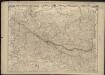
Haute et Basse Alsace, Suntgaw, Brisgaw, Ortenaw et le Marquisat de Bade, avec les divers Routes et Passages des Montagnes et Forests Noires, pour entrer en Souabe
1 : 275000
Ducatus Wurtenbergici, 1
1 Blatt : Johann Baptist Homann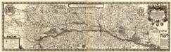
Alsatiae Svperioris et Inferioris accuratissima Geographica Descriptio
1 : 195000 Mollova mapová sbírka Sandrart, Jakob von Sandrart, Jacob von
D.O.M.S. Serenissimo Celsissimoque Principi ac Domino Domino Eberhardo Ludovico Duci Würtenbergiae et Thecciae Comiti Montis belgardi, Dynastae in Haydenheim etc. Sac. Caes. Mai. ac Rom. Imp. ut et Circuli Suevici General Mareschallo Campi et Generali Equitatiis etc. Domino suo Clementißimo Tabulam hanc in debitae submissionis tessoniman
1 : 315000 [S.l.] : [s.n.]
L'Alsace, ou conquestes du roy, en Allemagne, tant deca que dela le Rhein
1 : 325000 Alsasko (Francie) Sanson, Guillaume Pierre Mariette
Karte vom Schwarzwald
1 : 400000 Schnars, Carl Wilhelm ; Sachs, Friedrich Carl Winters's Universitätsbuchhandlung
Sheet 4, uit: Stanford's large scale map of the seat of war / Stanford's Geographical Estab[lishmen]t
1 : 300000 Stanford's Geographical Establishment, Londen London : Stanford
Haute et Basse Alsace, Suntgaw, Brisgaw, Ortenaw Et Le Marquisat De Bade
1 : 270000 Mollova mapová sbírka Fer, Nicolas de Danet, Guillaume
Totius s.r.i. circuli Suevici tabula chorographica, 1
1 Blatt : R. et J. Ottens
Landgraviatus Alsatiae tam superioris quam infer[ioris]
1 Karte : Kupferdruck ; 41 x 34 cm s.n.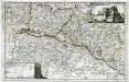
Topographia Alsatiæ, Svngoiæ, et Brisgoiæ
1 Karte : Kupferdruck ; 23 x 36 cm Bodenehr Johann Georg Bodenehr
Alsatia landgraviatus
1 Karte : Kupferdruck ; 57 x 48 xm Seutter Matthäus Seutter
Carte de la Haute et Basse Alsace Suntgaw, Brisgaw, Ortenaw et partie des marquisats de Baden
1 Karte auf 3 Blättern : Kupferdruck ; 90 x 34 cm Dulssecker; Fridrich chez I: R: Doulseker