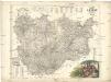
Maps of Central Serbia

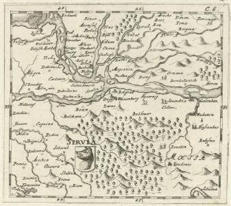
Servia
Mollova mapová sbírka Hoffmann, Johannes Hoffmann, Johann
Serbisch-österreichisch-Ungarische Grenzländer
1 : 864000 Albánie Peucker, Karl Scheda, Joseph von Artaria
G. Freytags Karte des nördlichen Serbien
1 : 600000 Bosna a Hercegovina Freytag, Gustav G. Freytag & Berndt
Serbisch-Österreichisch-Ungarische Grenzländer
1 : 864000 Serbien Grenze
Serbien
1 : 800000 Srbsko Kiepert, Heinrich Bugarski Geographisches Institut
Territoriale Entwicklung Serbiens seit 1815
Serbien
Karte von Serbien

Das Königreich Bosnien, und die Herzegovina (Rama)
Bosnien, Herzegowina
G. Freytags Karte von Serbien
1 : 600000 Albánie Freytag, Gustav G. Freytag & Berndt
G. Freytags Karte von Serbien
1 : 600000 Srbsko Freytag, Gustav G. Freytag & Berndt
Südöstlicher Kriegsschauplatz. Serbien
1 : 5000000 Serbien Weltkrieg <1914-1918>
Servia. Coal Resources of the World.
1 : 1500000 Milojkovitch, J.A.
Zemljepis od Serbije
1 : 822000 Srbsko Nipočić, Vasilij u c. k. Politechničeskoj inščotugu
Generalcharte von Servien und Bosnien
1 : 860500 Bosna Fried, Franz Riedl, J. im Kunst und Industrie Comptoir bey S. Schropp & Co.
Bevölkerungsdichte 1900 (administrative Gliederung von 1902)
Serbien Bevölkerungsdichte
Neu Eröffnetes Kriegs Theatrum das ist Gantz Neue und Accurate Special Landkarten
Mollova mapová sbírka
Eisenbahnbau 1884-1915
Serbien Eisenbahnnetz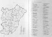
Administrative Gliederung Serbiens in Kreise und Bezirke 1902
Serbien Verwaltungsgliederung
Das Koenigreich Bosnien, und die Herzegovina [Rama] samt den angraenzen den Provinzen von Croatien, Sclavonien, Temesvar, Servien, Albanien, Ragusa, und dem Venetianischen Dalmatien
1 : 500000 Mollova mapová sbírka Müller, Franz Ignaz Alberti, Ignaz Schrämbl, Franz Anton
Serbien und Montenegro
1 : 600000 Srbsko Handtke, Friedrich Carl Flemming
Administrative Gliederung Serbiens in Kreise und Bezirke 1890 (1891)
Serbien Verwaltungsgliederung
Sheet XIX: Karte Des Oesterreichischen Kaiserstaates.
1 : 576000 Scheda, Josef
Carte d'une partie de la Servie et de l'Albanie
1 : 800000 Albánie Lapie, Pierre Schwaerzlé, J. Société géologique de France
Die Kriegsschauplatz in Ungarn
1 : 864000 Evropa jihovýchodní K.k. Generalstabes
Die Kriegsschauplatz in Ungarn
1 : 864000 Evropa jihovýchodní K.k. Generalstabes
La Serbie de Karageorges et de 1833-78
Serbien Geschichte
La Serbie de 1878
Serbien Geschichte
Knjažestvo Srbije
1 : 493000 Srbsko Milenkovie, Iovan