Maps of Apulia

Regnum Neapolis
1 : 1100000 Mollova mapová sbírka Valk, Gerhard Valck, Gerard
Karte vom Königreich Neapel diesseits des Faro
1 : 1000000 Annotatie: Met administratieve indeling van het koninkrijk en oppervlakte en aantal inwoners per provincie Glogau : C. Flemming
Atlante del Regno di Napoli
1 : 420000
Regni Neapolitani Verissima Secundum Antiquorum Et Recentiorum Traditionem Descriptio [Karte], in: Theatrum orbis terrarum, S. 328.
1 Karte aus Atlas Ortelius, Abraham Vrients, Jan Baptista
Regni Neapolitani Verissima Secundum Antiquorum Et Recentiorum Traditionem Descriptio. [Karte], in: Theatrum orbis terrarum, S. 89.
1 Karte aus Atlas Ortelius, Abraham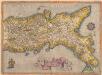
Regni Neapolitani Verissima Secundum Antiquorum Et Recentiorum Traditionem Descriptio [Karte], in: Theatrum orbis terrarum, S. 233.
1 Karte aus Atlas Ortelius, Abraham
Regno di Napoli
1 : 1000000 Neapolsko (království) Cantelli, Giacomo Casanate, Girolamo Gio. Giacomo de Rossi
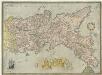
Composite: No.1 - 31. Regno di Napoli.
1 : 114000 Rizzi Zannoni, Giovanni Antonio (1736-1814)
Novißima & exactißima Totivs Regni Neapolis Tabvla praesentis Belli Statvi
1 : 1200000 Mollova mapová sbírka Homann, Johann Baptist Homann, Johann Baptista
Regno di Napoli
1 : 1100000 Mollova mapová sbírka Cantelli, Giacomo Widman, Giorgio De Rossi, Giovanni Giacomo
General Karte von dem Koenigreiche Neapel in 4 Blättern mit einem Theile von Sicilien und der ganzen Insel Malta
Neapol (Itálie) Rizzi Zannoni, Giovanni Antonio Artaria
Kingdom of Naples.
1 : 2500000 Tanner, Henry S.

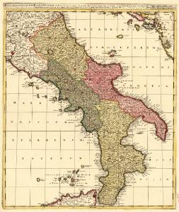
REGNUM NEAPOLIS
1 : 1115000 Neapolsko (království) Wit, Frederick de per Fredericum de Wit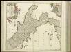
[32][32] Regnum Neapolis ..., uit: Atlas sive Descriptio terrarum orbis
Annotatie: Gedigitaliseerde versie. Amsterdam. Heiloo : Picturae (vervaardiger), 2015. tiff-bestand. Gedigitaliseerd: 07-01-2015; Origineel: Universiteitsbibliotheek Vrije Universiteit (XL.05127.-) ; Netherlands; Titelpagina ontbreekt Wit, Frederik de Amsterdam : Frederick de Wit
Königreich beider Sicilien nebst Südlichen Theile des Kirchenstaats / [Adolf Stieler]
1 : 1850000 Annotatie: Met administratieve indeling Gotha : Justus Perthes

Südliches Italien enthält Neapel und Sicilien nebst dem südlichen Theile des Kirchenstaates
Hand-Atlas über alle Theile der Erde nach dem neuesten Zustande und über das Weltgebäude Stieler, Adolf bei Justus Perthes
Le Royaume De Naples Divisé En Ses Douze Provinces
1 : 1100000 Mollova mapová sbírka Nolin, Jean-Baptiste Nolin, Jean-Baptiste I.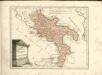

[Südliches Jtalien enthält Neapel und Sicilien]
Stieler's Hand-Atlas Stieler, Adolf bei Justus Perthes
South Italy (with) The Maltese Islands.
1 : 1267200 Arrowsmith, John
Regnum Neapolis
1 : 1100000 Mollova mapová sbírka Wit, Frederik de Covens, Johannes I
Unter Italien, beider Sicilien.
1 : 1200000 Kiepert, Heinrich, 1818-1899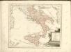
Regni Neapolitani Verissima Secvndvm Antiqvorvm Et Recentiorvm Traditionem Descriptio
1 : 1300000 Mollova mapová sbírka Ligorio, Pirro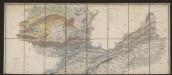
Neapolitanum Regnum [Karte], in: Gerardi Mercatoris et I. Hondii Newer Atlas, oder, Grosses Weltbuch, Bd. 2, S. 311.
1 Karte aus Atlas Mercator, Gerhard und Hondius, Jodocus Jansson, Jan
Regnum Neapolis Siciliae et Lipariae insulae multis locis correctae novissima descriptio
1 : 1100000 2 Karten auf 1 Blatt : Kupferdruck ; 54 x 47 cm und 14 x 17 cm, auf Blatt 62 x 53 cm Danckerts, Justus [Danckerts]