Maps of Landkreis Tübingen
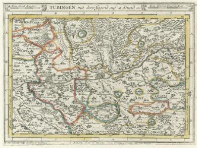
Tübingen mit dero Gegend auf 2 Stud etc.
1 : 150000 Mollova mapová sbírka Bodenehr, Gabriel Bodenehr, Gabriel
Blatt 109: Möffingen, uit: Topographische Karte von Württemberg im Massstab 1:25.000 / hrsg. vom Statistischen Landesamt
1 : 25000 titelvariant: Topographische Karte des Königreichs Württemberg im Massstabe 1:25.000; Annotatie: Titelvariant: Topographische Karte des Königreichs Württemberg im Massstabe 1:25.000; Incompleet (4 bl. aanwezig) Württembergisches Statistisches Landesamt [Stuttgart : Statistisches Landesamt]
Meßtischblatt [7520] : Mössingen, 1911
1 : 250000 Mössingen. - 1:25000. - Stuttgart, 1911. - 1 Kt.
Meßtischblatt [7519] : Rottenburg (Württ.). Bietenhausen (Preuß.), 1909
1 : 250000 Rottenburg (Württ.). Bietenhausen (Preuß.). - 1:25000. - Stuttgart, 1909. - 1 Kt.
Meßtischblatt [7420] : Tübingen, 1901
1 : 250000 Tübingen. - 1:25000. - Stuttgart, 1901. - 1 Kt.
Meßtischblatt [7419] : Herrenberg, 1901
1 : 250000 Herrenberg. - 1:25000. - Stuttgart, 1901. - 1 Kt.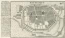
Reutlingen.
1 : 4000 Mollova mapová sbírka Bodenehr, Gabriel Bodenehr, Gabriel
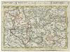
Geographica Provinciarum Sveviae Descriptio =
Mollova mapová sbírka Hurter, Johann Christoph Bodenehr, Johann Georg
Le Flambeau de la Guerre Allumee au Rhin
Mollova mapová sbírka Delisle, Guillaume Schenk, Peter II
Hohenzollern Hechingische Forst-Carte welche Occasione derer in solchem Territorio Ao. 1733 enstandenen Unruhe
1 : 50000 Mollova mapová sbírka Freusberg, Marquard Rudolph von
Meßtischblatt [7319] : Aidlingen, 1898
1 : 250000 Aidlingen. - 1:25000. - Stuttgart, 1898. - 1 Kt.
Meßtischblatt [7320] : Böblingen, 1900
1 : 250000 Böblingen. - 1:25000. - Stuttgart, 1900. - 1 Kt.
Meßtischblatt [7518] : Horb (Württ.). Imnau (Preuß.), 1909
1 : 250000 Horb (Württ.). Imnau (Preuß.). - 1:25000. - Stuttgart, 1909. - 1 Kt.
Meßtischblatt [7418] : Nagold, 1931
1 : 250000 Nagold. - 1:25000. - Stuttgart, 1931. - 1 Kt.
Meßtischblatt 7521 : Reutlingen, 1936
1 : 250000 Reutlingen. - Aufn. 1871/1903, hrsg. 1908, bericht. 1936. - 1:25000. - Stuttgart, 1936. - 1 Kt.
Meßtischblatt [7521] : Reutlingen, 1915
1 : 250000 Reutlingen. - Hrsg. 1908, 2. Ausg. 1915. - 1:25000. - Stuttgart, 1915. - 1 Kt.
Meßtischblatt [7521] : Reutlingen, 1910
1 : 250000 Reutlingen. - 1:25000. - Stuttgart, 1910. - 1 Kt.
Meßtischblatt [7521] : Reutlingen, 1908
1 : 250000 Reutlingen. - 1:25000. - Stuttgart, 1908. - 1 Kt.
Meßtischblatt [7421] : Metzingen,1901
1 : 250000 Metzingen. - 1:25000. - Stuttgart, 1901. - 1 Kt.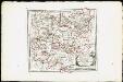
Des Herzogthums Würtemberg westsüdliche Aemter mit der freyen Reichsstadt Reutlingen : Nro. 188
Reilly, Franz Johann Joseph von
Tubingen
1 : 200000 Herder, Benjamin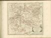

Nordwestlicher Abhang der Schwäbischen Alp
Geologischer Atlas zur Naturgeschichte der Erde Leonhard, Carl Cäsar von E. Schweizerbart'sche Verlagsbuchhandlung
Des Herzogthums Würtemberg westsüdliche Aemter mit der freyen Reichsstadt Reutlingen
1 Karte : Kupferdruck ; 23 x 26 cm Reilly F. J. J. von Reilly
Carte topographique d'Allemagne
1 : 218000 Alsasko (Francie) Jaeger, Johann Wilhelm Abraham Facius, Johann Gottlieb chez I.W.A. Iaeger
Carte topographique d'Allemagne
1 : 218000 Alsasko (Francie) Jaeger, Johann Wilhelm Abraham I. W. A. Iaeger
Nova et accuratißima Ducatus Wurtenbergici
1 : 300000 Mollova mapová sbírka Seutter, Matthäus Seutter, Matthäus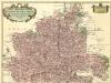
Carte tres Particuliere du Duché de Wirtemberg
1 : 240000 Mollova mapová sbírka Fer, Nicolas de Loon, Herman van L'Isle, Guillaume de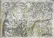
Geographica provinciarum Sueviae descriptio, 3
4 Blätter : Johann Georg Bodenehr