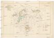
Maps of Czech Republic

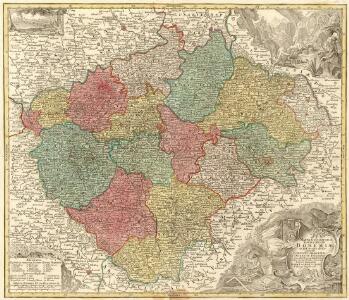
Mappa Geographica totius Regni Bohemiae in XII. Circulos divisae annexis Comitatu Glacensi et Districtu Egerano nec non aliis Principatib; finitimis Noviter et exactissime elaborata
1 : 740000 Mollova mapová sbírka Lotter, Tobias Conrad Lotter, Tobias Conrad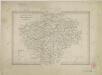
II. vojenské mapování Klad mapových listů

Železniční a silniční mapa Království Českého
1 : 525000 Praha (Česko : oblast) Wagner, Jan Eduard F. Kytka
Železniční a silniční mapa království Českého

Post Charte vom Königreiche Böhmen
1 : 1200000 Česko
Post Charte vom Königreiche Böhmen
1 : 1200000 Česko
Post charte vom Königreiche Böhmen
1 : 1200000 Česko
Post charte vom Königreiche Böhmen
1 : 1200000 Česko
Post Charte vom Königreiche Böhmen
1 : 1200000 Česko
Post Charte vom Königreiche Böhmen
1 : 1200000 Česko
Post Charte vom Königreiche Böhmen
1 : 1200000 Česko
Post Charte vom Königreiche Böhmen
1 : 1200000 Česko
Post Charte vom Königreiche Böhmen
1 : 1200000 Česko
Post Charte vom Königreiche Böhmen
1 : 1200000 Česko
Bohemiae Regnum in XII. Circulos divisum ...

Specielle Telegrafen und Eisenbahnkarte von Böhmen

Bohemiae Regnum in XII circulos divisum cum com. Glac et distr. Egerano ceterisque circumjacentibus terris ex Müllerianis aliisque chorographicis subsidiis delineatum nunc noviter revisum et emend. per Homannianos Heredes
Böhmen Verwaltungsgliederung
Mappa Geographica totius Regni Bohemiae...

Le Royaume de Boheme

Le Royaume de Boheme

Bez titulu: Statistické mapky Čech
Strassenkarte des Koenigreiches Boehmen

Charte vom Königreich Böheim
1 : 730000 Kladsko-oblast (Polsko) Müller, Johann Christoph von Homanns Erben
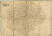
Mapa Čech
1 : 800000
Mapa království Českého

Hydrografická přehledná mapa povodí Labe a v Čechách nacházejícího se povodí Odry

Hydrographische Karte des Königreiches Böhmen

Království česke [sic]
1 : 1500000 Čechy (Česko) Trampler, Richard Filipovský, Karel