Maps of Jihočeský

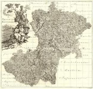
Provincia Bechinensis
1 : 217000 Mollova mapová sbírka Erber, Bernardinus Winkler, Johann Christoph Kurzböck, Josef von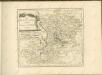

Regni Bohemiae Circulus Bechinensis
1 : 264000 Bechyně-oblast (Česko) Müller, Johann Christoph ab Homannianis Heredibus
Regni Bohemiae Circulus Bechinensis
1 : 264000 Bechyně-oblast (Česko) Müller, Johann Christoph ab Homannianis Heredibus
Bechiner Kreis
Bechyně-oblast (Česko) Berndt, Johann Christoph Anton Elsenwanger
Bechiner Kreis
Bechyně-oblast (Česko) Berndt, Johann Christoph Anton Elsenwanger
Regni Bohemiae Circuli Taborensis et Budweisensis...

Provincia Bechinensis
Bechyně-oblast (Česko) Bernardi, Augustin Augustin Bernardi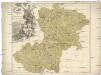
Provincia Bechinensis
Bechyně-oblast (Česko) Müller, Johann Christoph
Jihočeský kraj

Karte des Taborer und Budweiser Kreises im österreichischen Kronlande Böhmen
1 : 285000 Tábor-oblast (Česko) Obentraut, Maxmilian Friedrich Kretzschmar
Jihočeský kraj

Kraj Českobudějovický

Regni Bohemiae Circulus Kaurzimensis
1 : 180000 Kouřim-oblast (Česko) Müller, Johann Christoph ab Homannianis Heredibus
Regni Bohemiae Circuli Taborensis et Budweisensis
1 : 200000 Tábor-oblast (Česko) Müller, Johann Christoph ab Homannianis Heredibus
Jihovýchodní Čechy
1 : 220000 Jihočeský kraj (Česko) Wagner, Jan Eduard F. Kytka
Special-Karte des Budweiser Kreis - resp. politischen Verwaltungs Bezirkes in Böhmen
1 : 230000 České Budějovice-oblast (Česko) Schmidt, Eduard Wend. Morauer
Special-Karte des Budweiser Kreis - resp. politischen Verwaltungs Bezirkes in Böhmen
1 : 230000 České Budějovice-oblast (Česko) Schmidt, Eduard Wend. Morauer
Special-Karte des Budweiser Kreis, resp. politischen Verwaltungs Bezirkes in Böhmen
České Budějovice-oblast (Česko) Schmidt, Eduard Steyrer, Fr. C. Wend. Morauer
A. Budweis und B. Taborer Kreis
1 : 180000 Tábor-oblast (Česko) Berndt, Johann Christoph Anton Elsenwanger
Spezial-Karte des Budweiser Kreis...

Circulus Budvicensis pars regni Bohemiae
1 : 253000 České Budějovice-oblast (Česko) Henatsch, Ant. Berka, Jan Peter franza [sic]
Circulus Budvicensis pars regni Bohemiae
1 : 253000 České Budějovice-oblast (Česko) Henatsch, Ant. Berka, Jan
Circulus Budvicensis pars regni Bohemiae
1 : 253000 České Budějovice-oblast (Česko) Henatsch, Ant. Berka, Jan Peter franza [sic]
Circulus Budvicensis pars regni Bohemiae
České Budějovice-oblast (Česko) Henatsch, Ant. Berka, Jan Peter franza [sic
Mapa ku IV. dílu Hradů, zámků a tvrzí českých
1 : 278000 Jindřichův Hradec (Česko : oblast) Král z Dobré Vody, Vojtěch Šimáček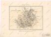
Der Budweiser Kreis

Budejowský kraj w Králowstwí Českém

Charte vom Budweiser Kreise ...