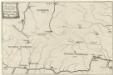
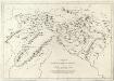
Maps of Banská Bystrica

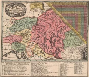
Provincia Austriaca Societatis Iesu, aeri ineisa et orrdis Patribus ejusdem Societat. in dicta Provincia decenti observantia oblata
1 : 1700000 Mollova mapová sbírka Seutter, Matthäus Mayr, Johann Baptist Seutter, Matthäus
Generalcharte des Erzherzogthums Niederöstreich
1 : 950000 Dolní Rakousko (Rakousko) Hohlgartt, Ludwig von Liechtenstern, Joseph Marx von Verlage von T. Riedls Kunsthandlung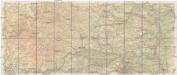
Hölzels Strassen-Karte von Österreich für Automobilisten und Radfahrer
1 : 200000 Kremže (Rakousko) Geogr. Institut Ed. Hölzel
Comitat Abaúj-Torna
1 : 290000 Košice (Slovensko : oblast)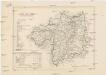
Comitat Abaúj-Torna
1 : 288000 Košice-oblast jižní (Slovensko)
Vermehrte und Verbesserte Landkarten des Königreichs Ungarn :
1 : 500000 Mollova mapová sbírka Stier, Martin Böner, Johann-Alexander Endter, Martin
Tabula Universalis Austriae
Mollova mapová sbírka Insprugger, Sebastianus Schwendimann, Wolfgang
Tabula Universalis Austriae
Mollova mapová sbírka Insprugger, Sebastianus Schwendimann, Wolfgang

Československo v mapách
Appendix ad Mappam Mineralographicam
Mollova mapová sbírka Marsili, Luigi Ferdinando
Kraj banskobystrický
Bez titulu: mapy slovenských krajů

Das Erzherzogthum Niederoest[erreich] unter der [Enns]
1 : 380000 Dolní Rakousko (Rakousko) Liechtenstern, Joseph Marx von List, Joseph Artaria
Tabula Austriae Inferioris
1 : 680000 Mollova mapová sbírka Insprugger, Sebastianus Voigt, Maria Theresia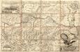
Archiducatus Austriae Inferioris Accuratissima Geographica Descriptio
1 : 320000 Mollova mapová sbírka Vischer, Georg Matthaeus
Vestigium Operationis Astronomico-Geometricae :
1 : 533000 Mollova mapová sbírka
Charte des Mühl Viertels in dem Erzherzogthume Niederöstreich uiber der Enns
1 : 440000 Dolní Rakousko (Rakousko) Liechtenstern, Joseph Marx von Bendovsky, Thomas bey Joh. Schönberg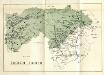
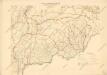
Stolice Zvolen a Gemer
Komitat Altsohl, Komitat Gemer, ethnische Gruppe
Lundenburg 133, uit: Special-Karte von Mittel-Europa / nach amtlichen Quellen bearbeitet von W. Liebenow
1 : 300000 titelvariant: W. Liebenow's Mittel-Europa; Annotatie: Titel boven de bladen: W. Liebenow's Mittel-Europa Johannes Wilhelm Liebenow 1822-1897 Frankfurt a. M. : Ludwig Ravenstein
Das in dem Ertzhertzogtumb Vnter Osterreich
1 : 246000 Dolní Rakousko (Rakousko) Vischer, Georg Matthaeus Hoffmann, Jakob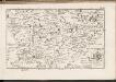
C. Tornensis
Ungarn Komitat Torna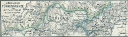
Nördliche Türkengrenze im 16ten u. 17ten Jhdt.
1 : 1850000 Osmanisches Reich / Europäischer Teil Grenze
Zólyom vármegye térképe
1 : 300000 Zvolen (Slovensko : oblast) Kogutowicz, Manó Magyar Földrajzi Intézet
Ob Mannharts Berg
1 : 640000 Mollova mapová sbírka Insprugger, Sebastianus Märtin, Johann Heinrich Voigt, Maria Theresia
Unter Mannhartsberg
1 : 640000 Mollova mapová sbírka Insprugger, Sebastianus Voigt, Maria Theresia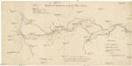
Übersicht der Canaltracen der Strecke Wien-Budweis
1 : 300000 Vídeň (Rakousko) Staff, A. Rosenberg, K.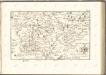

Stolice Abauj-Torna a Boršod
Abaúj-Torna, Komitat Borsod, ethnische Gruppe