Mappa catalogata
n/a


Titolo completo:n/a
Anno di illustrazione:1791
Data di pubblicazione:1791
Dimensione fisica:20 x 30 cm
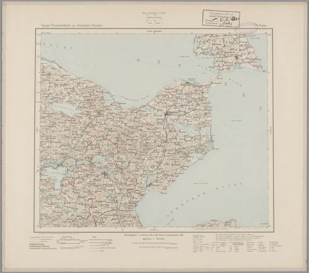
24. Eutin, uit: Topographische Uebersichtskarte des Deutschen Reiches / herausgegeben v. d. Kartogr. Abt. d. Königl. Preuß. Landesaufnahme
1899
Königlich Preußische Landesaufnahme. Kartographische Abtheilung
1:200k
n/a
1791
Ostsee
1922
Reichs-Marine-Amt
1:50k
n/a
1791
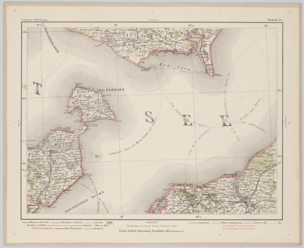
Rostock 22, uit: Special-Karte von Mittel-Europa / nach amtlichen Quellen bearbeitet von W. Liebenow
1899
Johannes Wilhelm Liebenow 1822-1897
1:300k
Holsatia ducatus
1630
Mercator; Hondius

Atlas minor, mapa ze strany: 119
1610
Mercator Gerhard
Meßtischblatt 2032 : Kalkhorst, 1912
1912
1:250k
Meßtischblatt 662 : Travemünde, 1879
1879
1:250k
Meßtischblatt 661 : Schwartau, 1900
1900
1:250k