Maps of Highland

L'Escosse delà le Tay
1 Karte : Kupferdruck ; 39 x 52 cm Sanson; Fortin; Gordon; Pont chez Fortin ing.r mecanicien du roi pour les globes rue de la Harpe pres celle du Foin
L'Escosse delà le Tay
1 Karte : Kupferdruck ; 39 x 53 cm Sanson; Mariette; Gordon; Pont chez Pierre Mariette rue St. Iacques a l'esperance
Scotland.
1 : 2400000 Bowen, Frances
Ecosse.
1 : 2000000 Malte-Brun, Conrad, 1775-1826
Scotland.
1 : 1600000 Colton, G.W.
Composite: Scotland.
1 : 633300 Johnston, W. & A.K.
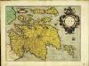
MAGNAE BRITANNIAE
1 : 970000 Skotsko Vischer, Georg Matthaeus Homann, Johann Baptist Iohan. Bapt. Homanno
MAGNAE BRITANNIAE
1 : 970000 Skotsko Vischer, Georg Matthaeus Homann, Johann Baptist Iohan. Bapt. Homanno
Magnae Britanniae pars septentrionalis qua regnum Scotiae
1 : 950000 Skotsko Vischer, Georg Matthaeus Homann, Johann Baptist J. B. Homann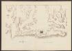
Scotiae Regnum [Karte], in: Atlas, sive, Cosmographicae meditationes de fabrica mundi et fabricati figura, S. 86.
1 Karte aus Atlas Mercator, Gerhard
Scotland.
1 : 2000000 Lucas, Fielding Jr.
Scotland.
1 : 980000 Playfair, Principal
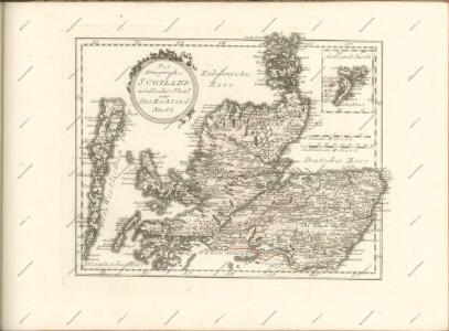
A New and Correct Mercator Map of Northern Britain [or Scotland]
During the Jacobite Rising, the English forces, led by George II’s son, William, Duke of Cumberland pursued Bonnie Prince Charlie's army back across the Scottish border. They arrived at Edinburgh at the end of January 1746, and then ventured north to Aberdeen. The Jacobites fled further north, but Cumberland was in no mood to hurry after them. He was acutely aware of the difficulty of moving troops through the Highland terrain, where roads were few and opportunities for ambush many. The most up-to-date map of Scotland available to both the English and the Jacobite sides was this map by John Elphinstone, a military engineer who served with the Duke of Cumberland's army. Though it was drawn in 1745, and was a great improvement on earlier maps, it nonetheless attracted criticism for its inaccuracies. Elphinstone's depiction of hills, for example, is entirely schematic with none of the detail necessary to thread a route between Highland glens or plan military offensives. Cumberland realised his lack of local topographical knowledge would put the English at a serious disadvantage. He spent the next two months acquiring what information he could about the lie of the land and training his troops for the particular type of campaign they would be forced to fight. Elphinstone's map was engraved by Thomas Kitchen, who worked in London's Holborn, and published by Andrew Millar in the Strand. Copies of the map were sold for 1s 6d. This one has been coloured by hand to indicate the territories of the Highland clans. Elphinstone, John Kitchin, Thomas
Scotland.
1 : 1650000 Carey, Mathew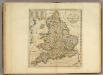
Scotland.
1 : 1550000 Carey, Mathew
Scotland.
1 : 1584000 Carey, Mathew
Scotland.
1 : 1520640 Carey, Mathew
Scotland.
1 : 1520640 Carey, Mathew
L'Ecosse
1 Karte : Kupferdruck ; 54 x 47 cm Le Rouge; Basset; Basset chez Basset rue Saint Jacques
Nova et accurata totius regni Scotiæ, secundum omnes provincias et adjacentes insulas, exquisito studio determinatæ, delineatio
1 Karte : Kupferdruck ; 56 x 48 cm Lotter; Silbereisen Tobias Konrad Lotter
L'Ecosse
1 Karte : Kupferdruck ; 54 x 47 cm Le Rouge; Bowles chés le Sr. le Rouge ingen.r géog. du roy rue des grands Augustins
Nova et accurata totius regni Scotiæ, secundum omnes provincias et adjacentes insulas, exquisito studio determinatæ, delineatio
1 Karte : Kupferdruck ; 56 x 48 cm Seutter; Silbereisen Matthäus Seutter
Scotia regnum
1 Karte : Kupferdruck ; 56 x 49 cm Wit ex officina J. Cóvens et C. Mortier
Novissima regni Scotiæ septentrionalis et meridionalis tabula
1 Karte : Kupferdruck ; 49 x 58 cm by I. Cóvens en C. Mortier op de Vygendam
Scotia Cambdeni et Sibbaldi
1 Karte : Kupferdruck ; 37 x 31 cm Weigel; Camden; Sibbald; Kauffer Christoph Weigel
Novissima regni Scotiæ septentrionalis et meridionalis tabula
1 Karte : Kupferdruck ; 56 x 48 cm Schenk Pieter Schenk
Nouvelle carte d'Ecosse
1 Karte : Kupferdruck ; 33 x 31 cm Châtelain s.n.
Regnum Scotiæ, seu pars septent: Magnæ Britanniæ
1 Karte : Kupferdruck ; 46 x 58 cm Valck; Valck G. und L. Valck
Magnæ Britanniæ pars septentrionalis qua regnum Scotiæ in suas partes et subjacentes insulas divisum accurata tabula
1 Karte : Kupferdruck ; 56 x 46 cm Visscher; Homann Johann Baptist Homann
Le royaume d'Escosse
1 Karte auf 2 Blatt : Kupferdruck ; 84 x 57 cm Sanson; Jaillot chez H. Jaillot
Scotia regnum
1 Karte : Kupferdruck ; 56 x 49 cm Wit ex officina Frederici de Witt
Scotia regnvm
1 Karte : Kupferdruck ; 37 x 49 cm Janssonius apud Ioannem Ianssonium
Novissima regni Scotiæ septentrionalis et meridionalis tabula
1 Karte : Kupferdruck ; 49 x 58 cm Allard by Carolus Allard op den dam
Exactissima regni Scotiæ tabula
1 Karte : Kupferdruck ; 55 x 46 cm Visscher Visscher
Scotia regnvm
1 Karte : Kupferdruck ; 37 x 48 cm Blaeu Joan Blaeu
Scotia, regnum
1 Karte : Kupferdruck ; 33 x 39 cm Mercator; Hondius Henricus Hondius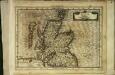
Scotia, regnum
1 Karte : Kupferdruck ; 17 x 24 cm Mercator Cloppenburgh
Scotia, regnum
1 Karte : Kupferdruck ; 33 x 38 cm Mercator; Hondius Jodocus Hondius
Scotiæ tabvla
1 Karte : Kupferdruck ; 35 x 47 cm Ortelius s.n.