Maps of L'viv

Wandkarte der Čechoslovakischen republik
Machát, František
Nástěnná mapa Československé republiky
Machát, František
Národnostní mapa Republiky československé
Boháč, Antonín
Carte nouvelle des royaumes de Galizie et Lodomerie avec le district de Bukowine
1 : 956000 Bukovina (Rumunsko a Ukrajina) Probst, Johann Michael chez Iean Michel Probst
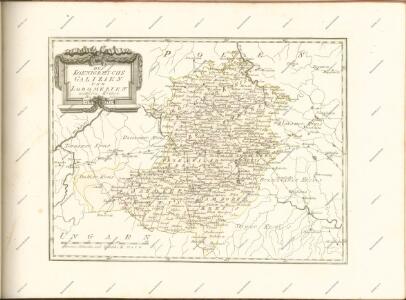
Lubomeriae et Galliciae Regni Tabula Geographica
1 : 1100000 Mollova mapová sbírka Homann, Johann Baptist Homann, Johann Baptista - dědici
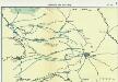
Bez titulu: Šest listů speciálních map Ukrajiny
Halič
Halič (Polsko a Ukrajina)
Strategische Übersichts-Karte des polnisch-litaurischen Armee-Bewegungraumes
Strassen und Eisenbahnkarte des oesterreichischen Kaiserthumes

Pohlen, Rußland, Gallicien, Wolhinien, Podolien. Ungarn. Ungvárer Comitat
Ungarn Verkehrsweg
Strassen- und Eisenbahnkarte des oesterreichischen Kaiserthumes
1 : 864000 Blatt 4 Schaller, G. K.K. Militärisch-Geografisches Institut, Karten-Evidenthaltungs-Abteilung
Ost Galizien
Halič (Polsko a Ukrajina) Liesganig, Joseph m Verlage des Kunst- und Industrie- Comptoirs
Sheet IV: Karte Des Oesterreichischen Kaiserstaates.
1 : 576000 Scheda, Josef
Ost-Galizien
Halič (Polsko a Ukrajina) Liesganig, Joseph im Verlage des Kunst und Industrie Comptoirs
IV, uit: General-Karte des oesterreichischen Kaiserstaates mit einem grossen Theile der angrenzenden Länder / durch Josef Scheda ... bearb. und hrsg
1 : 576000 Annotatie geografische gegevens: Maatstokken: oesterreichische Meilen, geografische oder deutsche Meilen, preussische Meilen, türkische Berri, französische Lieues, russische Werste; Maatstok per blad: wiener Klafter, öster. Meilen; Blad XIX: statistische en taalkundige informatie; Blad XIX: legenda [Wien : K.K. Militärisch-Geografisches Institut]
Übrige Länder der ehemaligen Österreich-Ung. Monarchie
1 : 900000 Halič (Polsko a Ukrajina) Koch, Wilhelm Opitz, Carl Arnd
Sbírka map a diagramů použitých na mírových konferencích v Paříži v letech 1919 - 1920
Galizien, Westlicher Theil
1 : 700000 Halič (Polsko a Ukrajina) Karl Fr. Pfau
Ost Galizien
Halič (Polsko a Ukrajina) Liesganig, Joseph m Verlage des Kunst- und Industrie- Comptoirs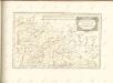
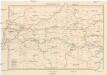
Strecke
Ivano-Frankivsk (Ukrajina) K. k. Österreichische Staatsbahnen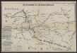
Übersichtskarte des Kampfgeländes
1 : 650000 Polen Tarnów Weltkrieg <1914-1918> Verl. Gerhard Stalling, Oldenburg
Augustissimo Romanor. Imperatori Iosepho I. Hungaria Regi Invictissimo Mappam Hanc Regni Hungariae
1 : 540000 Mollova mapová sbírka Müller, Johann Christoph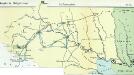
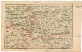
Nr. 6b. Kämpfe in Ostgalizien. Im Dnjestrgebiet
Galizien Weltkrieg <1914-1918>, Ostfront
Generalkarte von Zentraleuropa

Generalkarte von Zentraleuropa

Generalkarte von Zentraleuropa
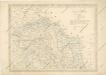
General-Karte des Königreiches Galizien und des Herzogthumes Bukovina