Mapa catalogado


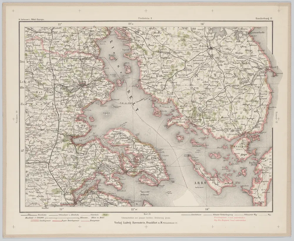
Sonderburg 11, uit: Special-Karte von Mittel-Europa / nach amtlichen Quellen bearbeitet von W. Liebenow
1899
Johannes Wilhelm Liebenow 1822-1897
1:300k
Fionia
1630
Mercator; Hondius

Atlas minor, mapa ze strany: 123
1610
Mercator Gerhard
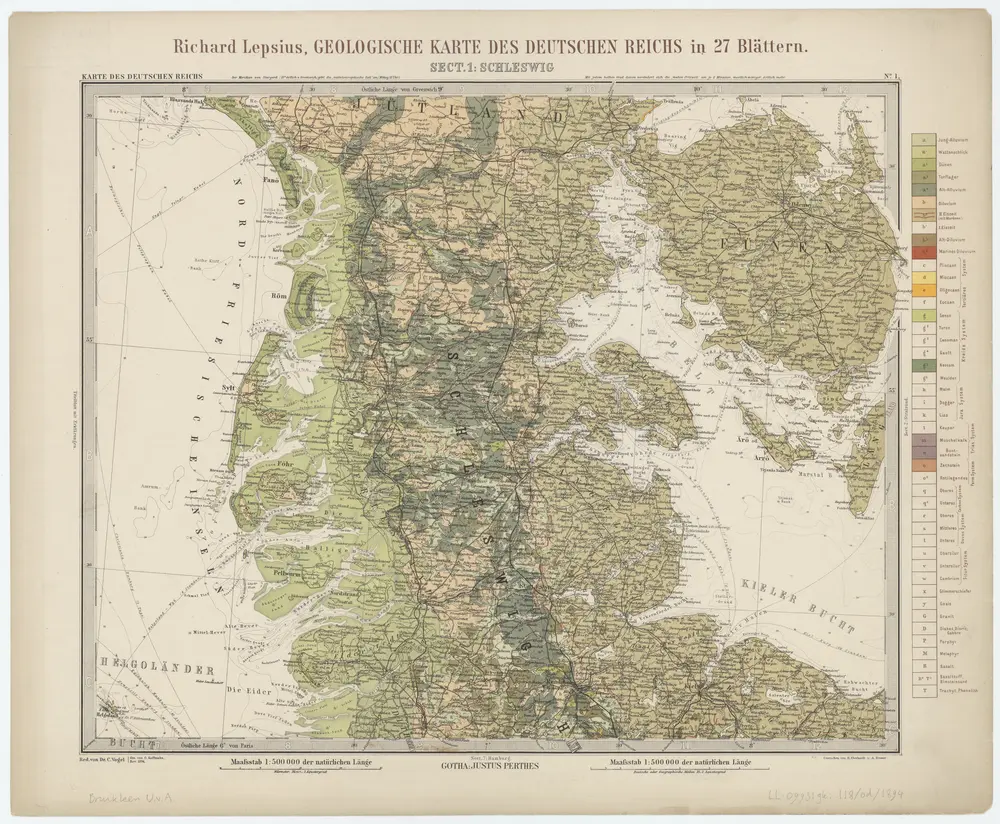
Sect. 1: Schleswig, uit: Geologische Karte des Deutschen Reichs in 27 Blaettern / [von] Richard Lepsius ; Red. von C. Vogel
1894
Carl Vogel 1828-1897
1:500k
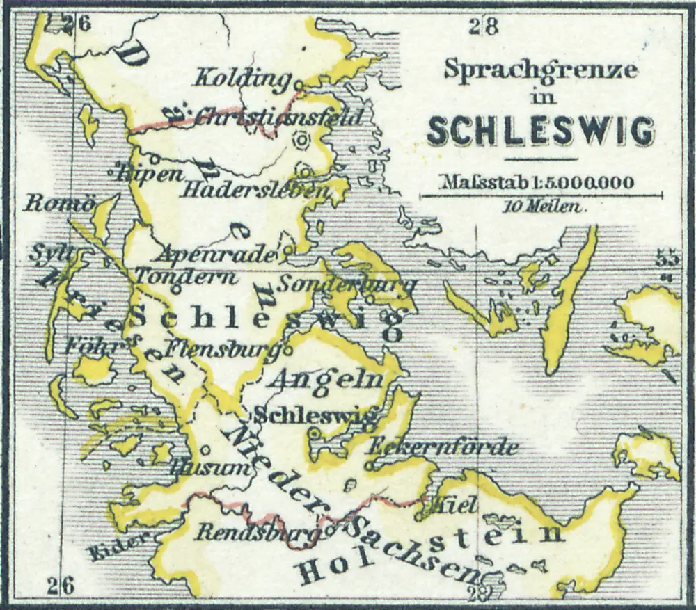
Sprachgrenze in Schleswig
1880
1:500k
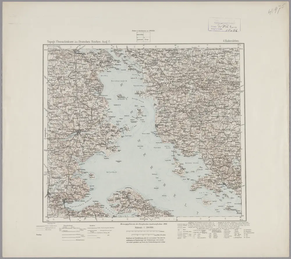
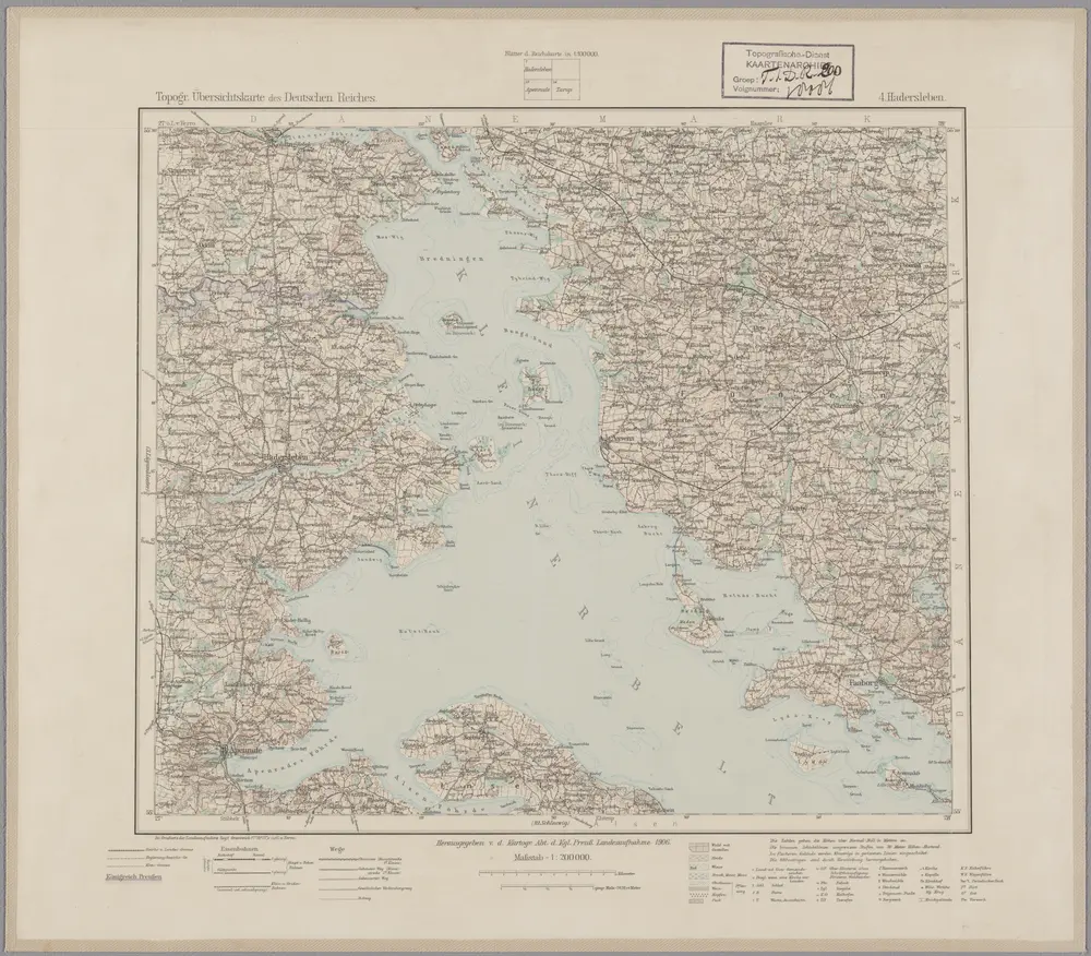
4. Hadersleben (papieren versie, niet op linnen), uit: Topographische Uebersichtskarte des Deutschen Reiches / herausgegeben v. d. Kartogr. Abt. d. Königl. Preuß. Landesaufnahme
1899
Königlich Preußische Landesaufnahme. Kartographische Abtheilung
1:200k

Neuer Atlas Uber die Gantze Welt, mapa ze strany: [217]
1714
Homann Johann Baptist
4. hadersleben, uit: Topographische Uebersichtskarte des Deutschen Reiches / herausgegeben v. d. Kartogr. Abt. d. Königl. Preuß. Landesaufnahme
1899
Königlich Preußische Landesaufnahme. Kartographische Abtheilung
1:200k
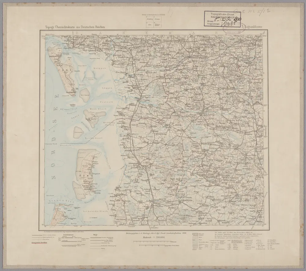
3. Lügumkloster, uit: Topographische Uebersichtskarte des Deutschen Reiches / herausgegeben v. d. Kartogr. Abt. d. Königl. Preuß. Landesaufnahme
1899
Königlich Preußische Landesaufnahme. Kartographische Abtheilung
1:200k
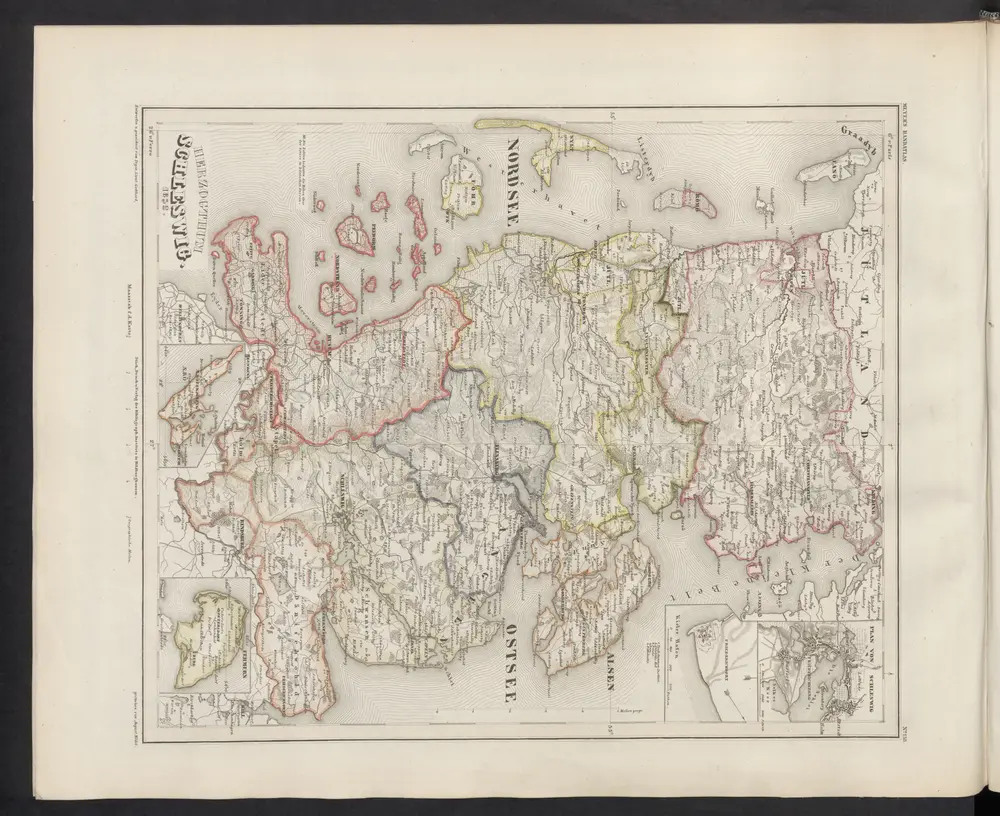
Herzogthum Schleswig
1860
Meyer, J.