Maps of Bavaria


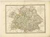
Circvlvs Bavariae Compositus ex Ducatu Bavariae, Palatinatu superiore ceteris que Territoriis emmediatis ecclesiasticis et Secularibus
1 : 2100000 Mollova mapová sbírka Franz, Johann Michael Homann, Johann Baptista - dědici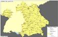
Straßen im Königreich Bayern 1848
Bayern Straßennetz Kunz, Andreas ; Treiling, Thomas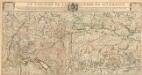
Le Théatre De La Guerre En Allemagne
1 : 490000 Mollova mapová sbírka Liébaux, Jean-Baptiste Bénard, Jacques-François
[Atlas zur Geschichte von Bayern] : I. Rhaetia, Noricum und die angränzenden Länder
K. v. Spruner [Gotha : Perthes]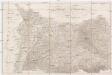
Kriegs Schauplatz vom Jahr 1796 in Deutschland
1 : 860000 Německo jižní Roßenberg Reiller, Fr.
Postkarte von Bayern, Würtemberg und Baden nebst Theilen der angrenzenden Laender
Bavorsko (Německo) Loehle, Franz Franz Loehle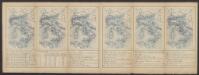
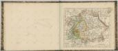
Suevia Et Bavaria XII. Nova Tabula. [Karte], in: Claud. Ptolemaeus. Geographia lat. cum mappis [...], S. 383.
1 Karte aus Atlas Münster, Sebastian [und Ptolemaeus, Claudius]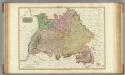
Germany south of the Mayn.
1 : 885000 Pinkerton, John, 1758-1826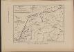
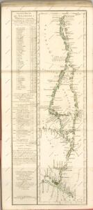
Cesta, kudy Hus ubíral se do Kostnice
Mitteleuropa Konstanz Reiseweg Hus, Jan
Suevia Et Bavaria XI. Nova Tabula. [Karte], in: Geographia universalis vetus et nova complectens Claudii Ptolemaei Alexandrini enarrationis libros VIII, S. 329.
1 Karte aus Atlas Münster, Sebastian [und Ptolemaeus, Claudius]
Regni di Baviera, Wurttemberg, Baden, Principati Prussiani.
1 : 2200000 Wieland, C. F.
Postkarte von dem Bayrischen und Schwaebischen Kreise
Bavorsko (Německo) Müller, Franz Deilly'schen Lankarten und Kunstwerke Verschleiss Komtoir
Postkarte von dem Bayrischen und Schwaebischen Kreise
Bavorsko (Německo) Müller, Franz im von Reilly'schen Landkarten und Kunstwerke Verschleiss Komptoir
Les cercles de Souabe et de Baviere
1 : 1740000 Bavorsko (Německo) Bonne, Rigobert André
Germany south.
1 : 1840000 Arrowsmith, Aaron; Lewis, Samuel
Germany south.
1 : 1840000 Arrowsmith, Aaron; Lewis, Samuel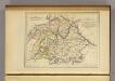
La Baviere, le Wurtemberg, et le Gr. Duche de Bade
1 : 2000000 Malte-Brun, Conrad, 1775-1826
Germany No. 3.
1 : 1457280 Colton, G.W.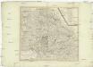
Chur-Bayern im Jahr 1802
1 : 1100000 Bavorsko (Německo) Herdegen, J. C. F. Karel Theodor J.L.C. Rheinwald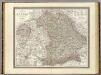
Bayern.
1 : 850000 Weiland, C. F. (Carl Ferdinand), d. 1847
Bayern, Wurtemberg, Baden, Hohenzollern.
1 : 1800000 Reichard, C. G.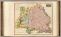
Germany S. of Mayne.
1 : 860000 Thomson, John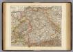
Wurtemberg, Bavaria.
1 : 1000000 Andree, Richard; Times (London, England)
Germany Southern.
1 : 1000000 Hall, S. (Sidney)
Bayern.
1 : 1390000 Flemming, Carl
Königreich Bayern Bezirksämter 1862
Bayern Bezirksamt Kunz, Andreas ; Johnen, Bettina ; Moeschl, Joachim