Maps of Paris

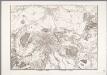
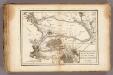
Typus choro-topographicus regiæ et totius orbis celeberrimæ urbis Lutetiæ parisiorum
1 Karte : Kupferdruck ; 49 x 57 cm Seutter Matthäus Seutter
Sorties de Paris
1 : 50000 Annotatie: Met register Paris : Services du Tourisme Michelin
[Paříž a okolí]
Paříž-oblast (Francie)
Plan von Paris

The Environs Of Paris.
1 : 95040 Colton, G.W.
Paris environs.
1 : 92000 Society for the Diffusion of Useful Knowledge (Great Britain)
Plan von Paris
1 : 50000 Paříž (Francie) Fritz Schischa
Paris, France.
1 : 59000 Colton, G.W.
Environs of Paris.
1 : 95000 Colton, G.W.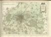

[Paříž]
1 : 40800 Paříž-oblast (Francie) Fer, Nicolas de N. de Fer
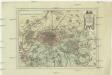
Topografische Karte von Paris ung Gegend
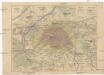
Der Gegend um Paris
1 : 73000 Paříž (Francie)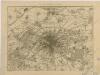
Karte der Befestigung von Paris
Paříž a okolí
Paříž (Francie) Weiland, Karl Ferdinand Pražák, K.
Paříž a okolí
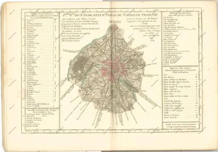
Carte militaire des environs de Paris relative aux traveaux de défence exécutés ou projetés en 1815 / gravé par E. Collin
1 : 30000 Annotatie: Herdruk van originele koperplaat; Oorspr. uitg.: ca. 1815 Collin, E. [Paris : IGN]
French Ports & Harbours, and Plan of Paris.
Fullarton, A. & Co.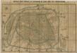
Noveau plan complet et historique de Paris, avec ses fortifications

Plan‘‘sraženija pod’’ Parižem‘‘, 18 marta 1814 g.
Frankreich Paris Befreiungskriege <1813-1815>
[Département de la Seine]. Paris, No. 5
1 : 40000 Annotatie: Herdruk van originele koperplaat; Oorspr. uitg.: [Paris] : Dépôt de la Guerre, [ca. 1850] [Paris : I.G.N.]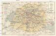
Plan de Paris
Paříž (Francie : oblast) Société S. Quentinoise d'Imprimerie
La Seine.
1 : 54000 Vincent
Nouveau plan illustré de la ville de Paris
Paříž (Francie) Vuillemin, A. Testard, A. Fatout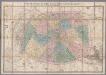
[Kaart], uit: Nouveau plan de Paris divisé en 20 arrondissements : dans un rayon de 10 kilomètres / le plan par Ch. Smith
1 : 17700 titelvariant: Paris et ses environs dans un rayon de dix kilomètres; Annotatie: Omslagtitel: Paris et ses environs dans un rayon de dix kilomètres Smith, Ch. Paris : Logerot
Paris illustré et ses fortifications / dressé par Maillard
1 : 10000 titelvariant: Plan de Paris; Annotatie: Omslagtitel: Plan de Paris; Met straatnamenregister Maillard, ... Paris : Logerot