Gecatalogiseerde kaart
n/a


Volledige titel:n/a
Jaar illustratie:1804
Pubdatum:1804
Fysieke grootte:20 x 30 cm
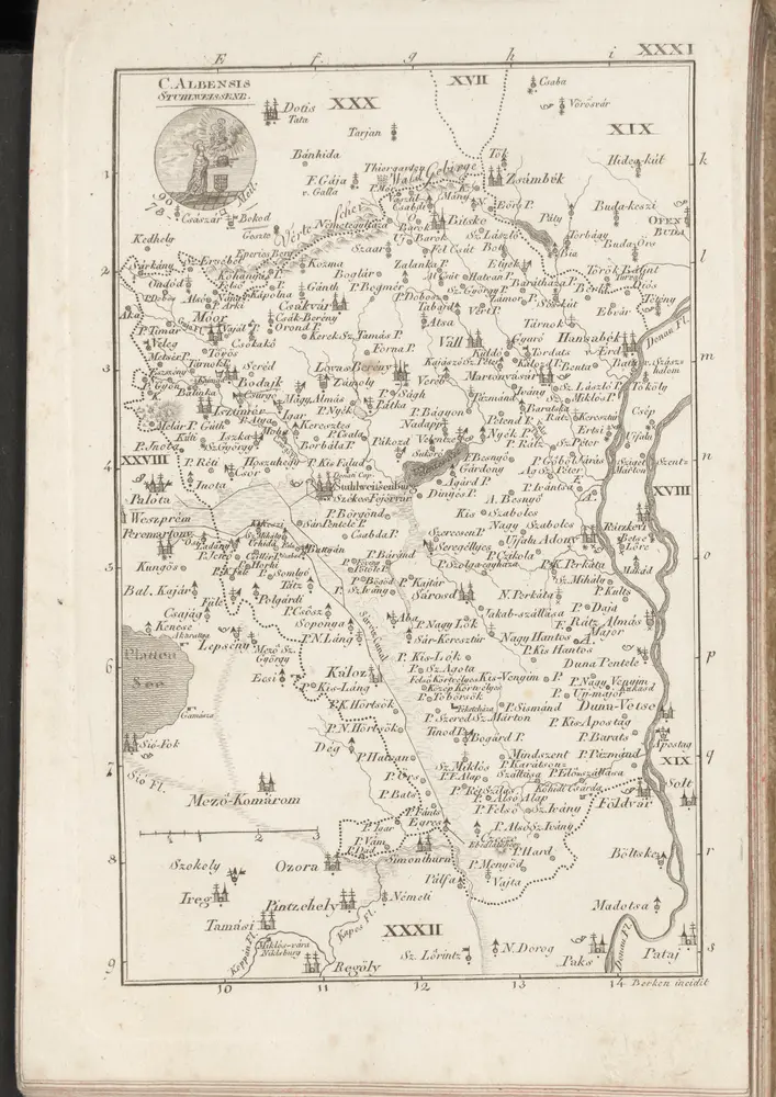
C. Albensis
1804
Comitat Stuhlweissenburg
1870
1:300k
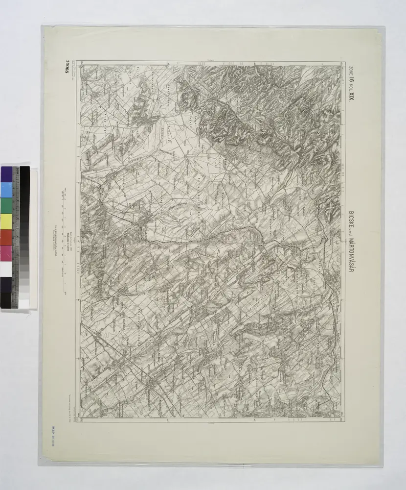
Bicske und Martonvasar.
1914
n/a
1804
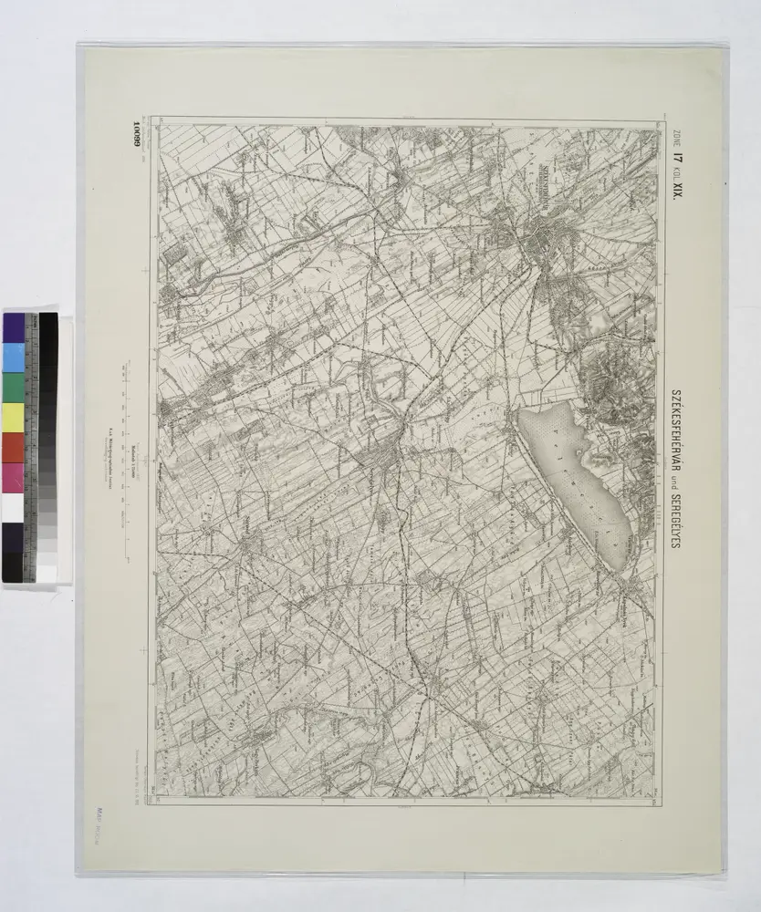
Szekesfehervar und Seregelyes.
1914
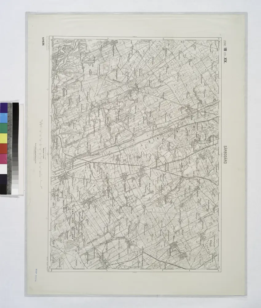
Sarbogard.
1914
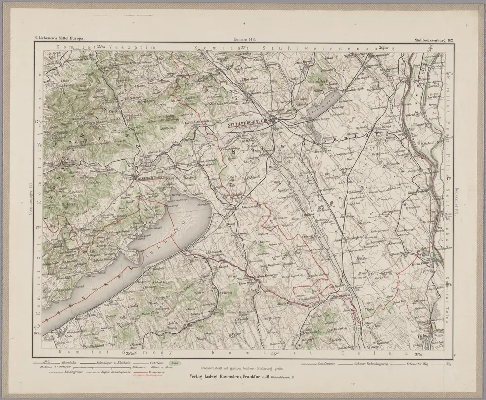
Stuhlweissenburg 162, uit: Special-Karte von Mittel-Europa / nach amtlichen Quellen bearbeitet von W. Liebenow
1899
Johannes Wilhelm Liebenow 1822-1897
1:300k
Veszprémer Comitat
1870
1:280k
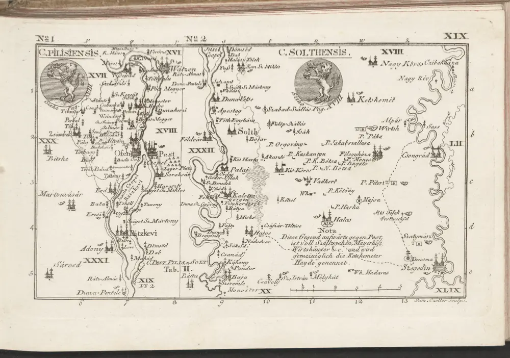
C. Pilisiensis ; C. Solthensis
1804
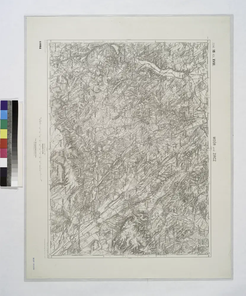
Moor und Zircz.
1914