Maps of Veszprém
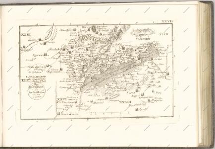
C. Szaladiensis. Tab. III
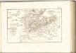
Ungarn Komitat Zala
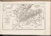
Szalader com[it.] Schackmin Cvrassie Regiments
1 : 467000 Balaton-oblast (Maďarsko) Cir, V.
Somogy vármegye térképe
1 : 400000 Kaposvár (Maďarsko) Kogutowicz, Manó Magyar Földrajzi Intézet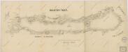
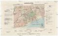
Balaton Tava
Balaton turistická mapa
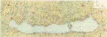
Balaton und Umgebung
1 : 200000 Balaton (Maďarsko : jezero : oblast) M. Kir. Állami Térképészet
Veszprém vármegye térképe
1 : 400000 Veszprém (Maďarsko : oblast) Kogutowicz, Manó Magyar Földrajzi Intézet
Sumeg und Zala-Egerszeg.
from Spezialkarte der osterreichisch-ungarischen Monarchie.
Nagyvazsony und Badacsonytomaj.
from Spezialkarte der osterreichisch-ungarischen Monarchie.
Kis-Komarom und Zala-Szt.-Mihaly.
from Spezialkarte der osterreichisch-ungarischen Monarchie.
Somogyvar.
from Spezialkarte der osterreichisch-ungarischen Monarchie.
Somogyvár
1 : 75000 Somogyvár, Komitat Somogy
Nagy-Vázsony
1 : 75000 Nagyvázsony, Komitat Veszprém
Sümeg
1 : 75000 Sümeg, Komitat Veszprém
Kis-Komárom
1 : 75000 Komorn (Ungarn)
Balatonfured und Varos-Hidveg.
from Spezialkarte der osterreichisch-ungarischen Monarchie.
Tamási
1 : 75000 Tamási, Komitat Tolna
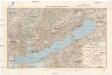
Balaton-Füred
1 : 75000 Balatonfüred, Umland
Tamasi und Igal.
from Spezialkarte der osterreichisch-ungarischen Monarchie.
Hegyes-Kis-Somlyo.
from Spezialkarte der osterreichisch-ungarischen Monarchie.
Devecser und Varoslod.
from Spezialkarte der osterreichisch-ungarischen Monarchie.
Devecser
1 : 75000 Devecser
Hegyes-Kis-Somlyó
1 : 75000 Komitat Vas
Veszprem und Varpalota (Ungarn).
from Spezialkarte der osterreichisch-ungarischen Monarchie.
Also-Lendva und Lenti.
from Spezialkarte der osterreichisch-ungarischen Monarchie.
Badacsonytomaj
1 : 25000 Maďarsko MM. Kir. Állami Térképészet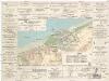
Siófok, Balatonkiliti-Vilmatelep
1 : 10000 M. Kir. Állami Térképészet
Tihanyi félsziget
1 : 20000 M. Kir. Állami Térképészet