Maps of Seine-Saint-Denis


Plan des verschanzten Lagers von Paris

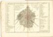
Département de Paris
1 Karte : Kupferdruck ; 35 x 41 cm Capitaine s.n.
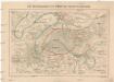
Fortifications du Departement de la Seine

Karte der Umgegend von Paris

Environs de Paris
1 : 40000 Paříž-oblast (Francie) Longuet magasin de cartes géographiques de Longuet s.eur de Simonneau
[Paříž a okolí]
Paříž-oblast (Francie)
Carte du Département de la Seine / exécutée en 1839 au Dépôt Général de la Guerre sous la dir. du Général de Division Pelet, d'après les levés des Officiers du Corps d'Etat-Major ; rev. et mise à jour en 1857 (etant directeur Le C.el Blondel)
1 : 40000 Dépôt Général de la Guerre; Corps d'Etat-Major [S.l. : s.n.]
Le métropolitain de Paris
Paříž (Francie : oblast)
Nieuwe kaart van de buitenstreeken van Parys : meetkundig opgenomen in 1792 en 1793 met alle de nieuwe sterkten, verschansingen en versperringen tusschen de rivieren de Seine en de Marne
Te Amsterdam : by Johannes Allart
Dept. De La Siene.
1 : 194000 Levasseur, Victor.
Stanford's map of the environs of Paris : shewing the fortifications
1 : 61000 Edward Stanford Ltd Edward Stanford
Topographische Karte von Paris und Gegend
1 : 103000 Paříž (Francie : oblast) Fr. R. Reiss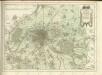
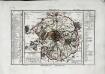
Département de Paris
1 Karte : Kupferdruck ; 17 x 18 cm, Bildgrösse 18 x 27 cm Houdan au dépôt de l'atlas national de France rue de la Monnoye no. 5
[Paříž]
1 : 40800 Paříž-oblast (Francie) Fer, Nicolas de N. de Fer
Environs Paris.
1 : 90000 Letts, Son & Co.
Paris
Paříž-oblast (Francie) Landes Industrie Comptoirs
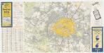
Société des Transports en Commun de la Région Parisienne: Autobus Tramways Bateaux Lignes de Banlieue
Die Befestigungen von Paris und dessen Umgebung
1 : 75000 Paříž (Francie) Hofmann, X. A. von Eduard Lott
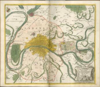
Typus choro-topographicus regiæ et totius orbis celeberrimæ urbis Lutetiæ parisiorum
1 Karte : Kupferdruck ; 49 x 57 cm Seutter Matthäus Seutter
Plan von Paris
1 : 50000 Paříž (Francie) Fritz Schischa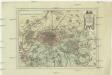
Der Gegend um Paris
1 : 73000 Paříž (Francie)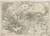
Plan von Paris
Sorties de Paris
1 : 50000 Annotatie: Met register Paris : Services du Tourisme Michelin
The Environs Of Paris.
1 : 95040 Colton, G.W.
Paris environs.
1 : 92000 Society for the Diffusion of Useful Knowledge (Great Britain)
Paris, France.
1 : 59000 Colton, G.W.