Maps of Europe


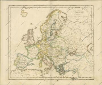
Accuratissima Europae Tabula
Allard, Carel


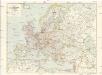
Staatenkarte von Europa
1 : 17500000 Evropa Richter, Emil Adolf Ed. Strache
Europa
1 : 15000000 Evropa Štůla, František Paul Sollors' Nachf.
Mapka Europy podług nowych traktatów
1 : 20000000 Evropa "Atlas" Institut Kartograficzny
Evropa
1 : 15000000 Evropa Kuchař, Karel Komenium
Übersicht der europæischen Seeküsten
1 Karte : Kupferdruck ; 60 x 49 cm Bowles; Schrämbl F. A. Schraembl
Politická mapa Evropy
1 : 17500000 Evropa Ryšavý, Jaroslav Vydavatelský odbor Ústř. sp. učit. na Moravě
Charte von Europa

Europa
1 : 10000000 Evropa Weiland, Karl Ferdinand Kratz, W. im Verlage des geograph. Instituts
Evropa
1 : 15000000 Evropa Kuchař, Karel Komenium
Europe.
1 : 10137600 Stanford, Edward
L'Europe
1 : 12000000 Evropa Sanson, Guillaume Cordier, Louis chez H. Iaillot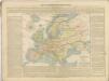

Evropa
Freytag & Berndts Handkarte von Europa
1 : 6000000 Evropa Freytag & Berndt

F. Umlaufta a J.G. Rothauga školní nástěnná mapa Evropy
1 : 3000000 Evropa Umlauft, Friedrich Krejčí, Josef Freytag a Berndt
Eduard Gaeblers Verkehrskarte von Europa
1 : 5000000 Evropa Gaebler, Eduard Eduard Gaeblers Geogr. Inst.
Carte de l'Europe
Evropa vrais amis de la paix
Eclipseos solis totalis cum mora, d. 12 maji 1706 horis antem: in Europa celebratæ, geographica repræsentatio
1 Karte : Kupferdruck ; 46 x 56 cm Schenk; Doppelmayr; Moolen s.n.
Politický přehled Evropy
1 : 5000000 Evropa Machát, František Tiskem a nákladem uměl. ústavu grafického V. Neuberta na Smíchově
EUROPA
1 : 2100000 Evropa Götze, Johann August Ferdinand
Europa
1 : 2100000 Evropa Götze, Johann August Ferdinand
EUROPA
1 : 2100000 Evropa Götze, Johann August Ferdinand