Mapa catalogado


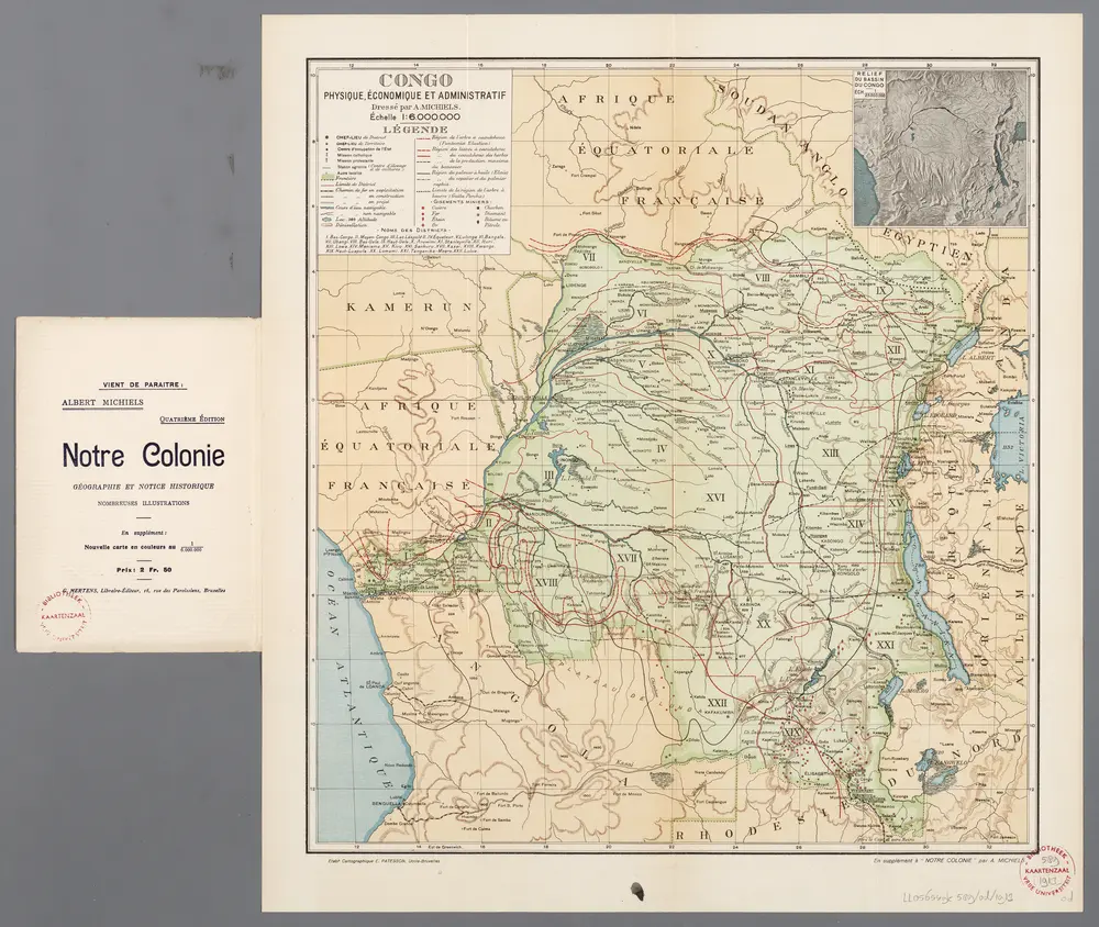
[Recto], uit: Congo physique, économique et administratif / dressé par A. Michiels
1913
Michiels, Albert
1:6m
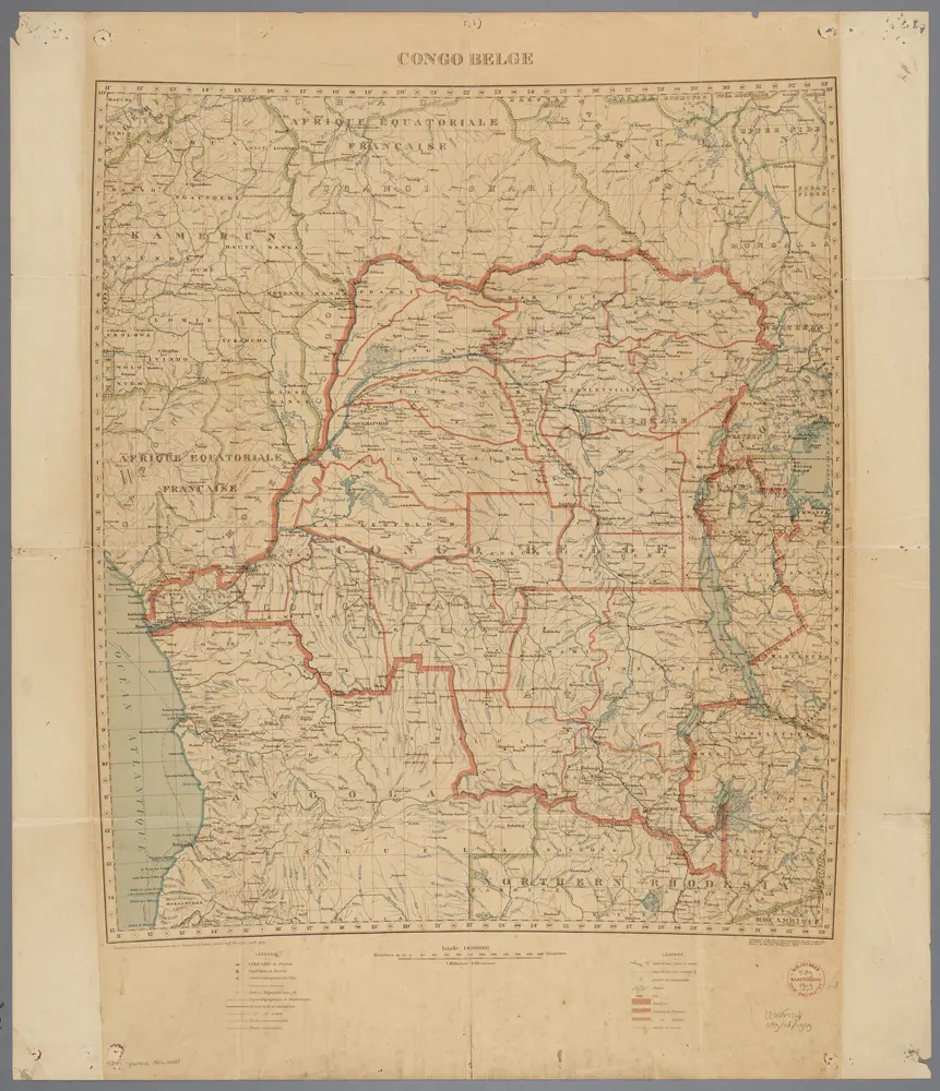
Carte de l'Etat indépendant du Congo [et] Carte du Bassin du Congo
1891
Wauters, A.-J. 1845-1916; Institut national de géographie. Belgique
1:8m
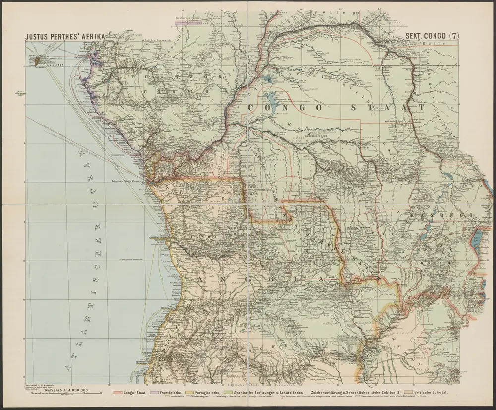
Congo Belge / comp. at the Royal Geographical Society under the dir. of the Geographical Section, General Staff ; drawn at the War Office
1919
Royal Geographical Society, Verenigd Koninkrijk; General Staff, Verenigd Koninkrijk. Geographical Section; War Office, Verenigd Koninkrijk
1:4m
Croquis hydrographique de l'Afrique centrale
1885
Institut national de géographie. Belgique
1:10m
Carte politique de l'Afrique centrale
1885
Institut national de géographie. Belgique
1:10m
Map of a portion of South Africa : illustrative of Lieut. Cameron's route from lake Tangayika to the west coast
1876
Ravenstein, Ernst Georg, 1834-1913
1:5m
Spezial-Karte von Afrika
1893
Habenicht, Hermann
1:4m
Carte géologique de l'Afrique équatoriale française. Planche sud
1918
Loir, Erasme, géologue 18..-19..
1:5m

Atlas minor, mapa ze strany: 599
1610
Mercator Gerhard
Inner Afrika. nach dem gegenwartigen stande der erforschung
1892
Riemer, C.; Geographisches Institut. Weimar, Allemagne
1:17m