Mapa catalogado


Région saharienne française
1903
Niox, Gustave-Léon 1840-1921
1:4m
Carte des divisions administratives de l'Algérie
1911
Calléja, N.; Algérie. Direction de l'agriculture et de la colonisation
1:3m
Algérie, Tunisie et Sahara central, pour servir particulièrement à l'intelligence des évenements actuels et notamment à suivre les deux explorations du colonel Flatters
1881
Barbier, Joseph-Victor 1840-1898
1:5m
Carte des divisions administratives des territoires du sud
1907
Calléja, N.; Gouvernement général de l'Algérie
1:3m
Esquisse du Sahara algérien
1907
Alger : imp. de A. Jourdan
1:3m
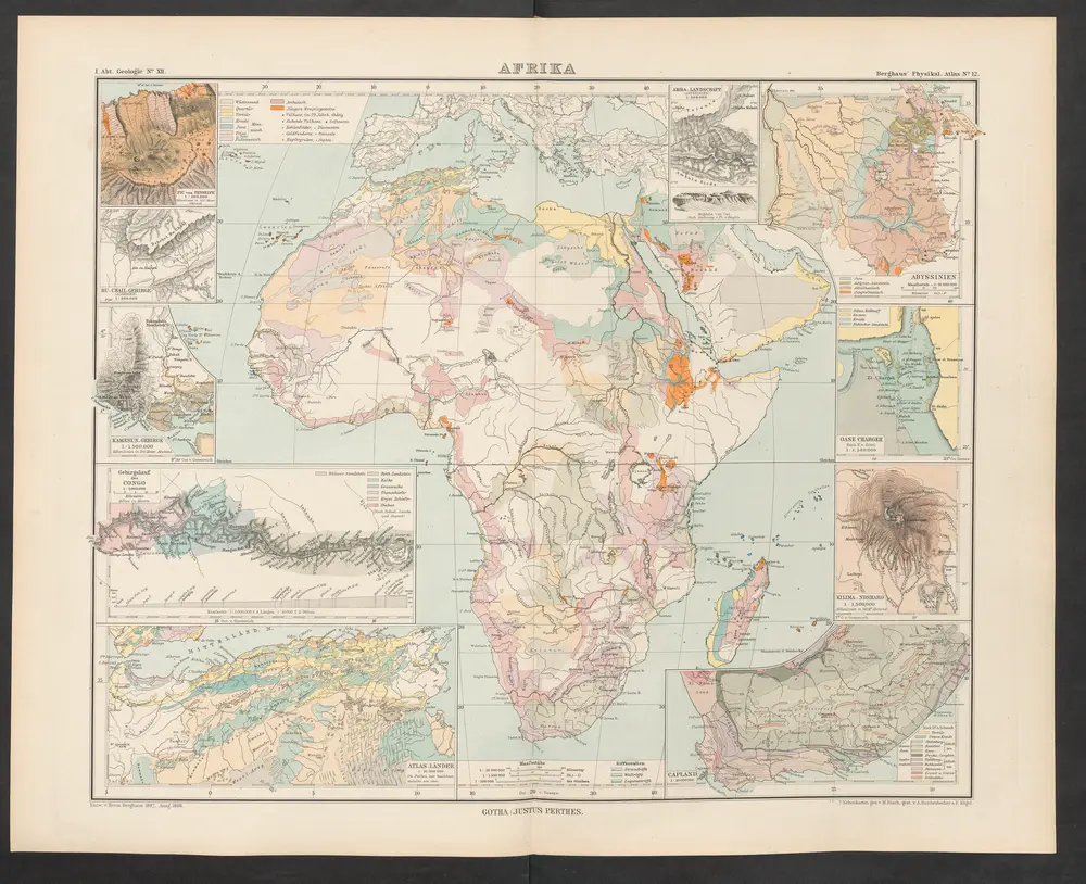
Afrika
1892
Zittel, K.v. ; Berghaus, Hermann
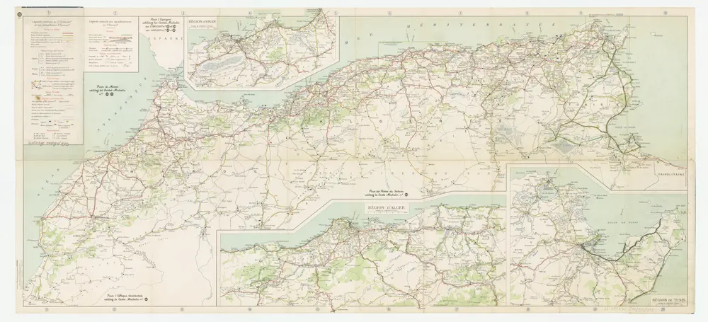
[Kaart], uit: Maroc-Algérie-Tunisie : carte au 2 millionième ... / Michelin
1949
Pneu Michelin, Paris
1:2m
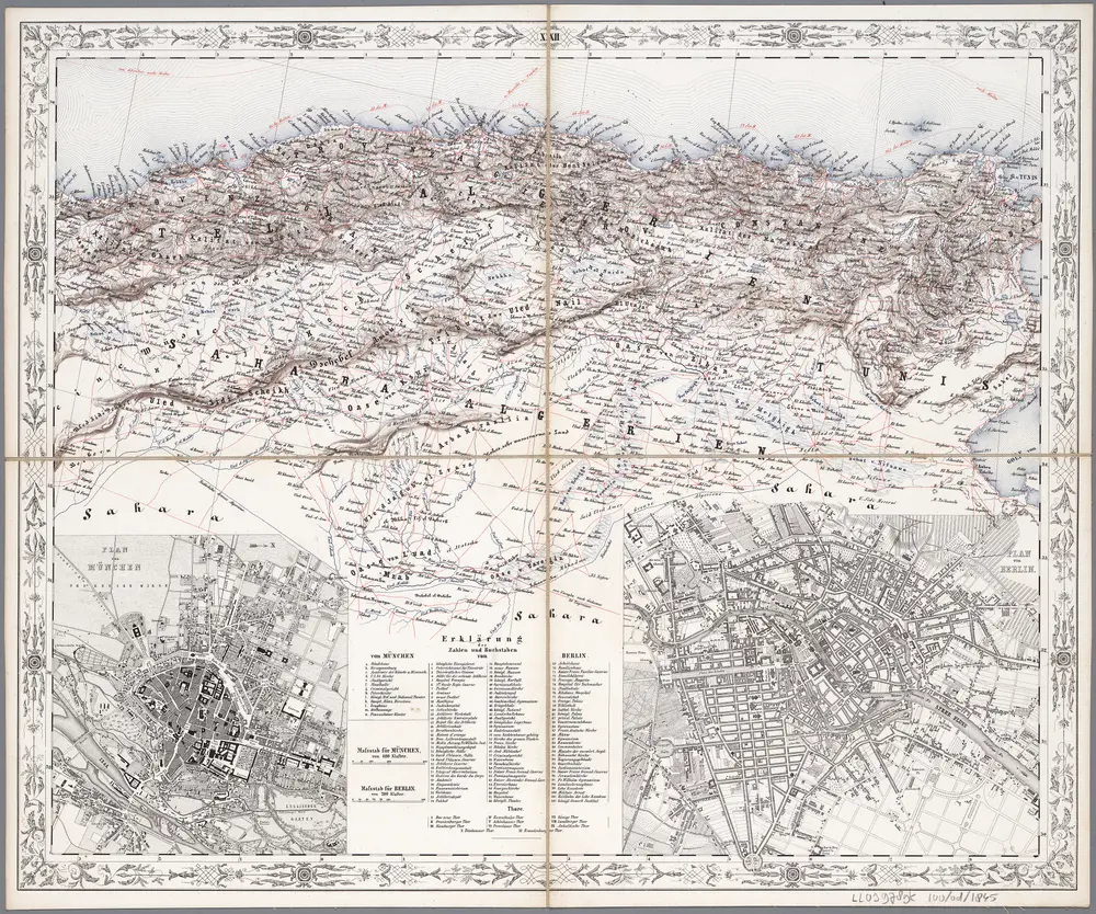
[XXII], uit: Geognostische Karte des Oesterreichischen Kaiserstaates mit einem grossen Theile Deutschland's u. Italien / hauptsachlich nach ... Haidinger's geognostischer Karte dieses Staates bearb. von Josef Scheda
1847
Scheda, Joseph
1:3m
Carte d'un tracé d'un chemin de fer proposé par Oran, Sebdou, le Touat
1879
Kramer
1:2m
Algérie et Tunisie
1903
Niox, Gustave-Léon 1840-1921
1:2m